 Districts of North Chotanagpur Division include Bokaro district, Chatra district, Dhanbad district, Giridih district, Hazaribagh district, Koderma district and Ramgarh district. Chotanagpur Division gives the tourist a wide landscape and the vast forestlands. Chota Nagpur Division which is also known as the South-West Frontier, was an administrative division of British Government in India. This division included most of the present-day state of Jharkhand as well as adjacent portions of West Bengal, Odisha, and Chhattisgarh. The districts of North Chotanagpur are simpler formation in independent India.
Bokaro District
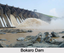
 Bokaro district is one of the most industrialized zones in India. It is one of the twenty-four districts of Jharkhand state. It was established in 1991 by carving out one subdivision consisting of two blocks from Dhanbad District and six blocks from Giridih District. Bokaro Steel City is the district headquarters. The district has a population of about 2 million (2011 census). Bokaro`s Steel Plant is the biggest in Asia. It is also an educational centre and a popular tourist destination for people from eastern region. Bokaro industrial area is located in Bokaro steel city established by state public sector BIADA (Bokaro Industrial Area Development Authority).
Chatra District
Chatra district is one of the twenty-four districts of Jharkhand and Chatra is the administrative headquarters of this district. The district covers an area of 3706 square kilometers.
Dhanbad District
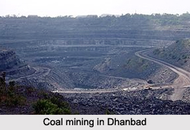
Dhanbad district is one of the twenty-four districts of Jharkhand and Dhanbad is the administrative headquarters of this district. As of 2011, it is the second most populous district of Jharkhand.
Giridih District
 Giridih district is one of the twenty-four districts of Jharkhand state, India, and Giridih is the administrative headquarters of this district.
Hazaribagh District
Hazaribagh district is one of the twenty-four districts of Jharkhand and Hazaribagh town is the district headquarters. It is currently a part of the Red Corridor.
Koderma District
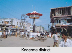
Koderma district is one of the twenty-four districts of Jharkhand and Koderma is the administrative headquarters of this district. Koderma district was created on 10th April 1994, after being carved out of the original Hazaribagh district. It is currently a part of the Red Corridor.
Ramgarh District
Ramgarh district is one of the 24 districts of Jharkhand. It was also a military district during the British Regime, referred to then as Ramghur district.


