Home > Travel > States of India > Nandurbar
Nandurbar
Nandurbar is a place in Nandurbar district of Maharashtra. This place is well known for the scenic beauties and the number of temples dedicated to the Hindu Gods and Goddess.

Share this Article:

Nandurbar, Nandurbar district, MaharashtraNandurbar is a city in Maharashtra. It is a municipal council in Nandurbar district in Maharashtra. The northern boundary of the district is defined by the great Narmada River.

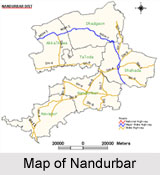
Location of Nandurbar
Nandurbar, the city in Maharashtra is located at 21.37 degree North and 74.25 degree East. Nandurbar has an average elevation of 210 metres (688 feet).

Geography of Nandurbar
The district headquarters is located at Nandurbar city. Nandurbar district occupies an area of 5034 square kilometers and has a population of 1,311,709 of which 15.45 percent is urban (as of 2001). Nandurbar in Nandurbar district is bounded to the south and south-east by Dhule district, to the west and north is the state of Gujarat, to the north and north-east is the state of Madhya Pradesh.

Administration of Nandurbar
Nandurbar of Maharashtra is an administrative district in the northwest corner (Khandesh region) of western part of India. On 1st July 1998, Dhule was bifurcated as two separate districts now known as Dhule District and Nandurbar District.

Demography of Nandurbar
According to the Population Census in the year 2001, Nandurbar had a population of 94,365. The males constitute 52% of the population and females 48%. Nandurbar has an average literacy rate of 72%, higher than the national average of 59.5%. The male literacy is 78%, and female literacy is 65%. In Nandurbar, 12% of the population is under 6 years of age.

Tourism in Nandurbar
Nandurbar has mainly hilly region and have Toranmal which is the second hill station after Matheran in Maharashtra. Near Nandurbar, there flows Tapi River is located at 12 km from city. In Nandurbar, there adds the beauty of the nature. It is the popular weekend gateway in Western Ghats Mountain Region of India. Narmada river forms the boundary in Nandurbar on the northern and north-eastern side. It is well known as the tribal area. One can see the tribal lifestyle while visiting this region.

Visiting Information
Nandurbar is served by a station on the Indian Railways network. Also ST buses are available. Nandurbar is connected to Madhya Pradesh and Gujarat by state highways.


Share this Article:

Related Articles

More Articles in States of India


East Indian States
East Indian States comprises of Bihar, Jharkhand, West Bengal, Odisha and also the Union Territory of Andaman and Nicobar Islands. It defines the cultural heritage, rich historical background and the linguistic unity.
Erode District
Erode District is one of the districts in the state of Tamil Nadu. The district of Erode is having a land-locked area with no sea coast.
Purnia District in Bihar
Purnia District is located in Bihar and extends from River Ganga to Nepal. The district has a rich Hindu history and glorious past.
South Delhi District
South Delhi District is the third largest district of Delhi as far as its area is concerned. South Delhi District is known for its economic, historical, cultural and social significance.
North Indian States
North Indian States formed the cultural and religious unity in spite of having many foreign invasion and the political disturbances from the early era till the British gained supremacy in Indian sub continent.
Kendujhar District
Kendujhar District, spread over an area of 8,240 sq kms, is as varied as the whole of Orissa with waterfalls roaring gorges, mountains and minerals. The manifold expressions of nature in Kendujhar District are considered as unique.
Hooghly district
Hooghly District along the bank of the river Hooghly is one of the principal trading ports of West Bengal.
Districts of South Tamil Nadu
Districts of South Tamil Nadu consist of many tourism destinations like archaeological sites and the history of Pandyas and Cholas. Considering their proximity to the sea, many districts also boast of serene beaches and coastal beauty.
Flora of Arunachal Pradesh
Flora of Arunachal Pradesh includes infinite species and is a subject of great interests for the botanists.
Districts of South Gujarat
Districts of South Gujarat are the epicenter of Jain pilgrimages and the early Hindu kingdoms.
North West States of India
North West States of India consist of three states, which are Rajasthan, Punjab and Haryana. All of them are culturally and traditionally diverse and they have been ruled by different dynasties in historical time.
Geography Of Chittoor District
Geography of Chittoor district is spread along the topography of the land which is divided into two natural divisions; Chittoor has a dry and healthy climate.
Districts of North Rajasthan
District of Northern part of Rajasthan is dotted with ancient forts and medieval villages.
Districts of North Odisha
District of North Odisha has Bengal boundary and shares the same culture. These are reachable if one pays a weekend visit to Digha.
Districts of West Bihar
Districts of West Bihar is comprised of medieval monuments that were built by the different governors of Mughal era.
Districts of South Haryana
Districts of South Haryana consists of many cities of industrial excellence. These districts are dotted with popular tourism destinations.
Medieval History of Assam
Medieval history of Assam narrates the advent and rule of a number of kingdoms in the region. The prominent dynasties of the kingdom left an everlasting imprint on the socio cultural heritage of India.
Geography of Meghalaya
The suitable climate, highland plateaus, rivers and the flora and fauna together forms the geography of Meghalaya.
Districts of Rayalaseema
Districts of Rayalaseema in Andhra Pradesh state has urban population and rural settlements as well.
Districts of South Punjab
Districts of Southern part of Punjab depict medieval history of Punjab and the rise of Sikhs.