Home > Travel > States of India > History of Diu
History of Diu
History of Diu dates back to the period of Maurya Empire. The region was ruled by a number of rulers and finally became a separate Union Territory in the year 1987.

Share this Article:

History of DiuHistory of Diu can be traced back to the times of Maurya Empire (322-220 B.C.). When the dynasty was ruled by the emperor Chandragupta Maurya, the ruler had extended his supremacy over the province of Saurashtra and Pushagupta was appointed as its Governor.

Girnar village near Junagadh was selected as the headquarters. From 273-237 B.C Yavanraj Tushappa was the Governor of Emperor Ashoka who ruled over Saurashtra. Later Yavana Thero was sent by the emperor as evangelist to the western sea board including Diu. From 229-220 B.C. Saurashtra was ruled by Samprati from Ujjain. It was during this period when Jainism was propagated and a number of Jain temples were constructed. The Jainism prevalent in Diu also dates back to this period.

In the following period Diu was ruled by Indo-Greek kings Eukratides (from 171 to 150 B.C.), Meanandar (from 115 to 90 B.C.) and Appollodotes II (in 1st century B.C.). Kshaharatas ruled over the district during 1st century A.D. Kshaharatas had spanned their kingdom in a vast area and captured the western part of the country including Saurashtra. In the following several years Diu remained a part of the territories of the dynasties that captured western India along with Gujarat. During the first decade of fifteenth century Diu was ruled by the last king of the Vaja dynasty who was also the ruler of Somnath Patan. Later Diu was captured by the Muslims Sultans of Gujarat and the region remained under their control for the next one and a half centuries.

In the early phase of 1535 Nuno da Cunha, the Portuguese Governor, tried to capture Diu through an expedition but was gravely defeated by the Sultan. During this period, however, the Mughals had also extended their territory up to the kingdom of Bahadur Shah, the Sultan of Gujarat. On one hand the Mughal emperor Humayun were trying to seize control over Diu while on the other the Portuguese were looking for an opportunity to capture Diu. Consequently, on October 25, 1535, Bahadur Shah signed a treaty with Nuno da Cunha according to which, Bahadur Shah was to be assisted against the invasion of the enemy through the land as well as sea. Nuno da Cunha in turn wanted to build a fortress at Diu for which a site was given to him in the harbour. Subsequently, the blunder of letting the Portuguese to build a fort was realized by Bahadur Shah as in 1546 the region was gradually conquered by the Portuguese. They ruled over the district till the year 1961.

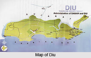
On 19th of December 1961, Diu was made a Union Territory along with Goa. Daman and Diu achieved statehood after delineation from Goa on 30th of May, 1987, thereby assigning them the status of separate Union Territory.


Share this Article:

Related Articles

More Articles in States of India


East Indian States
East Indian States comprises of Bihar, Jharkhand, West Bengal, Odisha and also the Union Territory of Andaman and Nicobar Islands. It defines the cultural heritage, rich historical background and the linguistic unity.
Erode District
Erode District is one of the districts in the state of Tamil Nadu. The district of Erode is having a land-locked area with no sea coast.
Purnia District in Bihar
Purnia District is located in Bihar and extends from River Ganga to Nepal. The district has a rich Hindu history and glorious past.
South Delhi District
South Delhi District is the third largest district of Delhi as far as its area is concerned. South Delhi District is known for its economic, historical, cultural and social significance.
North Indian States
North Indian States formed the cultural and religious unity in spite of having many foreign invasion and the political disturbances from the early era till the British gained supremacy in Indian sub continent.
Kendujhar District
Kendujhar District, spread over an area of 8,240 sq kms, is as varied as the whole of Orissa with waterfalls roaring gorges, mountains and minerals. The manifold expressions of nature in Kendujhar District are considered as unique.
Hooghly district
Hooghly District along the bank of the river Hooghly is one of the principal trading ports of West Bengal.
Districts of South Tamil Nadu
Districts of South Tamil Nadu consist of many tourism destinations like archaeological sites and the history of Pandyas and Cholas. Considering their proximity to the sea, many districts also boast of serene beaches and coastal beauty.
Flora of Arunachal Pradesh
Flora of Arunachal Pradesh includes infinite species and is a subject of great interests for the botanists.
Districts of South Gujarat
Districts of South Gujarat are the epicenter of Jain pilgrimages and the early Hindu kingdoms.
North West States of India
North West States of India consist of three states, which are Rajasthan, Punjab and Haryana. All of them are culturally and traditionally diverse and they have been ruled by different dynasties in historical time.
Geography Of Chittoor District
Geography of Chittoor district is spread along the topography of the land which is divided into two natural divisions; Chittoor has a dry and healthy climate.
Districts of North Rajasthan
District of Northern part of Rajasthan is dotted with ancient forts and medieval villages.
Districts of North Odisha
District of North Odisha has Bengal boundary and shares the same culture. These are reachable if one pays a weekend visit to Digha.
Districts of West Bihar
Districts of West Bihar is comprised of medieval monuments that were built by the different governors of Mughal era.
Districts of South Haryana
Districts of South Haryana consists of many cities of industrial excellence. These districts are dotted with popular tourism destinations.
Medieval History of Assam
Medieval history of Assam narrates the advent and rule of a number of kingdoms in the region. The prominent dynasties of the kingdom left an everlasting imprint on the socio cultural heritage of India.
Geography of Meghalaya
The suitable climate, highland plateaus, rivers and the flora and fauna together forms the geography of Meghalaya.
Districts of Rayalaseema
Districts of Rayalaseema in Andhra Pradesh state has urban population and rural settlements as well.
Districts of South Punjab
Districts of Southern part of Punjab depict medieval history of Punjab and the rise of Sikhs.