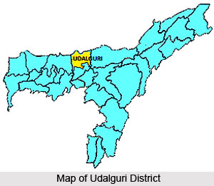
History of Udalguri district speaks about the birth of this region, which was a result of the Memorandum of Settlement between Bodo Liberation Tigers, Government of Assam and Government of India. On 10th February, 2003, this Memorandum had created the Bodoland Territorial Council. The Sixth Schedule of the Constitution of India was amended and the origin of Udalguri occurred immediately after that. Bodoland Territorial Autonomous District or BTAD came into existence following this settlement.
The term Udalguri is obtained from flora origin. The word Odal implies a tree while guri means roots of a tree or plant. Some historians state that the place derived its name due the presence of an `Odal` tree. However, others believe that the place came to be referred to as Udalguri due to the existence of a sage known as Uddalak Muni. Udalguri is also considered to have been originated from the Bodo terms `Ordhla` and `Gundri`. Bodo tribes pronounce the name of the district as `Odalguri`. According to the Bodo language, `Ordla` means spacious and `Gundri` refers to powdered object.
 A vast quantity of Bodo people inhabited the Udalguri district till the 19th century. Bodos were concentrated in the Darrang area as well. Historical records claim that in 1562 A.D. when Naranarayan, the Koch king had conquered the Ahom kingdom which was then ruled by King Sukhamfa with a vast amount of soldiers. Sukladwaj was the commander-in-chief of that army and they had established their camps at a place named as Tamtumoni which represents the present-day Mangaldai division. It was here that 12 groups of tribes surrendered to him. King Naranarayan ordered the creation of a temple which would be dedicated to Goddess Durga at a place called Bhairabkunda and also a hill fort.
The 1881 census report of the Government of Bengal revealed that the aggregate number of Bodo-Kachari tribes in the Darrang area was 69, 000. Out of this, 36, 468 were controlled by thana Kalaigaon and thana Chatgari of Mangaldai sub-division. The writings of many authors have brought to light the existence of a route from Bhairabkunda and Udalguri, through Bhutal hills, right upto countries like Afghanistan, China and Tibet. This route was quite significant for the interchange of culture, even though trade was not the actual intention of this route. It was utilized by Tantriks, Buddhist sromons, Yogi and Nath.
Between the time period of 1982 to 1933, a railway line was built which extended till Rangapara, starting from Tangla and continuing through Udalguri. From 1935 onwards, passenger trains began to be operated in this Indian district. During 1933 to 1934, violent floods of River Golondi submerged Nalbari and Kathalguri villages. Ever since that time, numerable inhabitants of these villages shifted to safer regions namely Badagaon, Sapkhaiti, Kapurpura, Bolondihabi and others. Even the police station which was based at Puronithana was moved to a rented place which was near the northern portion of the railway station of Udalguri in the year 1913.
The Udalguri Town L.P. School was constructed on 1st October, 1950 and Udalguri M.E. School in 1953. Before the creation of these schools, there was a faint idea of education in Udalguri district. Much before that, in the year 1865, other L.P. Schools were built. In 1925, the Middle English School was established though it was later shifted to Harishinga in the year 1930. There were 150 schools in Darrang in March 1868 which were connected to the Church Mission societies of the region of Tezpur. In 1948, Golma L.P. School was set up, followed by Gema Bogoribari in 1948, Bahinigaon M.V. School in 1949, Udalguri High School was in 1956 and so on.


