Home > Travel > States of India > Geography of Mokokchung District
Geography of Mokokchung District
Geography of Mokokchung District is the physiographical canvas of the region that lays bare the landscape of the region.

Share this Article:

Geography of Mokokchung District
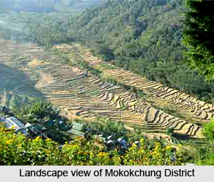
Geography of Mokokchung District is the exploration of the several mountainous regions and the flowing rivers and the green vegetation all around. Mokokchung District is bounded by the state of Assam to its north, Tuensang to its east, Zunheboto to its south and Wokha and Assam to its west, and lies between 93.53 and 94.53 Degrees Longitude and 25.56 Degrees Latitude.

There are several Ranges that run more or less parallel to each other in North-east or South-west direction. Between the Ranges, there are glens and gorges through which flow the hill streams. There are only two small valleys namely Changki and Tuli, and both of them are on the western side of the district adjoining the plains of the Sibsagar district of Assam. The entire District of Mokokchung is conveniently sub-divided into Ranges.

Tzurangkong Range is actually pimples of hillocks thrown at random adjoining the plains of Assam mostly along the valley of Dissai River and Jhanzi Rivers just before they flow into the plains of Assam. These hillocks are densely covered with bamboos and the climate of the entire range is warm.

Japukong Range is the outermost Range stretching from North-east to South-west lying to the interior south of Tzurangkong Range. Changkikong Range is a parallel Range east of Japukong Range. Changki village was said to be founded by a man named Changki, and so the Range too was named after him as Changkikong. Asetkong Range is a Central Range running from east to west but compared to the other ranges, it is the shortest one. This range lies between Melak and Menung rivers, and therefore, it resembles an island. Hence the name thrives to be Asetkong. Langpangkong Range is the easternmost range skirting along the course of Dikhu River. The river forms a natural boundary line of Mokokchung with Tuensang and Mon districts. This range is spread like a bed and so the name has been aptly given to this range. Ongpangkong Range is the southernmost range forming an irregular boundary of the Ao area with that of the Lothas and Semas to the south and with the Sangtams to the east. It is called Ongpangkong as the land is higher and cooler than the other ranges and the word has its etymological roots in the term higher.


Share this Article:

Related Articles

More Articles in States of India


East Indian States
East Indian States comprises of Bihar, Jharkhand, West Bengal, Odisha and also the Union Territory of Andaman and Nicobar Islands. It defines the cultural heritage, rich historical background and the linguistic unity.
Erode District
Erode District is one of the districts in the state of Tamil Nadu. The district of Erode is having a land-locked area with no sea coast.
Purnia District in Bihar
Purnia District is located in Bihar and extends from River Ganga to Nepal. The district has a rich Hindu history and glorious past.
South Delhi District
South Delhi District is the third largest district of Delhi as far as its area is concerned. South Delhi District is known for its economic, historical, cultural and social significance.
North Indian States
North Indian States formed the cultural and religious unity in spite of having many foreign invasion and the political disturbances from the early era till the British gained supremacy in Indian sub continent.
Kendujhar District
Kendujhar District, spread over an area of 8,240 sq kms, is as varied as the whole of Orissa with waterfalls roaring gorges, mountains and minerals. The manifold expressions of nature in Kendujhar District are considered as unique.
Hooghly district
Hooghly District along the bank of the river Hooghly is one of the principal trading ports of West Bengal.
Districts of South Tamil Nadu
Districts of South Tamil Nadu consist of many tourism destinations like archaeological sites and the history of Pandyas and Cholas. Considering their proximity to the sea, many districts also boast of serene beaches and coastal beauty.
Flora of Arunachal Pradesh
Flora of Arunachal Pradesh includes infinite species and is a subject of great interests for the botanists.
Districts of South Gujarat
Districts of South Gujarat are the epicenter of Jain pilgrimages and the early Hindu kingdoms.
North West States of India
North West States of India consist of three states, which are Rajasthan, Punjab and Haryana. All of them are culturally and traditionally diverse and they have been ruled by different dynasties in historical time.
Geography Of Chittoor District
Geography of Chittoor district is spread along the topography of the land which is divided into two natural divisions; Chittoor has a dry and healthy climate.
Districts of North Rajasthan
District of Northern part of Rajasthan is dotted with ancient forts and medieval villages.
Districts of North Odisha
District of North Odisha has Bengal boundary and shares the same culture. These are reachable if one pays a weekend visit to Digha.
Districts of West Bihar
Districts of West Bihar is comprised of medieval monuments that were built by the different governors of Mughal era.
Districts of South Haryana
Districts of South Haryana consists of many cities of industrial excellence. These districts are dotted with popular tourism destinations.
Medieval History of Assam
Medieval history of Assam narrates the advent and rule of a number of kingdoms in the region. The prominent dynasties of the kingdom left an everlasting imprint on the socio cultural heritage of India.
Geography of Meghalaya
The suitable climate, highland plateaus, rivers and the flora and fauna together forms the geography of Meghalaya.
Districts of Rayalaseema
Districts of Rayalaseema in Andhra Pradesh state has urban population and rural settlements as well.
Districts of South Punjab
Districts of Southern part of Punjab depict medieval history of Punjab and the rise of Sikhs.