Home > Travel > States of India > Damoh District
Damoh District
Damoh District of Madhya Pradesh has a long history dating back to ancient times. Damoh District has its headquarters located at Damoh city.

Share this Article:

Damoh District, Madhya Pradesh 
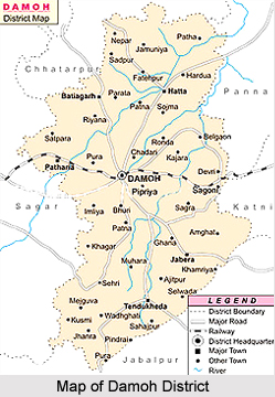
Damoh District is an administrative district of Madhya Pradesh. Damoh is the district headquarters. This district is located at 23 degree 9 minutes north latitude and 79 degree 3 minutes east longitude. Total area occupied by Damoh District is 7,306 sq kilometres. In Damoh District, there are 1229 villages.

History of Damoh District
In Damoh district, the Stone Age tools are found in Singrampur Valley. These are the testimony to the fact that Damoh District was the cradle of human civilization and habitat since millions of years. History also shows that it was part of Gupta Empire of Pataliputra. Damoh District was also a part of Chedi Empire ruled by the kings of Kalachuris from capital Tripuri. The magnificent temple at Nohta is a living example of the glory of Kalachuris in the region. Historical evidences also prove that some regions of the district were under the rulers of Chandella dynasty of the Jejak -Bhukti. In medieval times (8th to 18th century), the Muslim rulers also invaded the region. Later on, the Sultan of Malwa annexed the region in to his fold. In the last quarter of the 15th century, Sangram Shah of the Gond dynasty annexed the region into its dynamic and mighty empire consisting of 52 forts. It was the era of peace and prosperity for the region. Bundelas also entered into the region for a brief span after which the Maratha Empire took over the reigns in 1732 ruled up till the British East India Government annexed the Marathas kingdom after the death of Peshwa in 1888. Further, in the freedom struggle of the country, Damoh District had played a major role.

Demography of Damoh District
According to the population Census in 2011, Damoh District had a population of 1,263,703. Out of which the male and female were 660,478 and 603,225 respectively. The population of Damoh District constituted 1.74 percent of total population of Madhya Pradesh.

Education of Damoh District
The average literacy rate of Damoh was 70.92 percent. The male and female literacy rate was 80.96 and 59.90 respectively. The total literates in Damoh District were 763,448. Damoh District has proper education facilities. There are around 1424 Government Primary Schools, 520 Government Middle Schools and 44 Government High Schools. There are nearly 32 Government Higher Secondary Schools in Damoh District. Further, there are several, government degree colleges in the region.

Tourism in Damoh District
Damoh District has several offerings for the tourists. Jatashankar Temple, Fort of Singaurgarh, Nohleshwar Temple at Nohta, Nazara, Nidan Kund and Sad-Bhawna Shikhar are some of the popular tourist attractions. All these sites make Damoh District a popular tourist destination. People from distant places come and to explore the beautiful age-old temples in Damoh.


Share this Article:

Related Articles

More Articles in States of India


East Indian States
East Indian States comprises of Bihar, Jharkhand, West Bengal, Odisha and also the Union Territory of Andaman and Nicobar Islands. It defines the cultural heritage, rich historical background and the linguistic unity.
Erode District
Erode District is one of the districts in the state of Tamil Nadu. The district of Erode is having a land-locked area with no sea coast.
Purnia District in Bihar
Purnia District is located in Bihar and extends from River Ganga to Nepal. The district has a rich Hindu history and glorious past.
South Delhi District
South Delhi District is the third largest district of Delhi as far as its area is concerned. South Delhi District is known for its economic, historical, cultural and social significance.
North Indian States
North Indian States formed the cultural and religious unity in spite of having many foreign invasion and the political disturbances from the early era till the British gained supremacy in Indian sub continent.
Kendujhar District
Kendujhar District, spread over an area of 8,240 sq kms, is as varied as the whole of Orissa with waterfalls roaring gorges, mountains and minerals. The manifold expressions of nature in Kendujhar District are considered as unique.
Hooghly district
Hooghly District along the bank of the river Hooghly is one of the principal trading ports of West Bengal.
Districts of South Tamil Nadu
Districts of South Tamil Nadu consist of many tourism destinations like archaeological sites and the history of Pandyas and Cholas. Considering their proximity to the sea, many districts also boast of serene beaches and coastal beauty.
Flora of Arunachal Pradesh
Flora of Arunachal Pradesh includes infinite species and is a subject of great interests for the botanists.
Districts of South Gujarat
Districts of South Gujarat are the epicenter of Jain pilgrimages and the early Hindu kingdoms.
North West States of India
North West States of India consist of three states, which are Rajasthan, Punjab and Haryana. All of them are culturally and traditionally diverse and they have been ruled by different dynasties in historical time.
Geography Of Chittoor District
Geography of Chittoor district is spread along the topography of the land which is divided into two natural divisions; Chittoor has a dry and healthy climate.
Districts of North Rajasthan
District of Northern part of Rajasthan is dotted with ancient forts and medieval villages.
Districts of North Odisha
District of North Odisha has Bengal boundary and shares the same culture. These are reachable if one pays a weekend visit to Digha.
Districts of West Bihar
Districts of West Bihar is comprised of medieval monuments that were built by the different governors of Mughal era.
Districts of South Haryana
Districts of South Haryana consists of many cities of industrial excellence. These districts are dotted with popular tourism destinations.
Medieval History of Assam
Medieval history of Assam narrates the advent and rule of a number of kingdoms in the region. The prominent dynasties of the kingdom left an everlasting imprint on the socio cultural heritage of India.
Geography of Meghalaya
The suitable climate, highland plateaus, rivers and the flora and fauna together forms the geography of Meghalaya.
Districts of Rayalaseema
Districts of Rayalaseema in Andhra Pradesh state has urban population and rural settlements as well.
Districts of South Punjab
Districts of Southern part of Punjab depict medieval history of Punjab and the rise of Sikhs.