 Saharsa District, which is a territory near Kosi River, is an administrative district of Bihar. It has its headquarters located at Saharsa Town. Total area occupied by Saharsa District is 1661.30 sq kms.
History of Saharsa District
According to the history of Saharsa District, initially this region was a part of Bhagalpur Division. In the year 1972, Kosi Division was created by including Purnia district, Katihar District and Saharsa. The Headquarter was at Saharsa. Consequently, in the same manner a new Civil Sub-Division that is Birpur civil sub-division was formed in the same year by including 24 development blocks, which are Raghopur, Basantpur, Nirmali and Chhatapur. These development blocks were earlier under Supaul sub-division. Further, in the year 1981, two new districts namely Madhepura District and Supaul District have been created from Saharsa District. History of Saharsa District also states that Gupta Empire ruled the region for some time. After their fall, a political gap was formed that was utilized by the chiefs of the early inhabitants. Moreover, the decline of Pala dynasty in the state and Bengal led to the establishment of Karnata in Mithila and Sena dynasty in Bengal. Both Kanrnatas and Senas claimed their authority over some portions of Saharsa. British East India Company took over the control of the region in the year 1764. Saharsa District also played a significant role in the freedom struggle of the country.
Demography of Saharsa District
According to the Census in 2011, Saharsa District had population of 1,897,102 of which male and female were 995,502 and 901,600 respectively. The population of Saharsa District population constituted 1.83 percent of total population of Bihar. The average literacy rate of Saharsa in 2011 was 54.57 percent compared to 39.08 percent of 2001. If things are looked out at gender wise, male and female literacy were 65.22 and 42.73 respectively. The total literates in Saharsa District were 829,206 of which male and female were 521,560 and 307,646 respectively.
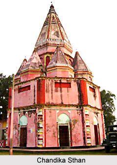
Tourism in Saharsa District
Tourism in Saharsa District includes several places of historical significance to explore. Interestingly, some of these places also reflect the rich past of the region. Tara Sthan, Chandika Sthan, Mandan Bharti Asthan, Sun Temple, Laxminath Gosaisthal Nauhatta, Udahi, Karu Khirhari temple and Matsyagandha Mandir are some of the noteworthy tourist attractions of this district. Tourism in Saharsa District provides an enriching travelling experience to the visitors. Every year, huge number of people comes to this place and explores the various places of interest offered by the district.


