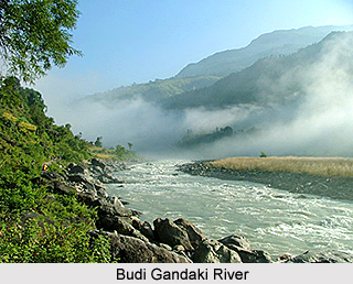
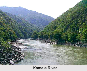
 Geography of Khagaria District spreads over vast tracts of flat alluvial plain and swampy lands. The northern part of the district is an extensive plain formed by the rich alluvial soil. The southern portion of Khagaria District consists of vast rice tracts and forests. The major part of the alluvial plain is inundated during the rains by the over flow of the rivers. However, the inundation has slightly decreased after construction of embankments but still a large part in the north eastern part of the district. The principal rivers of the district are Ganga River, Budhi Gandak River, the Bagmati River, the Kamla River and the Ghaghri (the mainstream of Kosi). The Ganga forms the southern boundary of Khagaria District.
Budhi Gandak River runs a criss-cross course through the district of Begusarai and enters Khagaria for a short while. It forms the western boundary of the Khagaria town and a protection embankment built along the eastern side of this river, protects Khagaria town from the floods caused by Budhi Gandak. Bagmati enters the district from the western side, through Begusarai. Kamla River enters the district from Darbhanga, near Mohraghat. It then flows south east to Chautham, merges into Bagmati, and the united stream flows into the district of Bhagalpur under the name of the Ghaghri, which is known as one of the main branches of the Kosi River.
 Geography of Khagaria District is characterized by a moderate climate. The climate of the district is medium between the dry, parching heat of northern part of the country and the close moist atmosphere of the south valley of Bengal. The heat is often intense but is very favourable during the rains because of low humidity. The seasons are the same as in the other parts of Bihar. The summer begins towards the middle of March and continues up to the end of June, when the rainy season begins. The rainy season continues up to October, while the water logging due to rainwater continues in some areas up to the end of December. The winters are quite pleasant in this area.
In contrast to the southern portions of the old district of Munger, this district, lying north to Ganga does not comprise any forest of Sal or other large trees. At most of the places, there are luxuriant gardens of mango and litchi, for which this district is mostly famous. Apart from these, Babul, Neem, Sirish and Sisho are also found. Wild animals, such as boars were occasionally found in the northern area of Khagaria District. During the winters, migratory birds come in large numbers in the northern part of the district. In Khagaria District there is no hill and no mineral is found in this district.


