 East Champaran District is a district of Bihar with Motihari as its administrative headquarters. East Champaran District is located between longitude 84 degree 30 minutes and 85 degree 16 minutes east and latitude 26 degree 16 minutes and 27 degree 1 minute north. This district is surrounded by Nepal in its north, by Sheohar and Sitamarhi District in its east, by Muzaffarpur and Gopalganj District in its south and by West Champaran District and Gopalganj District in its west. According to 2001 Census, East Champaran District has a population of approximately 3,933,636. East Champaran District is situated at a distance of 170 km from Patna.
History of East Champaran District
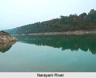
Champaran District was created in the year 1866. On 1st of December, 1971 Champaran district was split up into two districts, namely East Champaran and West Champaran. The name Champaran owes its origin to Champa-aranya or Champkatanys. Champa or Champaka means Magnolia and "aranya" means forest. Hence, Champaranya means Forest of Magnolia (Champa) trees. The history of East Champaran is a part of parent Champaran district. In the prehistoric period, Champaran constituted a part of the ancient kingdom of Videha. The Aryan Videhas were ordained to settle east of the Gandak or Narayani River. History of East Champaran District also includes Medieval Period. During the end of the rule of the Mughal dynasty, Champaran witnessed ravages of contending armies. History of East Champaran District also states that with Bengal, Champaran passed into the hands of British East India Company in 1764. However, in the beginning of 1857 movement the position of British army was precarious. The later history of the district is linked with the saga of exploitation of the indigo planters.
Geography of East Champaran District
Geography of East Champaran District includes several rivers like Gandak River, Sikarhana River, Bagmati River, Lal Bakeya River, Tilawe River, Kachna River, Motia River, Tiur River and Dhanauti River. The district enjoys a moderate climate with maximum temperature reaching up to 46 degree Celsius and minimum temperature of 5 degree Celsius. Average annual rainfall of the district is 1241.6 mm.
East Champaran District has six sub-divisions and 27 blocks. The total literacy rate of the district is 37.5 percent, out of which male literacy rate is 49.3 percent and female literacy rate is 24.3 percent.
East Champaran District
East Champaran District is an administrative district of Bihar. Motihari is the district headquarters. East Champaran District was formed in the year 1971.


