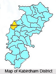
 Kabirdham District is an administrative district of Chhattisgarh. Formerly, this district was known as Kawardha District. Kawardha is the administrative headquarters of this district. Kabirdham District occupies a total area of around 4447.05 sq kms. This district of Chhattisgarh is located between 21 degree 32 minutes to 22 degree 28 minutes north latitude and 80 degree 48 minutes to 81 degree 48 minutes east longitude. Kabirdham District is bounded by Dindori District in north, by Bilaspur and Durg in east, by Rajnandgaon in south, and by Balaghat in west. The northern and western parts of this district are surrounded by Maikal mountain ranges of Satpura. Here the highest peak is Kesmarda in Maikal Mountain which is 925 metres high, while the minimum height is 320 metres.
History of Kabirdham District
Kawardha District came into existence on 6th of July, 1998 by merging Tehsil Kawardha from District Rajnandgaon and Tehsil Pandariya from District Bilaspur under the notification of the government of Madhya Pradesh. Further, according to the state government notification, Kawardha was specified as the headquarters. Present Tehsil Kawardha that is included in Kabirdham District was formerly a princely state till the first half of 18th century. It came into existence as Tehsil Kawardha in Mandla District from 1895 to 1902, in Bilaspur District from 1903 to 1911, in Raipur District from 1912 to 1948, in Durg District in 1948 and remained part of it till 1973. After that on 26th of January, 1973 this Tehsil became part of Rajnandgaon after it came into being, up to 1998. Likewise, the second Tehsil Pandariya included in the district was known as Pandariya Zamindari before 1952.
 In 1952 Pandariya became the community block headquarters in Bilaspur District. It got the status of tehsil in the year 1986 and from then it remained part of Bilaspur District till 5th of July, 1998. Both Kabirdham and Pandariya of Kabirdham District are considered important from historical point of view.
Geography of Kabirdham District
Central east and southern part of Kabirdham District is plain, whereas the northern and western part is mountainous. Mainly Regur Soil, Kanhar and Dorsa soil are found in the district, in which Nitrogen and Sulphur is available in medium quantity, whereas it lacks Zinc and Sulphur elements. The main rivers of the Kabirdham District originate generally from Maikal mountain range. Haf, Phok and Sakri rivers after emerging from north-west region of the district flow towards south-east and fall in river Shivnath, whereas Phen, Halon and Banjar rivers flowing towards west fall in Narmada River. The climate of Kabirdham District is temperate, where the maximum temperature in summer is 42 degree Celsius and the minimum temperature in winter goes to the lowest of 15 degree Celsius. The district receives low rainfall and the average rainfall is 990 mm.
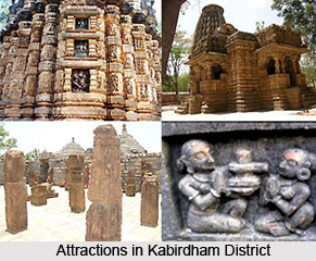
Kabirdham District is a peaceful and attractive place located on the southern bank of river Sakri. Due to the advent of Kabir Sahib and the establishment of the seat of descendants of his disciple Dharmdas, it was named as Kabirdham.


