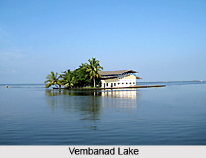
 Kottayam district is situated in the state of Kerala. It lies between the latitudes 9 degrees 15 minutes and 10 degrees 21 minutes and the longitudes 76 degrees 22 minutes and 77 degrees 25 minutes. Covering a total area of 2208 Sq. Kms, the district is naturally divided into highland, lowland and midland regions. The bulk of the district is constituted by the midland region. The taluks of Meenachil and Kanjirappally have highland and midland areas whereas Kottayam, Changanassery and Vaikom Taluks have midland and lowland areas. Kanjirappally and Meenachil Taluks have laterite soil, where as Vaikom Taluk, part of Changanassery and Kottayam Taluks have alluvial soil. The district has no coastal area. Positioned a little south to central Kerala, Kottayam district is bordered on the north by Ernakulam district, on the east by Idukki district and on the south by Alappuzha district and Pathanamthitta district. The Vembanad Lake forms the western boundary.
The district has a tropical climate with an oppressive hot season in the plains and plenty of rainfall throughout. The hot season from March to May, is followed by the south-west monsoon from June to September. The months of October and November constitute the post-monsoon or retreating monsoon season, when day temperature increases gradually and the heat is nearly as intense as in summer. The months of December to February form the north - east monsoon. Rain ceases early in January. The district normally gets an annual average rain fall of 3130.33mm.
The important rivers of the district are the Meenachil River, the Muvattupuzha River and the Manimala River. The 78 km. long Meenachil River flows through the Taluks of Meenachil, Vaikom and Kottayam. It has a catchment area of 1272 Sq kms and utilizable water resource of 1110 cubic mm. The river is formed by several streams originating from the Western Ghats mountain range in the Idukki district. At Erattupetta, Poonjar River also joins it, takes a sharp turn and flows towards the west. At Kondur, it is joined by the Chittar and at Lalam it receives the Payapparathodu and flows in a south-west direction till it reaches Kottayam. Here it branches into several streams before emptying into the Vembanad Lake. The important towns in the basin are Pala, Poonjar, Ettumanoor and Kottayam. Meenachil Medium Irrigation project has a net ayacut of 9960 hectares, 155 sq.km. catchment area and a water spread area of 228 hectares.The Muvattupuzha River originates from Idukki district, flows through Vaikom Taluk and empties into the Vembanad Lake. The most important town in the basin is Vaikom, the famous pilgrim centre. The Manimala River flows through Kanjirappally and Changanassery Taluks. The Chittar joins it on its course further down the west as it flows to Alappuzha district. The important town in the basin is Mundakkayam.


