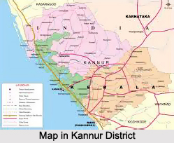
 Kannur district is situated in the state of Kerala, bounded by the Western Ghats mountain range. It lies between the North latitudes of 11 degrees 40 minutes and 12 degrees 48 minutes and East longitudes of 74 degrees and 52 minutes and 76 degrees 7 minutes. The district is bounded by Coorg district in the east, Kozhikode district and Wayanad district in the South, Lakshwadeep Sea in the West and Kasaragod district, the northernmost district of Kerala, in the North. The district can be divided into three geographical regions - highlands, midlands and lowlands. The highland region comprises mainly of mountains. This is the area of major plantations like coffee, rubber, tea, cardamom and other spices. Timber trees like teak, veetty, etc are grown in plenty in this region. The midland region, lying between the mountains and the low lands, is made up of undulating hills and valleys. This is an area of intense agricultural activity. The lowland is comparatively narrow and comprises of rivers, deltas and seashore. This is a region of coconut and paddy cultivation.
The climate of the district is humid. It has an oppressive hot season from March to the end of May. This is followed by the South-West monsoon which continues till the end of September. October and November make up the post-monsoon or retreating monsoon season. The North-east monsoon which follows extends up to the end of February, although the rain generally ceases after December. During the months of April and May, the mean daily maximum temperature is about 35 degree Celsius.
Temperature is low in December and January -about 20 degrees Celsius. On certain days the night temperature may go down to 16 degree Celsius. The annual average rainfall is 3438 mm and more than 80 percent of it occurs during the period of South -West monsoon. The rainfall during July is very heavy and the district receives 68 per cent of the annual rainfall during this season.
Kannur district is very rich in vegetation. Natural vegetation, except in some coastal regions, consists of different types of forests. However in spite of the generally favourable climatic conditions, the vegetation is not uniform throughout the district. In restricted regions, which have their own micro climate or special formations, assume different characteristics. Thus a great variety of plants are found in the region ranging from psammophytes and mangroves to evergreen forests. The coastal region is a comparatively narrow zone, characterised by secondary soil which is rather loose and sandy. The serile sandy tract supports only a poor vegetation of the psammophyte type. Plants are few and mostly prostrate. Erect species are small and short. Owing to very poor water holding capacity of the soil, these plants are provided with special xerophytic adaptations. Another conspicuous feature of this area is the mangrove vegetation, found at the estuaries of rivers and backwaters, and often extending to the interior along their banks. Human interference has much changed the vegetation of the coastal region.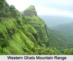
Major part of the district comes under midland region with numerous hills and dales and it presents an undulating surface gradually ascending and merging into the slopes of Western Ghats mountain range. Soil is secondary and lateritic with underlying rock of laterite or disintegrated greiss. The typical flora of this area is mostly deciduous forests, consisting of a mixture of evergreen and deciduous trees. Undergrowth consists of a variety of annuals and perennials. The mountains are a continuation of the midland region, gradually ascending to the main ridge of the Western Ghats. Soil in the western slopes is a ferrugenous red, sandy loam. Vegetation over the whole area is of the forest type. Irregular distribution of teak, localised areas of bamboo dominance, change of good quality forest into open grass lands, etc are characteristic features.
The geological formations in the district are of Archean and recent age. Archean formations comprise of greisses and charrockiates. Recent formations are alluvium and laterite. Archeans occupy the midland and highland regions of the district having rock types of basic charrockiates and hornblende-biotite greiss. The remaining portions in the coastal area are covered by laterite, alluvium, lignified woods, etc. Archean formations like foliated horn-blende-biotite greiss (gray or white in colour) is one of the main rock types in the northern portion of the district. Recent formations like laterite are developed on a limited scale along the coastal areas.


