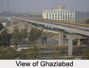
 Ghaziabad is a large planed industrial city in the Indian state of Uttar Pradesh. It is sometimes referred to as the "Gateway of UP" because it is close to New Delhi, on the main route into Uttar Pradesh. The city of Ghaziabad houses the headquarters of the Ghaziabad district. The city was initially included in the Meerut district after independence, till the time when due to some political intervention, Ghaziabad was separated and given a new district status. According to the Government of India, the district Ghaziabad is one of the Minority Concentrated Districts in India on the basis of the 2001 census data on population, socio-economic indicators and basic amenities indicators. Ghaziabad was founded by Ghazi-ud-din, who called it Ghaziuddinnagar after himself. Later the name was shortened to Ghaziabad.
History of Ghaziabad
The excavations, which have been carried out at the mound of Kaseri, banks of river Hindon and some 2 km north of Mohan Nagar, are the distinct proofs that civilization has existed here as early as 2500 BC. According to Hindu Mythology, some neighbouring towns and villages of the city including Garhmukteshwar, Pooth Village and Ahar region have been associated with the Mahabharata and the fort at Loni is associated with the legend of Lavanasura of the Ramayana period.
Geography of Ghaziabad
Ghaziabad is located about 1.5 km east of the Hindon River and 19 km east of Delhi. This city is situated at a latitude of 28 ° 40` north and longitude of 77 ° 25` east. On the north the city is bound by the district of Meerut, on the south by that of Bulandshahar and Gautambudh Nagar, on the southwest by Delhi and on the east by the district of Jyotibaphule Nagar. The boundary of Ghaziabad is adjacent to Delhi and it acts as the main entrance to Uttar Pradesh and hence is also called the Gateway of Uttar Pradesh.
 Demography in Ghaziabad
According to the 2011 census, Ghaziabad had a population of 2,358,525, of which males were 1,256,783 and females were 1,101,742. The literacy rate of the city was 93.81%. Ghaziabad is a subcategory B1 district of category B (its socioeconomic parameters are below the national average). It is the second largest industrial city in Uttar Pradesh after Kanpur.
Climate in Ghaziabad
Temperatures in Ghaziabad range from 10-20 degrees Celsius in winters and 30-40 degrees in summers. Since Ghaziabad is connected to the national capital, its temperature and rainfall are similar to Delhi. Monsoon arrives here during the end of the June or starting of July and normally it rains till October. Like other districts of northern India, mainly summer, winter and monsoon prevail in this district. But sometimes adverse weather can also be seen for the snowfall in the Himalayan and Kumaon Hills.
Rivers and Canal in Ghaziabad
Ganga, Yamuna and Hindon are the main rivers flowing close to Ghaziabad and they are filled with water throughout the year. Other than these there are some small rain-fed rivers, well known among them is the Kali River. Apart from these rivers the Ganga Canal flows across the district and irrigation work is carried out through different branches of the canal. The Ganga canal also caters to the drinking water for the people of Ghaziabad as well as Delhi.
 Economy in Ghaziabad
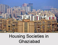
Ghaziabad is one of the most industrialized cities in Uttar Pradesh. The new industry sector upcoming in Ghaziabad is of high tech plant growth boosters. Many companies like Plastochem, Shriram Pistons, Crop health Products Pvt. Ltd. and Hind Biochem are giving it a new facet. It has industries that manufacture huge number of railway coaches, diesel engines, bicycles, tapestries, glassware, pottery, paint and varnish, heavy chains and so on. Recently a number of malls and multiplexes have been established in the city and the roads are being improved by the construction and widening of flyovers. There are a number of private hospitals and health-care centers in Ghaziabad that provide quality health care to the residents in nearby villages and towns such as Pilkhuwa, Hapur, and Dasna. Ghaziabad is also the home to Advanced Level Telecommunication Training Centre.
Visiting Information to Ghaziabad
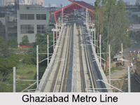
Ghaziabad Junction Railway Station is one of the largest railway junctions, witnessing more than 100 long distance trains every day, in addition to the numerous suburban trains to Delhi. This large industrial city is well-connected by all modes of transportation. Indira Gandhi International Airport is the nearest to this city. It can also be reached by road via National Highway 58.