Introduction
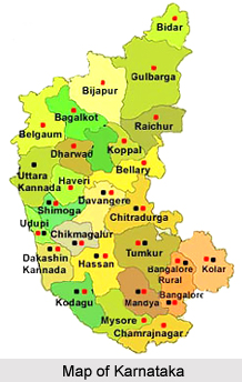
Bidar District is situated almost 700 kilometres from Bengaluru, at the farthest north-eastern corner of Karnataka. Bifurcated and truncated during the re-organisation of states in 1956, it is only a fraction of its vast expanse in the erstwhile state of Hyderabad. Bidar district as it exists today covers an expanse of 5448 sq. kilometres of land. It lies between 17 degrees 35 minutes and 18 degrees and 25 minutes North latitude and 76 degrees and 42 minutes and 77 degrees and 39 minutes east longitudes. Lying on the east are the districts of Nizamabad and Medak in Andhra Pradesh, and the districts of Nanded and Osmanabad in Maharashtra lie on the west. On the south lies the Gulbarga district of Karnataka. This central position in the Deccan had for long imparted to Bidar, the pre-eminent position in the history of the Deccan.

History of Bidar District
The history of Bidar has followed a long tradition of dynastic rule right until its reorganisation and formation in 1956. The earliest known ruling dynasty in Bidar was the Satavahana dynasty. In 231 B.C. the Satavahanas who were ruling at Paithan as vassals of the Maurya Empire proclaimed independence. They ruled over Dakshinapatha for about four centuries and a half. The Vakatakas dominated the Deccan. Following the Satavahanas, a number of different dynasties came into power here such as the Kadamba dynasty, the Rashtrakura dynasty, the Chalukya dynasty and the Kalachuris.
It came under Muslim rule sometime in 1322 when Bidar Town which was on the frontier of Telengana and Baswakalyan forts were taken by Ulugh Khan (Muhammad-Bin-Tughluq) who was then a prince. In 1656, Bidar was annexed to the Mughal dynasty. Asaf Jahi rule succeeded Mughal rule in 1724 and Bidar now came under the rule of Governors. The last member of the Nizam Shahi dynasty came, Mir Osman Ali Khan, became the Nizam. Nizam rule came to an end on 17th September 1948, and Hyderabad district became a part of the Indian union. Finally in 1956, Bidar district along with other districts of Hyderabad Karnataka became part of Mysore state but only with four talukas.
Geography of Bidar District
Geography of Bidar district is determined to a great extent by the general dryness prevalent here throughout the year. The district covers a total expanse of 5548 Kms of land, and lies between 17 degrees 35 minutes and 18 degrees and 25 minutes North latitude and 76 degrees and 42 minutes and 77 degrees and 39 minutes east longitudes. It is bounded on the east by the Nizamabad district and Medak district in Andhra Pradesh.

The entire district forms a part of Deccan Plateau and is made up mostly of solidified lava. The northern part of the district is characterized by expanses of level and treeless surface punctuated here and there by flat and undulating hillocks, black soils and basaltic rocks. The southern half of the district is a high plateau about 715 m above mean sea level and is well drained. The average elevation of the district is between 580 to 610 metres above mean sea level. Alluvial deposit is normally found along the banks of the Manjra River and its main tributaries. The top layers of the Deccan trap in parts of Bidar and Humnabad taluk are altered to reddish vesicular laterite, forming an extensive undulating plateau. The district falls under two distinct river basins, the Godavari river basin and the Krishna river basin. The main river of the district is Manjra River, which is a tributary of the Godavari River. The Karanja River itself is tributary of Manjra River. These rivers and their rivulets are not navigable.
The climate of this district is characterized by general dryness throughout the year, except during the southwest monsoon. The summer season is from the middle of February to the first week of June. This is followed by southwest monsoon season, which continues till the end of September. The months of October and November constitute the post-monsoon or retreating monsoon season. The winter season is from December to middle of February and the temperature begins to decrease from the end of November. December is the coldest month with mean daily maximum temperature of 27.3 degrees Celsius and mean daily minimum of 16.4 degree Celsius. From the middle of February, both day and night temperatures begin to rise rapidly. May is the hottest month with mean daily maximum temperature of 38.8 degrees Celsius and mean daily minimum of 25.9 degrees Celsius. With the withdrawal of southwest monsoon in the first week of October, there is slight increase in day temperature but night temperature decreases steadily. After October, both day and night temperatures decrease progressively.
The average annual rainfall at Bidar is 847.2mm. About 81% of annual rainfall is received during the period from June to September. Maximum rainfall is recorded in the month of September. The variation in rainfall from year to year is large and the district is drought-prone. The average numbers of rainy days in the district are 52. The relative humidity is high during the southwest monsoon. Summer is the driest part of the year. Winds are generally moderate in strength with some increase in force during the latter half of the summer season and during the monsoon. During the southwest monsoon season, winds mainly blow between the southwest and northeast directions. In the post monsoon season, winds blow predominantly between north and east directions. During the winter season winds are variable in directions.
Two types of soils founds in the district are Lateritie red soil and black cotton soil. Aurad and Bhalki taluks have mainly black cotton soil. Bidar and Humnabad taluks have mainly lateritic red soil. Basavakalyan taluk has both types of soils. The minerals found in the area are Bauxite, Kaolin and Red ochre. A deposit of highly siliceous bauxite clay has been located about three kilometres south of Basavakalyan. Similar deposits are noticed near Alwal and Kamthana Villages of Bidar taluk. A large deposit of Kaolin is located near Kamthana village. Red ochre deposits are found near Sirsi and Aurad Village.
Bidar Forest division is the northern most division of Karnataka encompassing the whole of Bidar district and 31 villages of the adjoining Gulbarga district. Forest areas of Bidar division are classified as Reserve forests, Protected forests and Unclassified forests. Bidar forest division covers about 8.5% of the total geographical area of the district. Most of the Reserve Forest areas are in Bidar and Humnabad ranges. Originally the forests in Bidar Division consisted of Dry deciduous and Scrub type vegetation. Over the years almost all the forest areas have been worked at one or more times resulting in large expanses of man made forests comprising mostly of Eucalyptus, Acacia auriculiformis, Glyricidia and miscellaneous species like Hardwickia, Albizzia, Azadirachta and Pterocarpus etc.
Demography of Bidar District
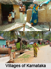
The people of the Bidar district represent a mix of various racial strains, ethnic groups and socio-cultural clusters. There has been the constant influx here of different groups of people such as the Turks, Mughals, Iranians, Afghans and Arabs who were welcomed and encouraged to settle down in the area. As a result of these admixtures there has been a cultural mosaic.
Tourism in Bidar District
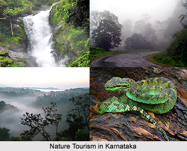
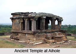
Tourism in Bidar district is replete with visits to places of historic and religious importance as well as trips to places of natural beauty. The district of Bidar has seen a long history of dynastic rule, and consequently a number of different monuments and ancient temples are found strewn across the district. Some of these are discussed below.

Pilgrimage tourism in Bidar District
The Papnash Shiva Temple at Bidar is a beautiful temple dedicated to Lord Shiva. According to legend, the Shivling at the temple is said to have been installed by Lord Rama during the course of his journey back from Lanka. Every year, during the time of the Shivaratri temple, a number of tourists visit the place. There is a natural spring that flows into a pond in front of the temple which is called 'Papnasha.'
At the Narsimha Jhira water cave temple is found a powerful deity housed in a cave nearly 300 metres long. In order to get a darshan of the deity one has to wade through water rising upto chest level. Bats and owls are found in the rooftops of the cave. The cave was air-conditioned and electrified in 1999 for the convenience of the tourists.
The Manik Prabhu temple at Humnabad attracts a lot of tourists, especially in the month of December when the annual celebrations of the temple are held. During these celebrations, a night of Classical music function is held. It is a much revered festival attended by the likes of Pandit Bhimsen Joshi, Zakir Hussain and many other noted musicians.
Two very ancient temples of Lord Veerbhadreshwara in Humnabad Taluk one at Humnabad and one at Changlara village attract lakhs of tourists in the Month of January and November respectively for the yearly Jatra and cart pulling Mahotsavs. The temple at Humnabad constructed in 1725 is famous for its moving pillar.
The Chidambra Ashram, Shri Siddharudha Math, (Gumpa) was built in the year 1986 by Shri Shivkumar Swamiji. Contained here are a total of twelve Jyotirlingas surrounding the Shri Siddharudha statue. The temple, located at the Manahalli road, is also known as the Gumpa. In the course of the last three years, the Gumpa has become a centre of religious, educational and social activities. Every year, devotees from all over India visit here to celebrate the Sadguru Siddharudha and the Shivakumar Mahaswamiji Jayanti. This is celebrated particularly in the month of November.
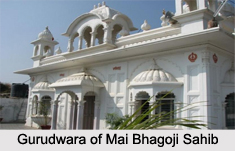
The Guru Nanak Jhira at Bidar is one of the holies places of the Sikhs in India. A number of tourists and religious devotees visit the place throughout the year, particularly in the months of November and March. Legend has it that Saint Guru Nanak visited the place while the land was in the grip of a famine The Guru performed a miracle at the request of the locals and a spring of water from the laterite rock mountain burst out. Till this day crystal clear water flows from the laterite trap. It is believed that drinking this water cures various ailments.
Leisure Tourism in Bidar District
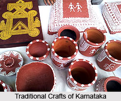
Bidar district is well known for its art works. Most famous here is the Bidriware. Deriving its name from Bidar, it is a 500 year old art which though Persian in origin is actually purely Indian in innovation. This art of engraving and inlaying is handed down by generations and is exclusive to Bidar.
Nath wood Industries owned by Shri Bandeppa, Karnataka Rajyotsava prasathi winner, located in Backchodi village of Bidar taluka, is specialised in wood carving particularly sandalwood. The carvings are intricate and specialised in making idols of Gods and Goddesses particularly of Lord Buddha. Most of these items are marketed through Kaveri emporiums of Karnataka and Lepakshi of Andhra Pradesh. The idols of Lord Buddha are exported to Taiwan, Japan and other Buddhist Countries. The sandalwood required by this industry is purchased from the sandalkotis of Dharwad and Shimoga districts.
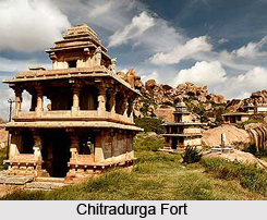
Among the various places of historic interest are the various monuments located here such as the Chidambaram ashram, Bidar fort, the Chowbara clock tower, the Barid Shahi tombs, the Chalukyan fort etc. Eco tourism is being popularised in Bidar in a big way, and one of the prime exhibits herein is the Dev Vana. Dev Dev Vana is a botanical garden, a great eco tourism centre located 6 km away from Bidar town on the Bidar - Hyderabad highway. With more than 200 medicinal plants, this vana is believed to be something of an unconventional temple of plants. These are the various places of tourism located in Bidar district.
Temples of Bidar District
There are many temples of Bidar District in Karnataka and they are also some of the prime tourist spots of the region. Bidar District lies at the northeastern corner of Karnataka and has two distinct river basins, the Godavari basin and the Krishna basin. The main river is the Manjra River, along which many temples of Bidar District are constructed.

The temples of Bidar District include the famous Guru Nanak Jhira, Narasimha Jhira Water Cave Temple, Papanaash Shiva Temple, and Veerbhadreshewar Jatra`s at Humnabad and Changlare. Narasimha Jhira Water Cave Temple is more than just a religious site, since thousands of tourists come to behold this lovely temple. This temple of Bidar District enshrines the powerful deity Lord Narasimha on the wall at the end of a cave. There is a natural spring within the cave and the devotees have to wade for at least a furlong inside the cave with waist deep water to catch the view of Lord Narasimha. It is often an exciting experience with bats and owls sitting on the rooftop of the cave. It is also known as Jharani Narasimha Temple. The cave is now facilitated with air-condition and electricity for the convenience of the devotees. This is the only sun-terrain stream of Karnataka, which is 1 km from Bidar district.
Amongst the other temples of Bidar District, this is the most popular Hindu pilgrim center dedicated to Lord Shiva is located in a lush green valley. A pond called Papnasha is made in front of the temple and is supplied with water from a natural spring. It is believed that the shivling here is one of those installed by Shri Ram during the time of his return from Lanka. It is said that snakes guard the idol of Lord Shiva during Shivratri festival. The temples of Bidar District are of great reverence for the local people and also the pilgrims coming to the state.
Visiting Information on Bidar District
By Air: Rajiv Gandhi International Terminal, Begumpet, Hyderabad is Just 120 Kms away from Bidar District Head Quarters. Its just 2 and half hours drive from the airport to Bidar on NH9 till Zaheerabad and a diversion of 28 Kms after Zaheerabad.
By Rail: Rail facility is available from Bengaluru and Hyderabad. One may also take an Express train from Bengaluru to Gulbarga and take a bus from there to Bidar.
By Road: From Bengaluru many Govt Luxury Buses of KSRTC ply daily via Hyderabad, Its 16 hours journey from Bengaluru via Hyderabad on NH 7 and NH 9. It is a 20 hour journey from Bengaluru via Gulbarga and Bellary.