
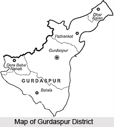
 Gurdaspur District is a northern district of Punjab. It falls in the Jalandhar division and is placed between Ravi River and Beas Rivet. Gurdaspur is the district headquarters. Gurdaspur District lies between north latitude 31 degree 36 minutes and 32 degree 34 minutes and east longitude 74 degrees 56 minutes and 75 degree 24 minutes. This district shares common boundaries with Kathua district of Jammu and Kashmir in the north, Chamba and Kangra district of Himachal Pradesh in the north-east, Hoshiarpur district in the south-east, Kapurthala district in the south, Amritsar district in the south west and Pakistan in the north-west.
Gurdaspur District
Gurdaspur District is located in the northern part of Punjab. This district was initially a sub-division of Lahore division before the independence of the country. Gurdaspur District is popular for its historical religious sites.
Introduction
Gurdaspur District is a northern district of Punjab. It falls in the Jalandhar division and is placed between Ravi River and Beas Rivet. Gurdaspur is the district headquarters. Gurdaspur District lies between north latitude 31 degree 36 minutes and 32 degree 34 minutes and east longitude 74 degrees 56 minutes and 75 degree 24 minutes. This district shares common boundaries with Kathua district of Jammu and Kashmir in the north, Chamba and Kangra district of Himachal Pradesh in the north-east, Hoshiarpur district in the south-east, Kapurthala district in the south, Amritsar district in the south west and Pakistan in the north-west.History of Gurdaspur District
 History of Gurdaspur District describes that Gurdaspur was founded by Guriya Ji in the beginning of 17th century. On his name, this city was named as Gurdaspur. He bought land for Gurdaspur from Jats of Sangi Gotra. It is also established from certain historical accounts that some people used to live in huts in the old city. Guriya Ji a Sanwal Brahmin of Kaushal Gotra belonged to Paniar village situated 5 miles north of Gurdaspur. The ancestors of Guriya Ji came from Ayodhaya long time ago and settled in Paniar.
Little is known about the ancient history of Gurdaspur District except a few antiquities like the rock temples at Mukheshwar. From the latter half of the 10th century up to 1919 AD this district was ruled by the Shahi dynasty under Jayapal and Anandpal. Kalanaur in this district was the most important town during the period of 14th to 16th centuries AD. It was twice attacked by Jasrath Khokhar, once in 1422 and again in 1428. In the second attempt, Jasrath Khokhar was defeated by Malik Sikander.
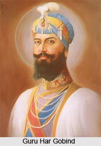
The history of Gurdaspur District also states that this district witnessed the decline and fall of the Mughal supremacy and the rise of the Sikh power in the region. Some of the Sikh Gurus have been closely associated with the district. Guru Nanak, born in 1469 in Lahore district, married Sulkhani in 1485. Guru Har Gobind re-founded Sri Hargobindpur which had been formerly known by the name of Rahila. Banda Bahadur, the disciple of Guru Gobind Singh used this district as a base to raid the country up to Lahore. The history of Gurdaspur District then degenerates into an account of their struggles of the rival Ramgarhia and Kanhaya Misals for supremacy in this part of the Doab, the power of the former was broken in 1808 and of the latter in 1811 by Maharaja Ranjit Singh, who thus assumed rule over the whole district.
During partition of India in 1947 the future of Gurdaspur District could not be decided for many days as this district included a huge Muslim community. However, later on Muslim population of the district migrated to Pakistan and the Hindus and the Sikhs of Sialkot migrated to Gurdaspur. They settled in Gurdaspur District.
Geography of Gurdaspur District
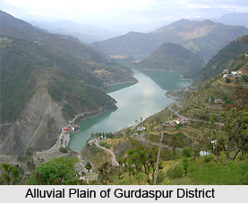 Geography of Gurdaspur District is composed of plains similar to the rest of Punjab plains in structure and surface configuration. Northern most part of the district is in the foot of Shivalik hills. The hilly tract covering the north-eastern parts of Pathankot and Dhar tehsils have typical geographical structures, ranging in elevation from about 381 to 930 metre above sea level.
From north to south geographical tract consists of three small ranges running in northwest to south east direction - Siali Dhar-Dangahri Dhar range, Dhaula Dhar-Nag Dhar range and the Rata Dhar range. The Siali Dhar-Dangahri Dhar range lies to the extreme north. In its western part Siali Dhar range is about 931 metres above sea level at its highest point and in the eastern part about 959 metres. This range is highly dissected by numerous streams. South of this is situated the Dhaul Dhar-Nag Dhar range which is about 13 km long and at places about 2.5 km wide and has an elevation varying from about 610 to 844 metres above sea level. Lastly, the Rata Dhar range is marking the boundary between the hilly tracts at the dissected undulating plain having an elevation of about 665 metres above sea level. To its south lies an area of about 128 sq kms which is highly dissected and is an undulating plain. Its elevation ranges from about 305 to 381 metres above the sea level.
The flood plains of the Ravi and the Beas are separated from the upland plain by sharp river cut bluffs. They are low lying, with slightly uneven topography. Sand dominates in the soil structure of the flood plains, but it diminishes in both quantity and coarseness in the upland plain. The upland plain covers a large part of the district. Its elevation ranges from about 305 metres above sea level in the north-east to about 213 metres above sea level in the south west, with a gentle gradient of about 1 metre. This is the most important physiographic unit in the district. Geography of Gurdaspur District has the topographic characteristics of Ropar and Hoshiarpur districts.
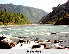 Geography of Gurdaspur District includes river system and power resources. Beas River and Ravi River are the two main rivers which flow through the district, both of which originate near the Rohtang pass in Himachal Pradesh. The Chaki Khad is the chief tributary of the Beas in Gurdaspur district. Like other rivers of Punjab the water of the Beas and the Ravi fluctuate from season to season and from year to year. This fluctuating discharge of the rivers does not permit their navigational use. Gurdaspur District possesses a fairly dense network of canals of the Upper Bari Doab Canal system which irrigates most of the area of the district.
There are mainly two seasons - summer and winter. The summer season falls between the months of April to July and the winter starts in November and continues up to March. In summer season the temperature reaches around 44 degree Celsius or even sometimes crosses it. June is the hottest month and January is the coldest one. Most of the rain is received in the month of July. The winter rains are experienced during January and February. The dust storm occurs in the month of May and June. The south-west monsoon generally arrives in the first week of July and continues up to the end of August. 70 percent of the rainfall occurs during this period. The average rainfall of the district is 875.4 mm. The rainfall in Gurdaspur District is greater in the sub mountain parts and it decreases rapidly towards the southwest.
Vegetation varies in Gurdaspur District depending on the soil, topography and elevation. Geography of Gurdaspur District mainly includes loamy soil with clay content below 10 percent. Soils of this district contain small quantities of lime but the magnesia content is high. They are well supplied in potash and phosphoric acid but the quantities available are low. The agriculture is dependent to a large extent on the nature of its soils which in turn, is influenced materially by climatic factors. Further, the soil of the district is quite alluvial and fertile. The minerals found in the district are building stones, foundry sand, lime stone, ochre, fullers-earth, etc. Brick-earth is found in plenty through out the district.
Education in Gurdaspur District
Educational facilities in Gurdaspur District are quite good. There are around 119 Government Senior Secondary Schools, 125 Government High Schools and 240 Government Middle Schools. There are several degree colleges like Bearing Union Christian College, Sikh National College, M.S.D.R.S.D. College, Govt. College, Gurdaspur, Govt. College, and more.
Tourism in Gurdaspur District
Tourism in Gurdaspur District mainly includes visits to its various shrines and Gurudwaras. Gurdaspur District is known for its ancient temples and Gurudwaras and it generally offers pilgrimage tourism to its travellers. The main attractions of Gurdaspur District are Mahakaleshwar Temple at Kalanaur, Barath Sahib, Dera Baba Nanak, Achal Sahib, Achaleshwar Temple, Gurudwara Sri Kandh Sahib, Dhianpur Shrine, Mukeshwar Temple at Shahpur Kandi, Pandori Dham Temple, Shrine of Dhianpur Sri Baba Lal Dyal Ji and Gurudwara Chola Sahib Dera Baba Nanak. One of the main attractions of Gurdaspur District is Takht - I - Akbari, the coronation site of Mughal Emperor Akbar (1556 - 1605 AD). He was coroneted as the Emperor of Hindustan on 14th February 1556 AD. Akbar the great Mughal Emperor 1556 - 1605 was coronated at a place situated at a distance of 2 Kms East of Kalanaur. Chhinjh Mela and Baisakhi fair are two of the prominent attractions of Gurdaspur District.
Pilgrimage Tourism in Gurdaspur District :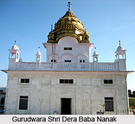 Pilgrimage tourism in Gurdaspur District includes visits to several shrines and temples. Travellers from all parts of the country come and explore the holy sites offered by pilgrimage tourism in Gurdaspur District. There are various temples and Gurudwaras that also have huge historical significance. Some of the popular pilgrimage sites of Gurdaspur District are as follows:
Mahakaleshwar Temple at Kalanaur: Since time immemorial, a big Shivaratri fair is held every year in the Mahakaleshwar temple on the occasion of Shivaratri when a large number of devotees gather here to offer their prayers.
Barath Sahib: Barath Sahib is situated 13 kms west of Pathankot city. The Gurudwara of Barath Sahib is associated with Baba Sri-Chand, elder son of Guru Nanak. Baba Sri-Chand is the founder of Udasi sect.
Dera Baba Nanak: Dera Baba Nanak is situated 45 kms west of Gurdaspur. This place is associated with Sri Guru Nanak Dev Ji. The two famous Gurudwaras at Dera Baba Nanak are Sri Darbar Sahib and Sri Chola Sahib.
Achal Sahib: Achal Sahib is 8 kms from Batala on Batala Jalandhar road. This is associated with Guru Nanak Dev and Kartik, the son of Lord Shiva and Parvati.
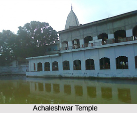 Achaleshwar Temple: On the opposite side of Gurudwara, there is Achaleshwar Temple. According to local sources, this temple belongs to Satyug period and is related to Lord Kartik.
Gurudwara Sri Kandh Sahib: This pious place is associated with Guru Nanak Dev Ji`s marriage.
Dhianpur Shrine: Dhianpur is situated 19 kms north of Batala. The town is associated with Baba Lal Ji, who is said to have lived during the time of Mughal Emperor Shah Jahan. There is a mythological brief associated with this place, which says that one who takes bath in the baoli on a moonlit night of Saturday the person will be blessed with a son.
Gurdas Nangal: Gurdas Nangal, which is associated with Banda Singh Bahadar`s last battle with Mughals, is situated about 7 kms west of Gurdaspur. Bhai Duni Chand`s Haveli earlier known as `Bande Wali Theh` is about one mile from the present village of Gurdas Nangal.
Sri Hargobindpur: Sri Hargobindpur is situated about 45 kms south of Gurdaspur city. This area was formerly known as `Rohila`. Guru Arjan Dev, the fifth Guru of Sikhs founded the town of Sri Hargobindpur in 1595 AD in memory of his son Hargobind`s birth.
Mukeshwar Temple at Shahpur Kandi: This temple is situated on the bank of Ravi River. It is about 8 kms north east of Shahpur Kandi. This temple is the earliest relics of antiquity. These are said to date back to the period of Pandavas.
Pandori Dham Temple, Gurudwara Chola Sahib Dera Baba Nanak, Shrine of Brave Haqiqat Rai (1724 - 1731 AD) at Batala and Shrine of Dhianpur Sri Baba Lal Dyal Ji are some of the other noteworthy pilgrimage sites that are worth exploring.
Pilgrimage Tourism in Gurdaspur District :
Pilgrimage tourism in Gurdaspur District includes visits to several shrines and temples. Travellers from all parts of the country come and explore the holy sites offered by pilgrimage tourism in Gurdaspur District. There are various temples and Gurudwaras that also have huge historical significance. Some of the popular pilgrimage sites of Gurdaspur District are as follows:
Mahakaleshwar Temple at Kalanaur: Since time immemorial, a big Shivaratri fair is held every year in the Mahakaleshwar temple on the occasion of Shivaratri when a large number of devotees gather here to offer their prayers.
Barath Sahib: Barath Sahib is situated 13 kms west of Pathankot city. The Gurudwara of Barath Sahib is associated with Baba Sri-Chand, elder son of Guru Nanak. Baba Sri-Chand is the founder of Udasi sect.
Dera Baba Nanak: Dera Baba Nanak is situated 45 kms west of Gurdaspur. This place is associated with Sri Guru Nanak Dev Ji. The two famous Gurudwaras at Dera Baba Nanak are Sri Darbar Sahib and Sri Chola Sahib.
Achal Sahib: Achal Sahib is 8 kms from Batala on Batala Jalandhar road. This is associated with Guru Nanak Dev and Kartik, the son of Lord Shiva and Parvati.
Achaleshwar Temple: On the opposite side of Gurudwara, there is Achaleshwar Temple. According to local sources, this temple belongs to Satyug period and is related to Lord Kartik.
Gurudwara Sri Kandh Sahib: This pious place is associated with Guru Nanak Dev Ji`s marriage.
Dhianpur Shrine: Dhianpur is situated 19 kms north of Batala. The town is associated with Baba Lal Ji, who is said to have lived during the time of Mughal Emperor Shah Jahan. There is a mythological brief associated with this place, which says that one who takes bath in the baoli on a moonlit night of Saturday the person will be blessed with a son.
Gurdas Nangal: Gurdas Nangal, which is associated with Banda Singh Bahadar`s last battle with Mughals, is situated about 7 kms west of Gurdaspur. Bhai Duni Chand`s Haveli earlier known as `Bande Wali Theh` is about one mile from the present village of Gurdas Nangal.
Sri Hargobindpur: Sri Hargobindpur is situated about 45 kms south of Gurdaspur city. This area was formerly known as `Rohila`. Guru Arjan Dev, the fifth Guru of Sikhs founded the town of Sri Hargobindpur in 1595 AD in memory of his son Hargobind`s birth.
Mukeshwar Temple at Shahpur Kandi: This temple is situated on the bank of Ravi River. It is about 8 kms north east of Shahpur Kandi. This temple is the earliest relics of antiquity. These are said to date back to the period of Pandavas.
Pandori Dham Temple, Gurudwara Chola Sahib Dera Baba Nanak, Shrine of Brave Haqiqat Rai (1724 - 1731 AD) at Batala and Shrine of Dhianpur Sri Baba Lal Dyal Ji are some of the other noteworthy pilgrimage sites that are worth exploring.
Recently updated articles in States of India

Bandare Waterfalls, Meghalaya
Bandare Waterfalls in South Garo Hills, Meghalaya, is a secluded natural attraction surrounded by dense subtropical forests and rugged mountain terrai...

History of Thissur District
Early History of Thissur District explains flourishing of the port cities. Now these port cities are transformed into archaeological sites.

Tippi Orchid Research Centre, Arunachal Pradesh
Tippi Orchid Research Centre in Arunachal Pradesh is renowned for its rich collection of exotic and endangered orchids. Surrounded by lush rainforest...

Tourism in Nashik District
Pilgrimage tourism in Nashik district involves visiting the various places of Hindu and Jain worship located here. Some of the holiest sites for Hind...

Mangadu, Kerala
Mangadu in Kerala’s Kollam district is a significant megalithic site known for its urn burials, cist burials, menhirs, and stone circles. Excavations...
Related articles in States of India

East Indian States
East Indian States comprises of Bihar, Jharkhand, West Bengal, Odisha and also the Union Territory of Andaman and Nicobar Islands. It defines the cult...

Purnia District in Bihar
Purnia District is located in Bihar and extends from River Ganga to Nepal. The district has a rich Hindu history and glorious past.

Hooghly district
Hooghly District along the bank of the river Hooghly is one of the principal trading ports of West Bengal.

Geography Of Chittoor District
Geography of Chittoor district is spread along the topography of the land which is divided into two natural divisions; Chittoor has a dry and healthy...

Districts of West Bihar
Districts of West Bihar is comprised of medieval monuments that were built by the different governors of Mughal era.