
 Geography of Nilgiris district is vast and it covers an area of 2452.50 square kilometres. This district in the state of Tamil Nadu in India is located at an elevation of nine hundred to two thousand six hundred and thirty six meters above mean sea level. The latitudinal and longitudinal dimensions of this district are one hundred and thirty kilometres by one hundred and eighty five kilometres. This district of Tamil Nadu is bounded on the North by the state of Karnataka, on the West by the district of Coimbatore and Erode district, on the South by the Coimbatore district and Kerala and on the East by the state of Kerala. In the district of Nilgiris the topography is rolling and steep. Approximately sixty percent of the land under cultivation is under the slopes ranging from sixteen to thirty five percent. The total area covered by this district is 2452.50 square kilometres.
As the district of Nilgiris is located at an elevation of 900-2236 meters above the mean sea level, during the summer season the climate remains to the maximum of 21 degree Celsius to 25 degree Celsius and the minimum of 10 degree Celsius to 12 degree Celsius. In the season of winter, the maximum temperature ranges from 16 degree Celsius to 21 degree Celsius and the minimum of 2 degree Celsius. The Nilgiris district usually receives rain both during the South-West monsoon and North-East monsoon. The Gudalur, Pandalaur, Kundah and some portions of Udhagamandalam taluk receive rain from the South-West monsoon and some part of Udhagamandalam taluk and the entire Kotagiri and Coonoor taluks are benefited by rain from the North-East monsoon.
 There are sixteen rainfall registration stations in this district of Tamil Nadu. The average annual rainfall received by the Nilgiris district is 1920.80 mm.
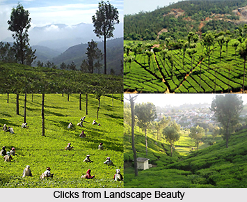
Irrigational schemes are not available in this district and the crops grown here are primarily rain fed. There are several check dams which are constructed at various places to exploit the natural springs of the district. The Nilgiris is a horticulture district and the entire economy of the Nilgiris district depends upon the success and failure of horticulture crops like cabbage, potato, carrot, coffee, tea, spices and fruits. The main cultivation of this district is plantation crops which are coffee and tea. Potato and other vegetables are also raised in Coonoor and Udhagai taluks. Ginger and paddy are grown in Gudalur and Pandalur taluks. Paddy is grown in Thengumarahada area in Kotagiri taluk. Apart from these crops, samai, ragi, wheat, vegetables etc are grown in small extent in the district.









