
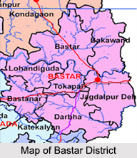
 Districts of Bastar division in Chattisgarh include the districts like Bastar District, Dantewada District, Bijapur district, Narayanpur district, Sukma District and Kanker District.
Bastar District
Bastar District is a district of the state of Chhattisgarh in central India. Jagdalpur is the district headquarters. The district has an area of 10755.79 square km. Bastar District is bounded on the northwest by Rajnandgaon District, on the north by Kondagaon District, on the east by Nabarangpur District and Koraput district of Odisha state, on the south and southwest by Dantewada District, and on the west by Gadchiroli District of Maharashtra state. It possesses a unique blend of tribal and Odia culture.
Dantewada District
 Dantewada District, also known as Dantewara District or Dakshin Bastar District (South Bastar District), is a district in the Indian state of Chhattisgarh. Dantewada is the district headquarters. The district is part of Bastar Division. Until 1998, the Dantewada District was a tehsil of the larger Bastar District.
Bijapur District
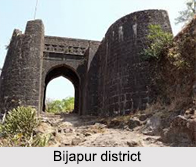
Bijapur district, formerly known as Birjapur is one of the 27th districts of Chhattisgarh state in central India. It is one of the two new districts created on May 11, 2007. As of 2011 it is the second least populous district of Chhattisgarh after Narayanpur. Moreover, it holds the dubious distinction of being the second least literate district in India at 41.58 percent, as per the 2011 census, after Alirajpur, Madhya Pradesh
Narayanpur District
Narayanpur district is one of the 27 districts of Chhattisgarh State in Central India. It is one of the two districts created on May 11, 2007. It was carved out from the erstwhile Bastar district. This district occupies an area of 6640 km sq. and it had a population of 110,800 in 2001.
Sukma District
Sukma is a town in the newly formed, southernmost Sukma district in Chhattisgarh.
Kanker District
Kanker District is located in the southern region of the state of Chhattisgarh within the longitudes 20.6-20.24 and latitudes 80.48-81.48. The total area of the district is 5285.01 square kilometers. The population is 651,333. The Princely State of Kanker came under the control of the Bhosales of Nagpur during the reign of Bhoop Dev from 1809 to 1818. During the kingdom of Narhari Deb, the Princely State of Kanker came under control of British East India Company from Maratha Empire. As British government gave the adoption to Narhari Dev and he gave the acknowledgement of fealty to British Government of India. In 1882, the control of Princely State of Kanker handed over to Commissioner of Raipur.









