Introduction
Barbil stands as a prominent city and a Municipal Council within the Kendujhar district, acknowledged as the "Iron City," situated in the state of Odisha, India. This locale boasts of hosting one of the planet`s most substantial reserves of iron ore and manganese ore. The rich mineral deposits in the vicinity play a pivotal role in contributing significantly to the economic sustenance of both the central and state administrations. Additionally, Barbil holds the distinction of being classified as a fifth scheduled area under the constitutional framework of India, thereby affirming its unique legal status and administrative significance.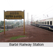
Location of Barbil
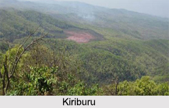
Barbil, situated at 22.12°N latitude and 85.40°E longitude, rests at an average elevation of 477 meters (1,565 feet). Nestled amidst hills, the town is encircled by the Kiriburu range, which runs parallel to its terrain. These surrounding hills are blanketed with dense forests, dominated by Sal trees. The town's close proximity to the forested areas has resulted in occasional sightings of wild elephants within Barbil.
History of Barbil
One distinctive feature of Barbil is that it has one of the oldest rocks of the world, approximately 38,000 millions year old spreading over an area of 100 square km at Asanpat. It also has the oldest stone writing found in Odisha presumably belonging to the Gupta period. In Sitabinj, there is the wall paintings in the cave shelter of Ravana Chhaya which were most probably made during the 5th century A.D. The district is home to two main tribes. These are the Juangs and the Bhuyans. The district of Keonjhar has a plethora of mineral resources. There are huge deposits of iron, manganese and chrome ores. About 30% of the entire area of the district is filled with dense forests.
Geography of Barbil
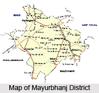
Barbil emerges as an enclave of distinctive terrain. The place is located amidst hills that envelop its boundaries. Serving as a village within the Saharapada Tehsil of the Kendrujhar District in Odisha, Barbil finds itself encircled by the Raruan Tehsil to the north, the Patana Tehsil to the west, the Karanjia Tehsil to the east, and the Sukruli Tehsil to the north. This locale resides at the crossroads of the Kendujhar district and the Mayurbhanj district, signifying its strategic placement. Its geographic proximity to the neighboring cities of Kendujhar, Karanjia, Anandapur, and Joda, further enhances its significance within the region.
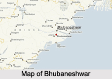
Notably, Barbil is situated at a distance of 43 kilometers from the district headquarters of Kendujhar, towards the east. Additionally, it stands 190 kilometers away from the state capital, Bhubaneswar, marking its accessibility and connectivity to major centers of administration and commerce.
Climate of Barbil
Situated at an elevation of 452.16 meters (1483.46 feet) above sea level, Barbil exhibits a humid subtropical, dry winter climate, characterized by the climatic classification Cwa. The district`s annual mean temperature is recorded at 27.82 degrees Celsius, signifying a modest 1.85% deviation from the national averages. In the course of a year, Barbil witnesses an average precipitation of approximately 161.71 millimeters (6.37 inches), accompanied by a frequency of 134.19 rainy days, which accounts for approximately 36.76% of the annual time span. Notably, the warmest month in Barbil is May, experiencing temperatures as high as 39.93 degrees Celsius, while the coldest month, January, records temperatures as low as 13.74 degrees Celsius.
Demography of Barbil
As per the 2011 India census, the demographics of Barbil manifest a population of 66,540 individuals. Within this populace, males comprise 53%, while females account for 47%, reflecting a balanced gender distribution. Barbil asserts an average literacy rate of 72.18%, underscoring the community`s commitment to education and knowledge acquisition. Remarkably, a segment encompassing 16% of the population is in the stage of childhood, under 6 years of age.
Beyond its resident population, Barbil dynamically accommodates an additional influx of approximately 50,000 individuals who converge upon the town for employment opportunities, rendering it a center of economic activity. Noteworthy is the social composition, wherein a significant portion, ranging from 45% to 48%, is constituted by Scheduled Tribes (ST) and Scheduled Castes (SC).
Administration in Barbil
Barbil boats of a well-structured municipality, attesting to its organized administration. This municipality is partitioned into 15 distinct wards, a strategic division that allows for efficient governance and service distribution across the township. The municipality diligently oversees the provisioning of fundamental necessities to its inhabitants, encompassing vital services such as water supply, electricity accessibility, and sewerage management, all contributing to the residents` quality of life. In the broader legislative context, Barbil is represented in the Champua assembly constituency.
Education of Barbil
Barbil has a multi-ethnic culture due to the arrival of people from almost all states of India. The town has very good convent school known by the name of `St. Mary`s School`. The city of Barbil has 24 primary schools and seven high schools. There is also the Barbil College and mining school for offering higher education.
Economy of Barbil
Barbil is an industrially developed town with a great many plants, crushers and mines around. The area near Barbil has the fifth biggest deposit of iron ore and manganese ore in the whole world. It is a major revenue earner for both the central and the state government. From here, iron ore is also exported to China. Moreover, steel and liquid oxygen are also produced here.
Tourism in Barbil
Amidst the verdant undulations along the banks of the Karo River in Odisha, Barbil emerges as a pivotal gem in the state`s tourist landscape. Reverberating with captivating vistas, the city resonates as an essential destination for travelers seeking remarkable experiences. Acknowledged as the fifth-largest repository of iron and manganese worldwide, Barbil’s unique geological composition itself attracts attention, but is not limited to mineral wealth only.
Barbil unveils an array of pilgrim sites, ancient temples, historical landmarks, verdant hills, expansive forests, and enchanting waterfalls, collectively rendering it a comprehensive hub of exploration. Among the notable highlights that punctuate Barbil`s tourism, the Uliburu reserved forest offer an immersive encounter with untamed wilderness. The Thakurani Hills stand as a sentinel of history of the region. Cascading with grandeur, the Murga Mahadev Waterfalls captivate the senses with their natural splendor. The serenity of Gonasika beckons those in pursuit of spiritual tranquility.
The place also boasts of famous shrines including the
Hamuman Mandir and Shiva Mandir. Ghatgaon emanates an aura of sanctity,
while Badaghagara and Sanaghagara waterfalls grace the
landscape with their picturesque beauty. Finally, the resplendent Khandadhar adds a touch of awe-inspiring
magnificence to Barbil`s tourism spectrum.
Here is a list of all the popular tourist attractions in
Barbil:
Ghatgaon Maa Tarini Temple: This is one of the most popular religious temples in Barbil, dedicated to the Hindu Goddess Maa Tarini. Devotees revere her as the Queen of the Forest. The temple hosts two prominent festivals, Patua Yatra and Ashadhi Parba, celebrated with great fervor in April.
Sana Ghagra, Barbil: The Sanaghagara Waterfall is a major tourist attraction in the Kendujhar district of Odisha. In addition to being a natural wonder, it serves as a popular picnic spot, drawing thousands of visitors and tourists year-round. The perennial stream enhances the scenic beauty of the forested area, making it a favorite destination for nature lovers.
Sitabinji: According to mythology, this site is believed to be the birthplace of Luv and Kush, the sons of Lord Rama and Sita. It holds significant religious importance for Hindu devotees, attracting thousands of visitors from across India.
Kanjhari Dam: Known as a famous water reservoir,
Kanjhari Dam is a popular spot for picnics, where visitors can spend quality
time with family and loved ones while enjoying its serene surroundings.
Murga Mahadev Waterfalls: Named after Lord Shiva’s son Kartikeya, also known as Murugan, this enchanting location boasts two stunning waterfalls cascading from the Thakurani Hills. The surrounding trees add to the site’s charm, making it a mesmerizing spot and a preferred picnic destination for locals.
Transport in Barbil
Barbil railway station is an integral part of the Tatanagar-Bilaspur section within the extensive Howrah-Nagpur-Mumbai rail network. This strategic placement facilitates robust connectivity between Barbil and significant urban centers across the nation, including Kolkata, Puri, Bhubaneshwar, and Jamshedpur. The transportation options via rail encompass the Jan Shatabdi Express departing from Howrah and a passenger train from Tatanagar, both extending their services to Barbil. Additionally, a daily Intercity Express train ensures consistent travel links between Barbil, Bhubaneshwar, and Puri.
Barbil does not possess its own airport. The nearest air gateway to the city is Ranchi Airport, located in the neighboring state of Jharkhand, approximately 146 kilometers from Barbil. For broader air connectivity, the Bhubaneshwar Airport, situated 207 kilometers away, stands as a prominent aviation hub. On the terrestrial front, Barbil boasts a robust road network that connects it seamlessly with various major cities. Travelers can rely on direct bus services that efficiently link Barbil with urban centers such as Bhubaneshwar, Kolkata, and Kendujhar.