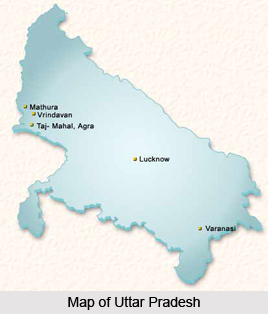
Introduction
Azamgarh District of Uttar Pradesh is a part of Azamgarh Division. Azamgarh is the district administrative headquarters. Total population of Azamgarh District is 39, 39,915 as per census 2001, out of which total male population is 19, 50,414 and female population is 19, 89,501. Azamgarh District occupies a total area of 4054 sq kms. Literacy rate of Azamgarh District is around 57 percent (male literacy rate is 70.5 percent and female literacy rate is 42.4 percent). Administration of Azamgarh District includes seven Tehsils and 22 development blocks.

History of Azamgarh District
Azamgarh District derives its name for Azam Khan who founded it on the ruins of the village Ailwal and Phulwaria in around 1665 AD. Azamat Khan, brother of Azam Khan built a fort in this place. At this time Azamgarh possesses only the ruins of the fort, constructed by Azmat. Adjoining Azmatgarh there is Azamgarh Tal, which was named after Azam Khan.
It is also believed that the district is named after its headquarters town, Azamgarh, which was founded in 1665 by Azam, son of Vikramajit. Vikramajit a descendant of Gautam Rajputs of Mehnagar in Pargana Nizamabad, like some of his predecessors, had embraced the faith of Islam. History of Azamgarh District includes ancient period, medieval period and modern period. Ancient period of the district`s history states that Azamgarh, one of the easternmost districts of Uttar Pradesh, once formed a part of Kosala, ancient state of northern India, except the north-eastern part of it which was included in the kingdom of Malla.
Kosala figured prominently among the four powerful monarchies of northern India during the time of the Lord Buddha, when its prosperity reached its peak. The district of Azamgarh possesses hardly any remains of much historical value. There are some deserted sites, forts and tanks to be seen in every tehsil of Azamgarh District and they carry vague legends regarding their builders. The early history of Azamgarh District can be traced only from the extant antiquities. That the region including this district was inhabited in ancient times is testified by the presence of old indigenous people like Bhar, Soeris and Cheru.
According to the medieval period of the history of Azamgarh District, the second battle of Tarain in 1192 AD established the Islamic power in India. But the region including the district of Azamgarh does not appear to have gone under the immediate sovereignty of the Muslims. From the establishment of Jaunpur kingdom to its extinction, most of the tract now included in this district fell under its rule; but no important place in Azamgarh District can be mentioned as having been the seat of administration for the surrounding Parganas.
Modern period of the history of Azamgarh District states that at the beginning of 18th century, the area covered by Azamgarh District was included in Jaunpur and Ghazipur and was held by the Raja of Azamgarh. At his time the prosperity of Azamgarh was at its top. Further, as per the history of Azamgarh District, on 18th September, 1832, Azamgarh District was formed. After the struggle of 1857 no major events except the Gaurakshini or the anti-cow slaughter movement of 1893 occurred in the district till the end of the 19th century. The Khilafat Movement started in 1920 and its impact also spread in this district. In August 1920, Mahatma Gandhi launched his famous non cooperation movement, and the people of the district actively took part in it under the leadership of Suryanath Singh.
In 1931, no-rent campaign was started in the district. Azamgarh was in the front line of the Quit India Movement, which was started on August 9, 1942. Thus, history of Azamgarh District shows that this district played a great role in the freedom struggle of the country.
Geography of Azamgarh District
Geography of Azamgarh District comprises level plain without any hills, the only variations in the surface being caused by the dire lands along the streams that drain it. Except in the proximity of the Ghaghara River, the region slopes gently towards the south-east. Topography of Azamgarh District also includes depressions of varying depth and extent in which the surface drainage of the interior collects. Further, there are some high lying plains.
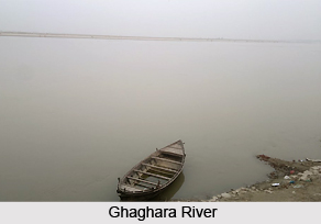
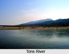
Geography of Azamgarh District also comprises some major river system and water resources. Ghaghara River is the main river flowing through the district. The river has its origin in the mountains of Kumaon and Nepal. Ghaghara River makes the northern boundary of Azamgarh District and separates it from Gorakhpur. Among the minor channels which traverse the district is Tons River. This river takes its rise many kilometers beyond the borders of Azamgarh in Faizabad District. It flows parallel with the Ghaghara till it caters the district around 9.6 km north-east of Mahul. It is soon after joined by a small tributary called the Majhoi on the borders of Pargana Nizamabad.
Tons River is perennial but during the dry months of the year only a sluggish current of water flows in the bottom of its bed. Lakes of the district are numerous but in many cases of considerable size. The more significant of them are, in the southern tract, those known as Kotail, Jamuawan, Gumadih, Kumbh, Pukh, Asaune and the largest of all the Gambhiran. In the northern section of Azamgarh District, the prominent lakes are Koila, Kasila-Gasila, Kaili, Duhia Birna, Ara Telhnan and Manchhil.
The climate of Azamgarh District is moist and relaxing except in winter and hot seasons. The year may be divided into four seasons. The period from March to the mid of June is the hot season. The south west monsoon season continues up to the end of September. The succeeding period lasting till the end of November is the post monsoon or transition season. The period from December to February is the cold season. The average annual rainfall in the district is 1021.3 mm. On an average there are 50 rainy days in a year in this district of Uttar Pradesh. This number varies from 48 at Deogaon to 52 at Azamgarh. For agriculture purpose the most critical period is rainy season from June to October.
Culture of Azamgarh District
Azamgarh District is rich in cultural and religious activities. The tradition language is particularly Bhojpuri language or Purvi. The major community of this district is divided into four branches. The ancient division was mainly occupational but gradually it developed into a hereditary order. People perform several pujas and celebrate the popular festivals with great enthusiasm. The practice of a taking a holy dip in river is also famous in the district. The important festivals of the district are Durga Puja, Ramnavami, Janmashtami, Shivaratri, Diwali, Dussehra and Holi. The famous folk songs of the district are Kajri, Barahmasi, Chaumas, Phagua, Kahrava, Birha, Kawwali, Alha, Kirtan, Jogia, Bhajan, Kavi sammelan, Musayara, etc. The famous folk dances of Nautanki, Ramlila, Krishnalila, Bandar and Bhalu dance, Kaharwa dance, Dhobiya dance, Kirtan dance, Ahirwa Dance, etc.
Tourism in iAzamgarh District
Tourist places in Azamgarh District in Uttar Pradesh are of great historical significance. These places reflect the rich past associated with the district. People across the country come and explore these places of interest.
Some of the prominent tourist places of Azamgarh District are as follows:-
Azamgarh City: The principal town of the district also gives its name to the district headquarter and forms a tehsil of the name Sadar. The city was founded around 1665 by Azam Khan, son of Vikramajit. The old fort of Azam Shah is situated on the bank of Tons River in east of city. This city reflects the rich history that is associated with it.
Nizamabad: A local tradition ascribes its nomenclature to Sheikh Nizam-ud-din, a Sufi saint. The famous Gurudwara of this place possesses a pair of wooden slippers and a dagger said to be of Guru Nanak who once visited the place.
Maharajganj: The place is said to have derived its nomenclature from one of the rajas of Azamgarh, after whom the place came to known as Maharajganj. An old shrine dedicated to Bhiron Baba also known as Deotari, is by one tradition the spot where Parvati is said to have exhumed herself. Yet another tradition describes it as being a gate of the ancient city of Ayodhya.
Mubarakpur: Mubarakpur is situated in the north-east of the district headquarter. Its original nomenclature is said to have been Qasimabad, and it was resettled, in the name of Raja Mubarak, a Sufi of Manikpur Karaa. The place is famous for the manufacture of Banarasi Saree, which are very popular throughout the world. Among some old buildings the temple of Thakurji and mosque of Raja Sahib is situated there.
Mehnagar: It is situated 36 kilometers from the district headquarter in east-south. This place is popular for its ancient monuments.
Durvasa: This place is famous for the Ashram of Durvasa Rishi where a famous fair is held every year on the occasion of Kartik Purnima.
Dattatreya: This place is situated on the Sangam of Tons River and Kunwar River. There is an ancient Ashram of Dattatreya Rishi. Here huge fairs are organised on the occasion of Shivaratri.
Govindsahab and Avantikapuri are other important tourist places of Azamgarh District.