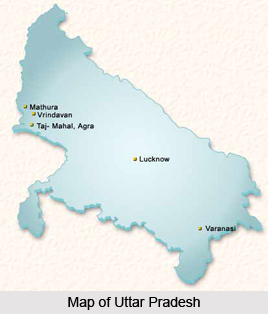
Introduction
Auraiya District is an administrative district that lies in the south-western portion of Uttar Pradesh. It is located between 26 degree 21 minutes and 27 degree 1 minute north latitude and 78 degree 45 minutes and 79 degree 45 minutes east longitude. Auraiya District forms a part of the Kanpur Division. This administrative district of Uttar Pradesh is bounded on the north by the district of Kannauj; its western border adjoins tehsil Bharthana of the Etawah district and the district of Gwalior. The eastern frontier marches with the district of Kanpur Dehat, and along the southern boundary lies Jalaun. Auraiya town is the district administrative headquarters.

History of Auraiya District
with the fall of Delhi and Kannauj in 1193 AD, Auraiya District passed with in the sphere of the Muslim rulers. To the early period of the thirteenth century is probably to be ascribed the invasion and settling of the Rajputs. With the passage of time, Sengars spread themselves over Bidhuna and Auraiya. Lately the western portion of the district passed into the hands of the Chauhans. Along with these Rajputs immigrants, Brahmans and Kayasthas also spread over the district. The allegiance, however, which some of these hardy tribesmen owed to successive occupants of Delhi throne, was for many years merely nominal. The trouble first began in the reign of Nasir-ud-din Muhammad Shah who ascended the throne in 1389 AD. Ibrahim Lodi, who succeeded his father in 1517 AD, lost much of his power and influence in his quarrel with his brother, Jalal Khan. The whole country was in an extremely disturbed condition, and, for two years before Ibrahim`s death in 1526 AD, most of the local governors appear to have been in a state of more or less open rebellion.

In 1760 AD Ahmad Shah Durrani invaded India. This was then in the possession of the Marathas, and accordingly in 1762 a Rohilla force was sent under Mullah Mohsin Khan to wrest the assigned property from the Marathas. The occupation, however, was merely nominal at first; the Zamindars refused to pay revenue to Inayat Khan and, secure in their mud forts set his authority at defiance. Strong reinforcements were sent to the Rohillas, including some artillery, under Sheikh Kuber and Mullah Baz Khan, and many of the smaller forts were destructed.
Further, according to the history, from 1774 to 1801 the district of Etawah remained under the government of Oudh. Little is known regarding its history. For many years the administration of the district was in the hands of Mian Almas Ali Khan. The cession on 10th of November, 1801, the district was made over to the British Government by the Nawab Saadat Ali Khan together with the rest of the lower Doab and other tracts. Still for some years Etawah was threatened with Maratha inroads. In 1885, the Indian National Congress was established. In Etawah it had, however, not assumed the shape of a political organization.
In 1920, the Congress declared that its objective was `the attainment of Swarajya by the people of India by all legitimate and peaceful means`. Towards this end, Mahatma Gandhi launched his famous Non Cooperation Movement all over the country in August of that year. In Etawah the response of the people to this movement was enthusiastic and wide-spread. On November 23rd, 1929 Gandhiji visited the district and addressed a large public meeting at Auraiya.

In 1930, the Civil Disobedience movement was started in Etawah, as in other parts of the country. The first phase of the movement was violation of the Salt Act. The Quit India Movement of 1942 received wide support from people in the district. The district of Etawah has had contributed in the freedom struggle of the country. As per the history of Auraiya District, on 17th of September, 1997 Auraiya and Bidhuna tehsils were separated from Etawah District in order to form the new district of Auraiya. Since then the district administration is normal and the socio-economic environment remained as usual except minor ups and downs.
Geography of Auraiya District
Geography of Auraiya District lies entirely in the Gangetic plain, but its physical features vary considerably and are determined by the rivers which cross it. The area of Etawah and Auraiya districts is divisible into four portions of district natural characteristics. The first of these run across it from west to east almost parallel to Yamuna River; it includes the northern portions of tehsils Etawah and Bharthana. The second tract comprises a slightly undulating switch of country covering portions of Etawah and Bharthana and the bulk of Auraiya Tehsil. The tract includes parts of some tehsils that adjoins the river Yamuna. Beyond the Yamuna, stretching from the borders of tehsil Bah in Agra to the confluence of the Sindh River, Kuwari, Chambal River and Yamuna rivers, lies high and broken lands. These tracts differ from each other in a very marked degree though each presents general conformity within its own limits.

The average annual rainfall in the district is 792 mm. About 85 percent of the annual normal rainfall in Auraiya District is received during the south west monsoon months from June to September, August being the rainiest month. Further, after February there is a steady increase in temperature. May is generally the hottest month with the mean daily maximum temperature at about 42 degree Celsius and the mean daily minimum at about 26 degree Celsius. The nights are warmer in June than in May. Summer season is characterized with hot, dry and dust-laden westerly winds which make the weather severely trying. In this season maximum temperatures on individual days sometimes reach 46 degree Celsius or over.
With the onset of the south-west monsoon around the third week of June there is appreciable drop in the day temperature and the weather becomes more bearable. But the nights still continue to be as warm as in the latter part of the summer. After the end of monsoon season by about the end of September there is a slight increase in the day temperature and there is a rapid drop in the night temperature. During the rainy season the relative humidity is generally high being over 70 percent. Thereafter the humidity decreases and by summer which is the driest part of the year the relative humidity in the afternoons become less than 30 percent. Winds are generally light and are mostly from directions between south-west and north-west.
The portion of Auraiya and Etawah districts jointly lying in the north of Yamuna presents no great changes of level. It may be described as a plain intersected by shallow river valleys formed by small streams such as the Ahneya, Sengar and Rind, sloping from north-west to south-east. In the Pachar and Ghar tracts the soils are broadly distinguishable into loamy, clayey and sandy. Besides these are found everywhere low-lying beds of clay in which water collects during the rains and rice alone can be grown; these clay beds are known as Jhabar. In the Kurka and trans-Yamuna tract several other classes of soil are found.

Geography of Auraiya District also includes several rivers and streams. The rivers and streams of the Auraiya and Etawah districts jointly consist of the Yamuna, Chambal and Kuwari and their tributaries. The general excellence of the natural drainage afforded by the rivers and their tributary streams and watercourses over the bulk of the district is exemplified by the general rarity of lakes and marshes.
Economy of Auraiya District
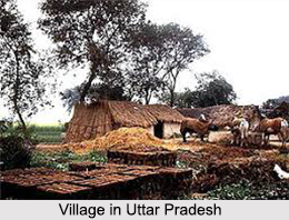
Economy of Auraiya District is mainly agrarian in character. Auraiya is an agriculture land. The main occupation of the people in the district is agriculture. Thus, the means of irrigation keeps the important role on such lands. In earlier times the district was almost wholly dependent on wells and, to a small extent, on tanks. The well-irrigation appears to have been largely replaced by canals. The chief sources of irrigation are wells and tanks. The practice of growing more than one crop simultaneously in a single field in a single season gives additional harvest. Thus, this practice increases the over all yield and ensures maximum use of the soil and nutrients. In Auraiya District, rotation of crops is practiced heavily by the farmers. Scientific rotation of crops helps the farmers to maintain the fertility of the fields by growing exhaustive crops in rotation with restorative crops.

A particular crop sown in one season restricts the cultivator to sow the other crop in the next season, which is most beneficial for the field and by this practice the turnout also is enhanced to some extent. The popular rotations followed in the district are Paddy Wheat, Paddy Gram, Paddy Peas, Maize Wheat, Maize Potato-wheat, Bajra Wheat or Peas or Gram or Peas and Gram, on account of being leguminous crops, have restorative qualities. Cultivation of these crops in rotation with exhaustive crops like paddy and bajra helps to maintain the fertility of the fields. Sugarcane is generally sown in three years rotation.
The methods of cultivation in Auraiya District are generally the same as those found elsewhere in the Doab. There are the usual harvests known as the Kharif or autumn, the Rabi or spring and Zaid or extra harvest. The chief Kharif crops are the millets, known as Bajra and Jowar, paddy and maize. These are sown either alone or in combination with Arhar. Wheat heads the list of Rabi cereals in the district in point of area, Sugarcane, oil seeds, vegetables and fruits, sweet potato and spices are the main non-food crops of the district. Vegetables though they occupy a small area in the district especially around the towns and large villages, constitute valuable crops. In the past indigo was also grown in the district.
The region covered by the present district of Auraiya had flourishing trade with the adjoining regions of Farrukhabad, Mainpuri, Agra, Gwalior and Kanpur, since early times. Economy of Auraiya District does not include any big industry. Only the two towns namely Dibiyapur and Auraiya are equipped with main industries. Further, there are least facilities in the district to sale the products off and so the sale is mainly dependent on the districts nearby. In Auraiya city itself the wooden furniture work is on large scale and due to its cost and quality factor, the furniture has made a good place in the market of nearby districts.
Culture of Auraiya District
The language of practically the entire population is what is known as western Hindi. Culture of Auraiya District is really vibrant and colourful. Several popular festivals are celebrated in the district. Like for instance, Durga Puja, Navratri, Holi, Shivaratri, Makar Sankranti, Diwali, Id ul Zuha, Id Ul Fitr, Muharram, etc. are some of the most important celebrations of Auraiya District. About sixty fairs, big and small, are held annually in the district. Most of the festivals are accompanied by local fairs too. Of these, the exhibition and cattle fair of Etawah is the most important. Traditions, beliefs and lifestyle of the people constitute the culture of the region.
Devkali Temple, Badi Devi Temple and Guraiya Temple are some of the significant holy sites of Auraiya District.