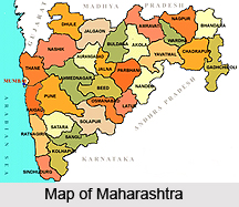
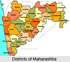
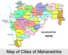
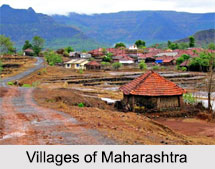
Introduction
Bahndra, the `District of Lakes` is the administrative district in the state of Maharashtra.The place is famous for its rice production. Bhandara town is also known as `Brass City` owing to the presence of a large brass products industry.

Geography of Bhandara District
Bhandara is an important district of Maharashtra. The area of the district is 3890 km². The place is located at 21.17° N 79.65° degree East and has an average elevation of 244 metres. The topography of Bhandara district can be divided into two parts- the hilly tracts and the lowlands. There are a number of hill ranges found in the district of Bhandara. The lowest and most northerly of these hill ranges is the Ambagad range. It is on the extreme outlier of the Satpura mountain range running in the extreme north-west of the district area to the north and west of the Wainganga River. It separates the valley of the Bawanthari River from that of the Wainganga. There is wide gap, with a width of about 3 km. wide in the Ambagad range, just east of the spur of the Ambagad fort; it is drained by the Amabagad nadi, and is used by the Tumsar Katangi road and railway.

About 9km south-west of Bhandara town, there lie two isolated hill ranges, each about 5 km long in a south-west-north-east direction and about 2 km wide; these hills together may be termed as the Ballahi range. These hills, rising about 150m above the valley floor, overhang the Great Eastern Highway on either side and form prominent features of the landscape that can be seen for quite some distance along the road. These hills are underlain by sandstones, quartzites and granulites. Just west of the Wainganga river and the township of Pauni in the south western extremes of the district are a clump of hills called the Gaidongri and Nishti hills rising to about 300 km. above sea-level, and barely 50 to 100 m. above the adjoining plains.
The lowlands of Bhandara district lie mainly along the valley of the river Wainganga, Bagh, Chullband and Bawanthari, and the most extensive of them occur along the first two rivers. The other two river valleys have a rolling topography dotted with a number of residual hills.
The soils of the district are varied, arising out of the tropical sub-humid weathering of crystalline metamorphic and igneous rocks. They are essentially residual, though along the southern extremes of the Wainganga valley, downstream of Pauni, alluvial soil predominates. Kali or black Regur soil derived from the weathering of basaltsis generally rare in the district. Kanhar or very rich alluvial soils occur widely. These soils crumble readily and are easy to work. They are clay loams in texture, very deep, sticky and retentive of moisture; they bear double crops.

Morand soils are coarser in texture and occur farther away from the rivers, in relatively higher ground in comparison to the Kanhar soils. They generally have an admixture of sands or lime or both. The Khardi soils are dark in colour with a considerable admixture of lime; they are generally shallow. They are poor soils. The sihar is a reddish yellow soil derived from crystalline rocks as a result of oxidation under tropical humid conditions and cracks very little in the hot weather. It degrades into the khardi.
Most of the cultivable soils of the district belong to the morand and sihar types, both of which are light and slightly acidic. The sihar are the best rice soils of the district while the morand soils are devoted to rabi crops like wheat and linseed and kharif jowar. Poor lateritic bardi soils are found in foothills and sloping areas. Along the immediate banks of rivers, black kachhar soils, reddish and sandy marhani soils, and sandy retari soils are found; these soils are mostly immature. The marhani soils are devoted to garden crops.
The entire district of Bhandara falls within the drainage of the Wainganga River and one of its principle affluent, the Bagh. The source streams of the Wainganga rise in the Chhindwara and Seoni plateaus of Madhya Pradesh. The river flows south through the Balaghat district before entering Bhandara district at its northern extreme. It initially flows west along the northern boundary, then turns south-west and gradually southwards through the Bhandara tahsil. Before leaving the district to enter Chandrapur, the river runs south-east. Thus, the Wainganga drains mainly the western parts of the district. The Bawanthadi River rises in the Kurai plateau of Seoni district (Madhya Pradesh) flows south, enters the district at the north-western limit of the boundary, and runs east forming the northern boundary for a distance of 48 kms before falling into the Wainganga. Through small and seasonal in its upper course, the river after entering this district is fed by numerous hill torrents and is perennial. It drains the north-western parts of the district around Ambagad and Chandrapur. The river has low banks and hence, in floods, overflows the banks. Quicksand occurs in many parts of the river bed.

The Ambagad nadi rises in the foothills to the north of the Ambagad range, flows south through a wide breach in the Ambagad hills to join the Wainganga on its right bank east of Tumsar. The Bodalkasa nadi drains the overflow of the Bodalkasa tank westwards to join the Wainganga on its left bank just downstream of the confluence of the Ambagad nadi. Just before its confluence with the main stream, it is met by an affluent, the Chorkhamara nadi draining the overflow of the Chorkhamara tank. The Garhvi nadi, also known as the Itiadoh nadi, rises in the granitic plateau of Chichgarh in the south-eastern part of Sakoli tahsil and flows west in a deep and narrow valley. As it flows past the village Palasgaon, the Valley opens out, but about 15 km downstream, it cuts through a quartzite spur of the Nawegaon hills in a deep gorge; the panorama from the Pratapgad fort eastwards as the river rushes out from the gorge is a pleasant sight to watch. The river continues further south, opening out into a wide valley with shallow banks to enter into the Chandrapur district before joining the Wainganga. The river has a flow of 60 km. through this district.
The average annual rainfall in the district is 1,470.6 mm (57-89). The rain fall generally increases from the west towards the east. It varies from 1312.9 mm (51-69) at Chandpur near the western border of the district to 1578-5 mm (62-15) at Gondia near the north eastern border of the district. The south-west monsoon arrives over the district by about the second week of June. The rainfall during the period from June to September constitutes about 90 percent of the annual normal rainfall. July and August are the months with heaviest rainfall, July being the rainiest month. The variation in the annual rainfall from year to year is small.
Economy of Bhandara District
The economy of Bhandara is mixed with agriculture, industries and forest resources. Bhandara District is mainly the paddy growing area. There is also a vast teak forest here. The main industries of the district are Rice Mills, Poha Mills, Bidi manufacturing, Saw Mills, Brass manufacturing units, Ceramic Bricks, Engineering workshop etc. Tumsar, a tahsil town, is a famous rice market. The minerals found here are iron, gold,laterite, shale, sandstone.
Ashok Leyland, a Hinduja Group Company, has a production facility at Gadegaon near Bhandara. Sunflag Iron Steel company and Shivmangal Ispat Pvt. Ltd. are other major industrial undertakins in the district.
Demography of Bhandara District
As per the 2001 census, the population of Bhandara is1, 136,146 of which 15.47% are urban. Males constitute 51% of the population and females 49%. Bhandara has an average literacy rate of 80% which is higher than the national average of 59.5%. The male literacy rate is 85% and the female literacy rate is 75%.
Culture of Bhandara District
Culture of Bhandara district, as of any other place, is reflected in the lifestyle, dress, habits and festivities that define the people. In the district of Bhandara, a mix of different faiths is found among the people. As regards the Hindus, Hindu life is replete with celebrations of all kinds. There are holidays and other religious festivals and birthday anniversaries of various deities and mythological heroes which as a rule are observed every year. Gudi Padwa, Rama Navami, Hanuman Jayanti, Ashadhi and kartiki Ekadashis, Gokulashtami, Poda, Ganesh Chaturthi, Gauripujan, Dussehra, Diwali and Holi are the main holidays which are celebrated with enthusiasm. Among Muslims Muharram, Ramzan, Id and Bakr-Id festivals and some other fairs are observed.

Men as a rule use white clothes, sometimes with a red turban that is folded. Cultivators use rough loin-cloth of strong and sturdy make. On the head they have a small piece of cloth which they call rumal. Under the head cloth men often wear little cotton caps. Women wear one long cloth secured round the waist and folded over shoulders which is called sari when it has a silk border and a lugde when it has cotton borders. Ponwar, Dhimar, and Kohli women often wear white clothes, locally called karvan. Immigrants from the north such as the Umre kalars, Bhaore Manas, Kirars and others wear the angia or breast-cloth tied behind while those of the south have the choli which is tied in front. Men hardly use any ornaments but among women they are popular. Even in this respect fashions have much changed and there is a desire to imitate people from cities like Nagpur. For Children, a number of bracelets, anklets and necklaces are used. They are of gold among well to-do and of silver among the poor.
Cultivators in Bhandara eat ambil, a gruel of boiled jovari and water for breakfast and dinner. Tamarind vinegar is mixed with this to add to its relish and it is eaten with salt, onion and chillies. For the evening meal they have bhakar or thick chapattis made of Jovari with vegetable and pulses, or besan, i.e., gram flour cooked in water with salt, chillies and onions. If a man is eating his food and he is touched by a person of any caste other than the one from which he is allowed to accept food the meal is polluted and must be thrown away.
The people generally smoke home-grown tobacco and the bidis made in Tirora are sent outside the district also. Most men smoke and a good many chew tobacco and some take it in the form of snuff. Women do not usually smoke but many of them chew tobacco.
Flora and Fauna of Bhandara District
More than one third of the area of the district lies under jungle that yields gum, medicinal fruit and nuts, edible fruits, lac. honeyand the blossoms of the mahuci tree. The principal crops are rice, wheat, millet, other food-grains, pulse, linseed and sugarcane. The fauna found here are tigers, panthers, deer, wild hogs.

Tourism in Bhandara District
Tourism in Bhandara district comprises visiting a number of places of both religious significance as well as leisure activities. Apart from the ancient temples, the district of Bhandara has a lot of activities to offer the tourists. There are ancient sites, such as the Ambagarha fort buikt in 1700 AD or the village of Brahmi which contains a well said to have been built by rakshahas. Or one can visit Andhalgaon, famous for the weaving industry here especially the Kosa cloth. When looking for rest and relaxation, the places that Bhandara has to offer its tourists are places like Rawanwadi, Koka etc. which are full of scenic beauty. Discussed below are the various places of tourism in Bhandwara district.

Pilgrimage Tourism in Bhandara District
Chaundeshwari Devi
This temple is in Mohadi which is about 20 km distance from Bhandara. Many pilgrims visit during Navaratri. This place is a popular tourist spot of Bhandara.
Bondgaon
Bondgaon, is a small village in Sakoli tahsil situated about 13 miles south of Sakoli near the Chulband river. In honour of Gangajumna Devi, who is supposed to dwell in a tank in the village, a fair is held on Chaitra-Parnima. The fair lasts for a fortnight. On Ashvin Shudha another fair is held. The priest of the temple is much revered and goes about on tour in Chaitra. He is believed to possess the gift of divination and prophecy.
Rawanwadi
This place is famous for a more than hundred year old temple dedicated to Lord Rama constructed by Shri Sitaram Prasad Dube, a resident of Gunthara village on a hillock. On Ekadashi/ Amawasya day of kartik month, religious gathering takes place here. On both sides of the tank there is dense forest which has converted it into not only a tourist and picnic spot but also a bird sanctuary.

Leisure Tourism in Bhandara District
Ambagar Fort
This medieval period fort is situated in Tumsar taluka and about 13 kms away from Tumsar in the district. The fort was constructed by Raja Khan Pathan, the subhedar of Bakht Buland Shah, the ruler of Devgadh around 1700 A.D. Later it came under the possession of Raja Raghuji Bhosla of Nagpur who used it as prison for captives. Later on it was taken over by the British.
Brahmi
Brahmi is a small village in Bhandara tahsil lying about 25 miles south of Bhandara. It contains an antique well constructed of long slabs of stone. The local people ascribe its building to the giants or rakshasas.

Gaimukh
Gaimukh, is a small village in Bhandara tahsil 20 miles north of Bhandara and six miles from Ambagad. It is so called because a spring issues from the rocks here, and the name gaimukh or cow`s mouth is usually applied to such springs, the form of a cow`s mouth being sometimes carved out of the rock. There is a cave temple ascribed to the Kuramvars.
Andhalgaon
Andhalgaon also known as Andhalgaon or the dark village is a village in the Bhandara tahsil lying about 16 miles north of Bhandara and connected with Mohali by a good metalled road. It is one of the principal centres in the district having a considerable weaving industry, silk bordered cloths for women being chiefly produced. The kosa (silk) cloth for which the district is so well-known has become very costly and hence the demand for it has correspondingly declined. A weekly market is held on Wednesdays to which some cattle are also brought for sale.
Adyar
Adyar is a large village in Bhandara tahsil, situated about 14 miles south of Bhandara on the Pauni road. A number of Gandlis are engaged in weaving silk-bordered saries, cloth and dhotis on handlooms on co-operative basis, the silk-bordered saris being particularly known for their fine texture and quality. Bamboo baskets and matting are also made. At the weekly market held on Sundays household goods, provisions and cattle are put up for sale. In fact Adyar is one of the important cattle markets in the district. The agriculture labourers of this village are known for their skill and knowledge of paddy cultivation and hence are sought after by the agriculturists of the neighbouring villages. The village was previously owned by malguzars but the system of malguzari has since been replaced by the ryotvari system.
Gondumri
Gondumari is a village in Sakoli tahsil about ten miles distant from Sakoli. Soft matting of sukhavasa grass is manufactured here by the Gonds. Gondumri was the head-quarters of the Gond-Umri zamindari.

Chandpur
Chandpur is in Tumsar taluka of Bhandara district. It is situated in hilly ranges and surrounded by dense forests. By constructing a huge wall between two rocks a big reservoir has been created. The reservoir is surrounded by hillocks with dense plantation. One can view the fantastic scenic beauty by standing on the wall of the reservoir. One km.to the south of the reservoir is the water tank and Chandpur.
Koka
Koka is about 30 km from Bhandara which is covered with dense forest. The trees in this forest are more than a hundred years old. There is a lake here famous for being the abode of famous Siberian birds. These migratory birds come in the month of December and return in mid January.
These are the various places of tourist interest located in the district of Bhandara.
Some of the other important places of attraction in Bhandara district are: