
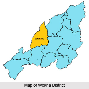
 Wokha District is situated in the mid-western part of Nagaland, adjacent to the Sibsagar plains of Assam. Wokha is the district headquarters. Wokha District is bounded by Mokokchung district in the north, by Kohima District in the south, by Zunheboto District in the east and by Assam in the west. Wokha District is situated at latitude of 26 degree 8 minutes north and longitude of 94 degree 18 minutes east. Total population of Wokha District is 1, 61,098, out of which male population is 83,620 and female population is 77,478. Wokha is located at a distance of 80 kms from Kohima as well as from Mokokchung.
History of Wokha District
In the year 1876, British Government occupied Wokha as the district headquarters of Naga Hills under Assam. Again in 1878, the headquarters was shifted to Kohima and Wokha remained as a Sub-Division. In the year 1889, the Sub-Division was shifted to Mokokchung. Further, in 1957, when Mokokchung became a district, Wokha again became a Sub-Division.
 During the first General Election of January 1964, there were five Assembly Constituencies in the Sub-Division among the total of 40 Constituencies of Nagaland. In the year 1973, Wokha District was created and the third General Election was held in 1974, with the additional 20 Constituencies for Tuensang and Mon Districts. It was during these elections, in the re-distribution of Constituencies, the number of Assembly Constituency for Wokha District was reduced to four and it remains so till date.
Geography of Wokha District
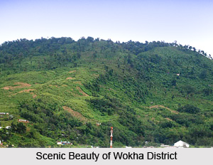
Geography of Wokha District is more or less similar with that of the other districts in the state, having hill ranges and ridges dissected by seasonal streams. Climate of this district is warm in the lower plain areas, moderately warm in the upper region during summer but cold in winter. The monsoon season starts from May and continues till October. The annual rainfall varies from 200 cm to 250 cm. Geography of Wokha District is divided into three ranges, and these are Wokha Range or Upper Range (it falls in the upper north eastern parts of the district), Sanis Range or Middle Range (it covers the middle part of the district) and Bhandari Range or Lower Range (It covers the outer most part of the district which extends from Japukong range of Mokokchung District and gradually slopes down to Assam plains in north western side). Two of the most fertile valleys are in the Lower Range. These are Baghty and Tchiying valleys. Highest mountain peak in Wokha District is Tiyi Enung, with an altitude of 1970 metres. Important rivers which flow through the district are Doyang, Chubi, Nzhu and Nruk. The district lies in a seismically active earthquake zone.
In Wokha District there are five Rural Development Blocks namely Wokha Rural Development Block, Chukitong Rural Development Block, Wozhuro Rural Development Block, Bhandari Rural Development Block and Sanis Rural Development Block.









