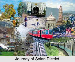
History of Solan District traces the evolution as well as existence at the time of the reorganisation of the districts of the State on Ist September, 1972. The district carved out and made its existence felt out of Solan and Arki tehsils of the then Mahasu district and tehsils of Kandaghat and
Nalagarh of the then
Shimla District. Administration wise, the district is alienated into four Sub-division viz. Solan comprising of Solan and Kasauli tehsils and Nalagarh that covers the jurisdiction of Arki and Kandaghat Sub-divisions that covers their respective tehsils. The total geographical area of the district according to the Surveyor General of India is 1,936 sq. km. which constitutes 3.49 percent of the total area of the State and ranks 9th amongst the district. Solan District derives its name from Solan town which came into existence after the construction of the Cantonment at that place around the last quarter of the 19th century.
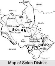
Bounded by Shimla district in the North and by Ropar District of
Punjab and Ambala district of
Harayana in the south Solan district has its place felt amidst the map of Himachal.
Mandi District touches the boundary of Solan district in north-east. Shape wise the district is rectangular with tinges of slight bulge felt on the northern side presumptuous towards the obtrusive Mandi district. Solan district has a cultural phantasmagoria of its own. The elevation of the district ranges from 300 to 3,000 metres above east level. The mountain ranges are placed at the outer Himalayas and are a part of
Shivalik Hills. The mountain ranges fall into the category of lower elevation while the western-southern parts of the district comprising of Nalagarh and Arki tehsils consists of higher ranges in the central and finally extending up to north-eastern corner of the District comprising of Solan tehsil and parts of Arki tehsil, Kasauli tehsil and Kandaghat tehsil which are located in north-eastern direction of the district and are having the highest ranges of the District.
In the contemporary age and time the district comprises of the erstwhile princely states of Bhagal, Bhagat, Kunihar, Kuthar, Mangal, Beja, Mahlog, Nalagarh and parts of Keonthal and Kothi and hilly areas of composite
Punjab State which were merged in Himachal Pradesh on the Ist November, 1966 on the reorganisation of composite Punjab on the basis of linguistic diversification. As history states, most of these were subjected to the onslaught of Gorkha invasion from the year 1803 to 1805. The year 1815 saw that after the Gorkhas were defeated by the British, finally these states were freed of the shackles of slavery and the individual rulers of the consecutive states were restored to power and position. All the states were small in power and position the control of the superintendent of Shimla Hill States before Independence. Himachal Pradesh appeared on the administrative map of the country on the 15th April, 1948 and the states of Bhagat, Baghal, Kunihar, Kuthar, Mangal, Beja, Keonthal and Koti formed a part of the then Mahasu District. Nalagarh state which was merged after Independence in Patiala and East Punjab State Union later on formed a part of Punjab when the reorganisation of the states took place in 1956 and remained a tehsil of Ambala District, Kandaghat and Shimla tehsils of Shimla district like other hilly areas of Kullu, Lahul and Spiti and Kangra districts become part of Himachal Pradesh on the Ist November, 1972 and Solan District sprang up on the administrative map of the state.
There are certain places that form the part of Solan District are-
Bhagat : Bhagat which is popularly derived form the term `Bau or Bahu` that is known to mankind having hilly connotations. Undoubtedly there are many places in the erstwhile Bhagat state that are consecutively known as Ghat. State headquarters of the Bhagat State were located at Bhoch in the Bhuchali Pargana which were shifted to the Solan district. The ruling family`s founder was known as Basant Pal or Hari Chand Pal, a Panwar Rajput from Dharana Giri in the
Deccan.
Bhagal : Bhagal state traces its origin from Aje De a Panwar a Rajput who has arrived all the way from
Ujjain. In the year 1905 there had been the outbreak of a rapturous revolt in the entire Kanet population that was putdown with the assistance of the Superintendent of
Shimla Hill state. The state was dexterously put under the domination of the Manager and the Tikka was crowned as Raja of the state. Raja Rajindra Singh had been the last ruler and the state was merged in Himachal Pradesh in 1948 and remained a part of Mahasu district till 31st August, 1972.
Kunihar : The state was founded by Abhoj Deo who arrived all the way form Akhnur in Jammu and acquired the state by conquest about the year 1154 A.D. as it had been in his blood his ascendants were keen warrior and they assisted Nalagarh and Bilaspur rulers in their diverse wars mainly against Kullu. When Keso Rai ruled over the state during 1600 A.D. it was then that the affairs of the state began to fall. The ruler being weak and incompetent as well as indolent the neighbouring states detained portion of the territory never to give back later.
Kuthar : Surat Chand, the founder of the ruling family is generally apprehended to have arrived from Kishtwar in
Kashmir and is said to have acquired the state by conquest. At the time of Gorkha invasion, Rana Gopal Chand was the ruler. The state was restored by the Britishers. The state was merged with
Himachal Pardesh in April, 1948 and remained part of the then Mahasu district till August, 1972.

 Solan district is the 12th district of Himachal Pradesh. Solan town in Solan District is the administrative headquarters of the district.
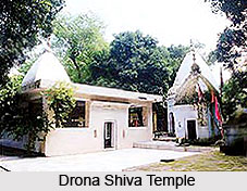 The district has been named after Goddess Soloni Devi, whose temple is located in the southern part of the town. Solan is well known for its numerous breweries that first started in 1835. The place renders a picturesque view with chir pine trees, apricots and walnuts visible in the surrounding hills. Kasauli, Barog, Chail, Parwanoo, Kiarighat, Shalooni Devi Temple, Bon Monastery-the 2nd oldest monastery in the world and Darlaghat are the legendary places located in proximity to Solan. Wonderful sculptures and interesting legend entwine the temples whilst making Solan a pious place.









