
 Kolasib District is situated on the northern part of Mizoram. It is one of the eight administrative districts of Mizoram with its headquarters at Kolasib town. Kolasib District is bounded by Cachar District and Hailakandi District, by Assam on the north and north west respectively, on the south and east by Aizawl District and on the south west by Mamit District. The location of the district occupies an important site as it is the main stream of road communication from other state of Mizoram. The total area of Kolasib District is 1472.12 sq kms. Total population of Kolasib District as per Census 2001 is 65960; male population is 34562 whereas female population is 31398. About 75 percent of the total population of the district entirely depends upon agriculture and allied activities.
History of Kolasib District
Kolasib was initially created as the centre of Tribal Development Block. It was later upgraded to be administered by the Area Administrative Officer. When Mizoram became a Union Territory in the year 1972, Kolasib was upgraded as the headquarters of Sub-Division administered by Sub-Divisional Officer (Civil) on 5th of May, 1975. Being the seat of administration for more than three long decades its present status as an independent administrative district was given by the state government of Mizoram following the trifurcation of Aizawl District in the year 1998.
Geography of Kolasib District
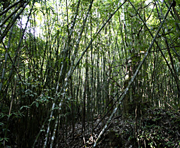
Geography of Kolasib District comprises vast forests and hilly terrains that ranges from north to south of the region. 70 percent of the total area of the district is covered by forests. Forests are crucial resource on which depends the livelihood of the majority of the population of the district. Tropical moist deciduous forest and bamboo forests are the found in the district. Numerous other trees, shrubs and herbs provide vegetables, fruits, fuel (fire wood), dyes, medicines and fibres are also found in these forests. Kolasib District comes under the tropical monsoon climate zone of India. It experiences direct impact of monsoon. The average annual rainfall is around 197 cm. In low lying valleys, the temperature fluctuation is low and the climate remains moderate throughout the year. Winter extends from November to February with temperature ranging within 12 degree Celsius to 23 degree Celsius. March to May comprises a short summer, during which the temperature varies between 20 degree Celsius to 30 degree Celsius with valleys hotter and humid while the hill tops are cooler and pleasant.
 Administration of Kolasib District
For the purpose of general and development administration, Kolasib District has been divided into three Sub-Divisions namely Kolasib Sadar, Vairengte and Kawnpui. Administration of Kolasib District includes two Rural Development Blocks namely Thingdawl and Bilkhawthlir. Total number of villages in the district is 34 and it also comprises four sub-towns namely Kawnpui, Bualpui, Bairabi, Vairengte.
Economy of Kolasib District
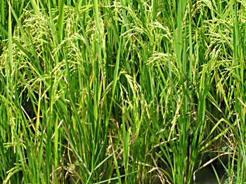
Economy of Kolasib District is dependent on agriculture. Agriculture is the most important land use in the district, which is mainly done through the primitive method of cultivation or shifting cultivation. The district covers low lying areas which is highly potential area for cultivation. Rice and other crops like pulses, fruits, vegetables, etc. are cultivated in the district. Lack of irrigational facilities is the main constraints of increasing agricultural production in the district. Rearing of livestock for economic purpose has not yet become very popular in Kolasib District.
Education in Kolasib District
Literacy rate of Kolasib District is 91.38 per cent. Efforts are being made to provide primary and school education through Sarva Shiksha Abhiyan and to raise the standard of quality of education in the district. In Kolasib District, there are two colleges, one Higher Secondary and 18 High Schools (including privates), 40 Government Middle Schools, three Deficit Middle Schools and around 15 Private Middle Schools and 100 Primary Schools.
Kolasib District also has Community Health Centre, Primary Health Centres and subsidiary Health Centres.









