
 Geography of Uttarkashi District consists of valleys and outer hills to the high peaks with perpetual snow and glaciers. Lying in the upper Himalayas, Uttarkashi District contains within itself varying geographic environments. Each ridge of the district leads to another coiling up in seemingly unending chains. Most of the terrain is mountainous consisting of high rise ridges, hills and plateaus and flat pieces of land are rare. The land in these areas is now in fertility due to large content of out crops of boulders and gravels. Made-up of alluvial soil, valley is a stream bed. Generally forests occur on the upper ridges that bound the valleys. On their sloping hill sides lie a chain of sparsely populated settlements interspersed with terrace cultivation.
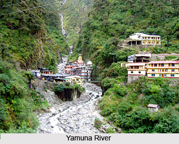
Geography of Uttarkashi District includes several rivers and waterways. It is the land of Uttarkashi district that gives rise to two great and reverent rivers of the country Bhagirathi River and Yamuna River. The third important river of this district is Tons River besides host of tributaries that drain these areas. Some of the better known lakes -Dodital, Nachiketatal, Kedartal, Ruinsara tal, Bharnala and Barsu - have already been mentioned in the section on `Trekking`. Others include four small lakes Dharali, Kheera tal, Sankat tal, and Vasuki tal. Besides, there are a number of glacial lakes, such as between Tapovan and Nandanvan, at the confluence of Meru glacier and Brahmapuri, etc.
Geography of Uttarkashi District comprises variations from beautiful landscape luxuriously decked with vegetation punctuated by streams, brooks and rivers to high rise awesome rocky ridges and mountains gently tapering off into lefty snow-capped peaks. The widely varying climate and topography of Uttarkashi District produce a wide range of vegetation and serve as habitats to diverse species of wild life. Forests occupy a large area and they are rich in variety of vegetation. As much as 88 percent of the total area of the district is administered by the Forest Department. Pine forests occur between the altitude of 900 metres to 2000 metres, Deodar forests between 2000 metres to 3000 metres, Fix and Spruce forests over 3000 metres and Kharshu, Birch and Junipers forests up to the height of 4000 metres. Above the Fir and Spruce forest zone, alpine pastures are found throughout the district between the heights of 3500 metres to 4877 metres above sea level.
Rich varieties of grass, shrubs and herbs come up during June-September while during the remaining part of the year these areas remain covered with snow. A large number of medicinal plants of great commercial value grow spontaneously in the forests. Some of these grow in the valleys; some in sub-montane tracts while some other on higher altitudes. Herbs are the most important minor forest produce.









