
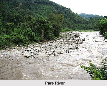
 Geography of Papum Pare district mainly includes endless high hilly regions. The entire Papum Pare district is mountainous forming a part of the Eastern Himalayas. The area covered by the Papum Pare district comprises a cross-section of the foothill region adjoining the border of the state of Assam, the lower hills and the towering mountain extending toward northwards. The natural vegetation of Papum Pare district comprises chiefly humid semi-evergreen and sub-tropical evergreen forests. At lower heights, the vegetation consists of tall trees, shrubs, bamboo, wild banana, cane and several other kinds of creepers, and at higher heights it is mostly composed of ferns and rhododendrons.
The geographical features of the Papum Pare district of Arunachal Pradesh can be divided into two parts and these Foothill Region and Hilly Region.
•Foothill Region - Strips of level area along the foothills bordering the northern border of Sonitpur and Lakhimpur districts of Assam form the plain belt of the Papum Pare district. In this area the plain ends and hills begin. The foothill region is enclosed with thick tropical evergreen forest and receives heavy rainfall during the monsoon season. This area forms the agricultural land of the district. Kimin, Balijan, Doimukh and Naharlagun are situated in this area.
•Hilly Region - The mountainous area of the Papum Pare district forms the hilly region, which is covered with thick and dense forests. This area has limited agricultural land. Jhoom cultivation is also practiced on the gentle slopes in this area.
Geography of Papum Pare district also includes some prominent rivers like Pare, Panior and Dikrong. These are the main rivers of the district
•Panior River - This River rises from Khoren Putu Mountain lying to the northwest of Segalee. The Panior known as Ranga-Nadi in the plains of Assam falls into Brahmaputra River. The Ranga-Nadi Hydro Electric project is built on this river.
•Pare River - This River originates from the Senkeng Gekah range lying about 40 kms away from Segalee. The main tributaries of the Pare River are Pang and Namte coming down from the nearby hillock.
•Dikrong River - Dikrong River drains the southern part of the district. The Par, Nirochi and Pachin rivers form it. It flows from the west to the southeast, and passing through Itanagar region and merges with Brahmaputra in the Lakhimpur district of Assam.
The altitude variations of the area, ranging from 170 meters to 800 meters and varied climatic conditions, have bestowed the area with three different types of forests and these are -
•Tropical evergreen forest
•Tropical mixed evergreen forest
•Secondary forest
The region is rich with numerous types of fauna. The various wild animals found in the district are elephants, barking deer, wild boars, etc. Different types of birds like jungle fowl, hornbill, dove, parakeet, snipes, swifts, cuckoo, owls, kingfisher, trogon, barbets, woodpeckers, jungle crow, tree pie etc. are found in the district. The geographical vastness is one of the prominent factors of attraction of Papum Pare district.









