
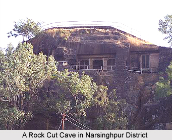
 Geography of Narsinghpur district has 26.55 percent of land covered with forest out of the total geographical area of 5125.55 square kilometers. Narsinghpur district is situated in the central parts of Madhya Pradesh and the state of Madhya Pradesh is located in the Central part of India.
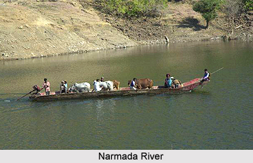
The district of Narsinghpur holds a special importance being located in the Country. It attracts special attention because of its natural situation as well. On the Northern ends Vindhyachal and on the southern ends through out the lengths is the Satpura Mountain Range. In the Northern part, Narmada River flows from East to West, which is as sacred and holy as the Ganga River. Narsinghpur district has received many natural gifts as Narmada Kachhar.
This district is situated between 22 degrees 45 minutes and 23 degrees 15 minutes to the North Latitudes and between 78 degrees 38 minutes and 79 degrees 38 minutes to the East Longitudes. The breadth of this district is 64 kilometers from South to North and its length is 121 kilometers from East to West. This district is situated at a height of 359.8 meters above sea level.
 Narsinghpur is a district, which is well known for its fertile land. It is said to be the most fertile land all over Asia. Black soil is suited for any kind of cultivation blessed with adequate irrigation facilities. Black Domat soil, rocky soil, smooth soil and sandy soils are there in which wheat, grams and all type of pulses has been mainly produced. Major sources for irrigation are wells, rivers, ponds, canals and tube wells. Irrigation has done mainly by tube wells. This district is famous for its rich agricultural production. Being situated at the upper part of Narmada Valley, which is much important for agriculture, the production of grains in this district is more than the actual requirement.Mainly crops are cultivated in two seasons namely Rabi and Kharif. This is based on the climate and the prevailing conditions in the district by the time. Rabi crop cultivated in October-November and cutting in April-May and the major Rabi crops are Pulses, Wheat, Peas, Masoor, Alsi, etc. The Kharif farming period is June-July and cutting in the month of October. The major Kharif crops are Jowar, Paddy, Bajara, Kondo, Makka, Kutki, etc.
About 26.55 percent of the area is covered by the forest which is of mixed kind including herbs, shrubs and scrub. In hilly areas of Satpura and Vindhyachal there are trees of Bamboo, Teak, Saal, Saj and in planes are full of Mahua, Khairi, Mangoes, Achar, Karonda, Baheda and Harr. Soap stone, fireclay, dolomite, limestone, etc are found excessively in this district. Apart from these, building construction stone is also found near the village Gontitoriya. Fireclay is found mainly in Kanharpani, Heengpani, Bachai and Hiranpur hills.
The climate of the Narsinghpur district is very pleasant except in summers. Except South West Monsoon, rest of the year waves moves slowly. The usual minimum temperature of the district rests around 25-26 degrees Celsius and maximum temperature rises up to 45-46 degrees Celsius. The month of May is the hottest month of the year. It is very hot during summer and in the end of this season dust-filled storms occur.
When Monsoon reaches, temperature goes down. 90 percent of the rainfall in the district is observed in the monsoon months only which is from June to September. An average rainfall is of 60 days and measuring about 40 inches. During December-January it is very cold and average temperature during the day is around 9 degrees Celsius. Sometimes cold waves and heavy fog is also observed during the minter months.









