
 Geography of Kanchipuram district is very vast with an area of about 4393.37 hectares. The district of Kanchipuram is situated on the north-eastern coasts of the state of Tamil Nadu in India. This district is also adjacent to the Bay of Bengal and Chennai city. The Kanchipuram district is having its borders as Vellore district and Thiruvannamalai district to the West, Thiruvallur district and Chennai district to the North, Villupuram district to the South and the Bay of Bengal to the East. This district is located between 11 degrees and 12 degrees to the North Latitudes and 77 degrees 28 minutes and 78 degrees 50 minutes to the East Longitudes. The maximum temperature experienced during the summer season in this district is 36.6 degrees Celsius and the minimum temperature is 21.1 degrees Celsius. The maximum temperature during winter is 28.7 Celsius and minimum temperature is 19.8 degrees Celsius.
Kanchipuram district has a total geographical area of 4393.37 hectares and is has a coastline of 57 kilometres. The pre-monsoon rainfall is almost uniform throughout the district of Kanchipuram in Tamil Nadu. The coastal taluks of this district receive more rainfall as compared to the interior regions. This district is mainly depending on the seasonal rains and the distress conditions prevail in the event of the failure of rains. The Northeast and Southwest monsoon are the major donors with 54 percent and 36 percent contribution each respectively to the total annual rainfall.
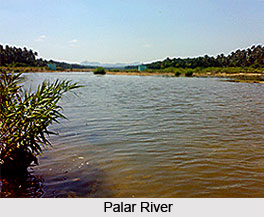
Agriculture forms the primary occupation of the people with 47 percent of the population of this district are engaged in it. Paddy is the major crop cultivated in this district and the other major crops grown in the district of Kanchipuram include groundnut, sugarcane, cereals and millets and pulses. The total forest area in the Kanchipuram district is 23,586 hectares and it is spread in the interior regions and around the district. In this forest area there are 366.675 hectares of reserved land. The Palar River is one of the most important rivers running through the district of Kanchipuram. Wells and tanks are the main sources of irrigation in this district. There are only a few hills of considerable elevation in the district. The southern part of Maduranthakam taluk in the Kanchipuram district contains small hills.









