
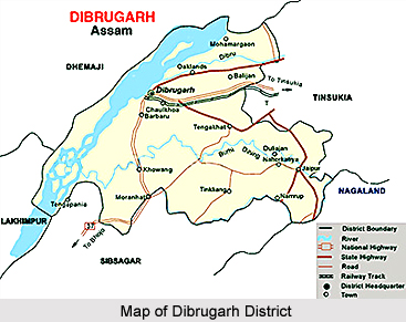
 Dibrugarh District with only one sub-division is located in the eastern part of Assam. This district is bounded by Dhemaji District and a part of Lakhimpur district in the north, part of Sibsagar and Arunachal Pradesh in the south, Tinsukia District in the East and Sibsagar District in the West. Brahmaputra River flows in the north of the district. The headquarters of this administrative district of Assam are situated at Dibrugarh. This district covers a total area of 3381 sq kms. The name of Dibrugarh District was derived from Dibarumukh. It was a renowned military camp of Ahoms during the war between Ahoms and Chutiyas. Previously, Dibrugarh was the headquarters of unbroken Lakhimpur District of the state. The major languages spoken in this district are Assamese Language, Hindi Language and Bengali Language. The administrative set up of Dibrugarh District is separated into villages, 7 blocks, and 93 Gaon Panchayats and one Zilla Parishad. The major towns of Dibrugarh District are Dibrugarh, Chabua, Naharkatia, Duliajan and Digboi Oil Town. The chief revenue circles are Dibrugarh East, Dibrugarh West, Tengakhat, Naharkatia, Chabua, Tingkhong, and Moran Town
Dibrugarh District
Dibrugarh District of Assam is an administrative district with its headquarters located at Dibrugarh. Geographically, it is a plain district and its main economic resources are tea and oil industries.
Introduction
Dibrugarh District with only one sub-division is located in the eastern part of Assam. This district is bounded by Dhemaji District and a part of Lakhimpur district in the north, part of Sibsagar and Arunachal Pradesh in the south, Tinsukia District in the East and Sibsagar District in the West. Brahmaputra River flows in the north of the district. The headquarters of this administrative district of Assam are situated at Dibrugarh. This district covers a total area of 3381 sq kms. The name of Dibrugarh District was derived from Dibarumukh. It was a renowned military camp of Ahoms during the war between Ahoms and Chutiyas. Previously, Dibrugarh was the headquarters of unbroken Lakhimpur District of the state. The major languages spoken in this district are Assamese Language, Hindi Language and Bengali Language. The administrative set up of Dibrugarh District is separated into villages, 7 blocks, and 93 Gaon Panchayats and one Zilla Parishad. The major towns of Dibrugarh District are Dibrugarh, Chabua, Naharkatia, Duliajan and Digboi Oil Town. The chief revenue circles are Dibrugarh East, Dibrugarh West, Tengakhat, Naharkatia, Chabua, Tingkhong, and Moran TownGeography of Dibrugarh District
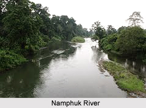 Geography of Dibrugarh District is spread over extensive plain formed by the Brahmaputra River and its major tributary is Buri Dihing. Dibrugarh District is situated in the northeastern corner of the upper Brahmaputra valley south with an elevation ranging between 99 to 474 meters.
The geography of Dibrugarh District is constituted by a variety of elements such as flood plain, beels and swamps, occasional highlands and foothills. Brahmaputra River is wide in this region. The general inclination of the district is from southeast to north-west. The altitude of the southeastern corner covering the Hapjan Parvat and Hilika Parvat of the Barail foot hills is around 200 metres. The northern belt of the area has a gentle slope from east to west. The altitude of the eastern part is 115 metres, while it is 99 metres in the western part. Because of moderately high slope and large volume of water, river Brahmaputra flows with a high velocity causing significant bank erosion in the area.
Geography of Dibrugarh District is divided into three distinct zones stretching parallel to the Brahmaputra River. These are the active floodplain and `charland`, the middle plain; and the southern foothills. The first zone is an extensive and active floodplain of river Brahmaputra. The second zone is extensive because of the presence of fairly large tributaries like the Dibru (which has now merged with the Brahmaputra) and the Buri Dihing through their head ward corrosion added alluvial land substantially to the great plain of the Brahmaputra River. This plain contains the rich belts of tea and rice cultivation. The foothill zone on the other hand consists of isolated hillocks interspersed with plain embayment extending into the Naga Hills. Tea gardens or dense forests mostly cover the high grounds of this zone.
On the northern margin of the Dibrugarh District lies river Brahmaputra which basically drains the whole area. Near the Dibrugarh city the river is 10 kms wide with a large number of sandbars. Buri Dihing River flows from almost east to west through the area. It has many tributaries such as Digboi, Tingrai, Tipling, Telpani, Deherang and Sessa in the north bank and Tipam and Disam in the south bank. In addition to the tributaries of the Burhi Dihing, there are three other tributaries of the Disang River (in Sibsagar) namely Gela Disam, Tiolo and Demow. Official reports suggest that Burhi Dhing is the erstwhile Namphuk River.
Like any other parts of Assam, this region is endowed with extensive water resources. Dibrugarh District possesses a large number of wetlands of varying sizes. The larger ones are popularly know as beel, while the marshes and swamps are generally known as jalah, doloni, pitoni, doba, etc. All these features constitute the wetland. The wetlands may broadly be divided into two categories - the lake-like ones and the swamps and marshes covered by weeds, grasses, etc. Both the beels and the swamps are geo-morphologically, ecologically and economically very important features. These comprise a major component of the area`s ecology. The beels are traditionally used as natural fisheries. Even today, the beels produce more fish per unit area than any many other man-made fisheries. A large number of beels are connected with the rivers by one or more feeder channels.
The soils of Dibrugarh District are basically the products of the fluvial processes of the Brahmaputra River and its tributaries. It includes plains that are composed of alluvium that are classified as new and old. The new alluvium varies mostly from clayey to sandy loam in texture and is slightly acidic in reaction. It is found in the vast plain of Dibrugarh District along the river valleys, especially in their lower courses. The old alluvium on the other hand occurs in the upper and middle parts of the valleys. The riverbanks of the region bear texturally three types of soil - sandy loam, loam and clayey loam. These favour the cultivation of rice, mustard, pea, vegetables, etc. Thus, geographically the soils of Dibrugarh District are considered as favourable for cultivation and plantation.
Demography of Dhibrugarh District
According to thePopulation Census in 2011, Dibrugarh District had a population of 1,327,748 of which male and female were 680,114 and 647,634 respectively. Dibrugarh District population constituted 4.26 percent of total population of Assam.
The population density of Dibrugarh district is 393 people per sq. km. The Dibrugarh district administers 3,381 square kilometres of areas. The average literacy rate of Dibrugarh was 76.22 percent. The male and female literacy rates were 82.59 percent and 69.52 percent respectively. The total literate in Dibrugarh District were 893,908. The males and females were 496,362 and 397,546 respectively.
Economy of Dibrugarh District
Oil and Tea are the major industries and revenue earners of Dibrugarh District. Tea plantations and tea industries surround the entire region. Interestingly, some of the tea gardens of this district are over 100 years old. The headquarters of the Oil India Limited is located at Duliajan, at a distance of around 50 kms from Dibrugarh town. Moreover, the major percentage of the total population is engaged in farming of rice, sugarcane, pulses, and fish farming. Further, several coal mining as well as petroleum production industries are also located in this district. Dibrugarh District also has proper education system and this district is well connected by railway, airway, roadway as well as waterway.
Climate of Dibrugarh District
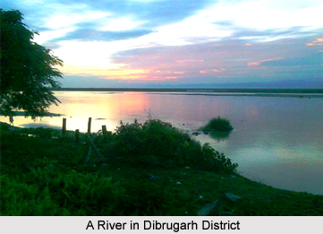 Climate of Dibrugarh District is basically sub-tropical monsoon because of its unique physiographic elements. This district experiences mild winter, warm and humid summer. Rainfall decreases from south to north and east to west in the region. The average annual rainfall of Dibrugarh city in the north is 276 cm with a total number of 193 rainy days, while at Naharkatia in the south the average rainfall is 163 cm with 147 rainy days. The temperature normally decreases from south to north. The average annual temperature in Dibrugarh and Naharkatia is 23.9 degree Celsius and 24.3 degree Celsius respectively.
Being situated on the bank of Brahmaputra River, the climate of Dibrugarh city is mild with low temperature and high rainfall as compared to Chabua in the east and Moran Town in the west. The standard annual temperature in Chabua and Moran is 28 degree Celsius and 32 degree Celsius respectively. Rainfall records show a declining drift towards east and west of the Dibrugarh city. The annual amount of rainfall in Chabua and Moran is 250 cm and 171 cm and 171 cm respectively.
Based on the climatic distinctiveness such as distribution of temperature, rainfall, rainy days, humidity, presence of fog and thunderstorms, the climate of Dibrugarh District may be classified into four seasons and these are winter, pre-monsoon, monsoon and retreating monsoon. The winter mainly covers the months of December, January and February. In this season, fair weather prevails occasionally associated with fogs and haze. December and January are the dry months and January is the coldest. The minimum temperature varies between 8 degree Celsius and 10 degree Celsius and the maximum between 27 degree Celsius and 29 degree Celsius. The average rainfall in the winter season is 20 cm.
Moreover, the months of March, April and May constitute the pre-monsoon season. From March, the land surface gets steadily heated and the temperature starts rising. Strong convection develops due to the narrow depressions formed especially in the afternoon. Maximum temperature ranges between 28 degree Celsius and 32 degree Celsius. This season is, in fact, a transitional phase between the dry cool winter and the warm moist monsoon. With the onset of monsoon in early June, heavy rainfall occurs in Dibrugarh District. Widespread low clouds and high humidity maintain uniform temperature over the region.
The maximum temperature varies between 33 degree Celsius and 37 degree Celsius. The average annual rainfall during the period is 300 cm. The occurrence of thunderstorms is the most obvious characteristic in this weather. The monsoon season is considered as the season of dominant agricultural operation in the area.
The monsoon withdraws from the area either in the last week of September or in the first week of October. The cool northeasterly winds originating over the superior mountains of the Arunachal Himalayas bring the temperature down. Rainfall decreases abruptly. Sunny days prevail until the end of November. Thus, warm and humid weather prevails in Dibrugarh District and it has a profound influence on the economy and life of the people of the area. This climate of the district is most suitable for the cultivation of a variety of grain and horticultural crops.
Recently updated articles in States of India

Bandare Waterfalls, Meghalaya
Bandare Waterfalls in South Garo Hills, Meghalaya, is a secluded natural attraction surrounded by dense subtropical forests and rugged mountain terrai...

History of Thissur District
Early History of Thissur District explains flourishing of the port cities. Now these port cities are transformed into archaeological sites.

Tippi Orchid Research Centre, Arunachal Pradesh
Tippi Orchid Research Centre in Arunachal Pradesh is renowned for its rich collection of exotic and endangered orchids. Surrounded by lush rainforest...

Tourism in Nashik District
Pilgrimage tourism in Nashik district involves visiting the various places of Hindu and Jain worship located here. Some of the holiest sites for Hind...

Mangadu, Kerala
Mangadu in Kerala’s Kollam district is a significant megalithic site known for its urn burials, cist burials, menhirs, and stone circles. Excavations...
Related articles in States of India

East Indian States
East Indian States comprises of Bihar, Jharkhand, West Bengal, Odisha and also the Union Territory of Andaman and Nicobar Islands. It defines the cult...

Purnia District in Bihar
Purnia District is located in Bihar and extends from River Ganga to Nepal. The district has a rich Hindu history and glorious past.

Hooghly district
Hooghly District along the bank of the river Hooghly is one of the principal trading ports of West Bengal.

Geography Of Chittoor District
Geography of Chittoor district is spread along the topography of the land which is divided into two natural divisions; Chittoor has a dry and healthy...

Districts of West Bihar
Districts of West Bihar is comprised of medieval monuments that were built by the different governors of Mughal era.