
Badarpur Railway Town is a census town situated in the Karimganj district in the state of Assam in India. Jointly with the contiguous Badarpur Town, it forms the Badarpur Urban Area, which one of two notable metropolitan areas in the district. Karimganj District is an administrative district with its headquarters located at the town of Karimganj. The district extends over an area of 1809 square km. It is surrounded on the northeast by the Cachar District, on the east by the Hailakandi District, on the south by the state of Mizoram, on the southwest by the state of Tripura, and on the west and northwest by the country of Bangladesh. The most popular means of transport in the district is by road. The airport closest to the district of Karimganj is Kumbhirgram (85 km) near Silchar - the headquarter of the adjoining district of Cachar. Karimganj town in Karimganj district is a significant center of business and commerce in the North East India. Its river port, with sophisticated infra-structures like cargo-terminal, warehouses, jetty and the like has the potential to handle large amounts of cargoes carried by steamers passing through river ways via Bangladesh. According to the 2001 census, the population of the district is 1,003,678. The literacy rate of the district is 55.78%. Muslims form a slight majority of 52% in the district while Hindus comprise 47% of the population (according to the 2001 census). Karimganj is one of several districts in Assam (the others being the districts of Barpeta, Cachar, Goalpara, Dhubri and Halaikandi) where the major fraction of the population speaks Bengali. Karimganj District has one sub-division, 5 tehsils or development circles (namely Karimganj, Badarpur, Patherkandi, Nilambazar, and Ramkrishna Nagar), two urban areas (Badarpur and Karimganj), three towns (namely Badarpur, Karimganj, and Badarpur Railway Town), 7 community development blocks (namely North Karimganj, South Karimganj, Patherkandi, Ramkrishna Nagar, Dullavcherra, Badarpur and Lowairpoa), 5 police stations (in the towns of Karimganj, Patharkandi, Ramkrishna Nagar, Badarpur and Ratabari), ninety six village panchayats, and seven regional panchayats.
As per the 2001 India census, Badarpur Railway Town has a total population of 9940. Males comprise 51% of the population and female amount to 49%. Badarpur Railway Town has a mean literacy rate of 84%, higher than the nationwide mean of 59.5%. 53% of the males and 47% of the females are literate. 8% of the population is comprised of children is below six years of age.
Badarpur Railway Town
Badarpur Railway Town is a town in the Karimganj district of Assam.
Recently updated articles in Cities of India

Lotus Mahal in Hampi
Lotus Mahal, also called, Chitragani Mahal and Kamal Mahal, is located in the Zenana enclosure of Hampi. It was built in the Indo-Islamic style. It is...
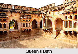
Queen’s Bath in Hampi
The Queen’s Bath in Hampi is a magnificent 15th-century structure believed to have served as a private bathing complex for the Vijayanagara royal fami...
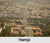
Hampi, The Lost City of Vijayanagara Empire
Hampi, located in Karnataka, is a historic destination renowned for its magnificent ruins, ancient temples, and remarkable Vijayanagara architecture....

Places of Interest in Deogarh Uttar Pradesh
A place of historical and archaeological significance, Deogarh is a site with few popular places of interest.
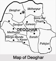
Deoghar in Jharkhand
Deoghar is the divisional headquarters of Santhal Parganas located in Jharkhand and is popular for the famous Baidyanath temple and Shiva Temples.
Related articles in Cities of India
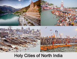
Holy Cities of North India
Holy Cities of North India are having the rich history of Hinduism and the entire civilization was grown up with the hands of beliefs, rituals and the...

Holy Cities of South India
Holy Cities of South India gives the detailed cultural formation of Dravidians from the early era, which later developed to the world by the Pallavas...
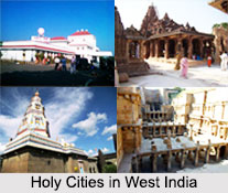
Holy Cities of West India
Holy Cities in West India were established by the rulers of Rajputs and the Satvahana Dynasty and the medieval rulers of Junagadh.
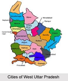
Cities of West Uttar Pradesh
Cities of West Uttar Pradesh include Meerut, Bulandshahr, Ghaziabad, Saharanpur, Muzaffarnagar, Bijnor, Bareilly, Rampur, Agra, Aligarh, Mathura and m...
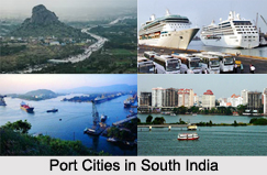
Port Cities of South India
Port Cities of South India are developed from the early phase of colonial era when the Portuguese and the French traders came to India