 Bagaha is a city and a municipality located in Pashchim Champaran district in the Bihar state of India. This place is known for scenic beauty and historical significance. This small town is positioned at the meeting point of Bihar, Uttar pradesh and Nepal. The official languages of this town are Maithili and Hindi. However, most of the people of Bagaha speak Bhojpuri language.
Location of Bagaha
It is located around 64 kilometres away from its district headquarters Bettiah towards north-west on the banks of the river Gandak. It is 294 kilometers away from its state capital Patna. It is located at 27.13 degree N 84.07 degree E. It has an average elevation of 135 metres.
Demographics of Bagaha
According to 2011 India census, the town had a population of 113,012 of which the males were 53% and females were 47%. 19% of the population was under 6 years of age. On the basis of the report of same year, the town had an average literacy rate of 38%, lower than the national average of 59.5%. The male literacy rate was 66% and female literacy rate was 34%.
Economy of Bagaha
Agriculture is one of the biggest sources of economy here. The region is very productive owing to its location in the terai of the Himalayas. The major crops grown here are wheat, paddy and sugarcane.
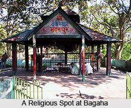
Attractions of Bagaha
Bagaha and the regions close to it are full of scenic beauty and historical significance. Around 10 km from Bagaha is the Valmikinagar wildlife sanctuary. The forest is full of subtropical trees like sal, sagwan, bamboo and cane and is home to animals like the Royal Bengal Tiger, black bear, python, leopard and many species of deer and birds. About 35 km from Bagaha is the small village of Valmikinagar, a place of strategic as well as legendary importance. It is believed that this was the place where Sita resided with her two sons after being banished from Ayodhya by Lord Rama. From the point where Valmikinagar ends, Nepal starts and there is a big barrage on the Gandak River, which acts as the border between the two countries. The forest region has many old temples of religious significance. The Valmikinagar forest has been registered under tiger reserved project.


