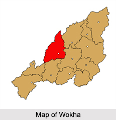
 The town of Wokha is a municipality in the state of Nagaland and is located at the foothills of the Wokha Hills at an elevation of 1,313 ft. The town is a trade and agricultural centre for the surrounding Naga Hills, where grains, especially rice and fruits are grown on previously forested slopes. Wokha also serves as the headquarters for the Wokha district, which has four assembly constituencies and 125 recognized villages.
Etymology of Wokha
The town of Wokha is predominantly inhabited by the Lotha tribe and the word "Lotha" literally means "head count" or "census" in Lotha language.
History of Wokha
In 1876, Wokha was made as the district headquarters of the Naga Hills under Assam by the British Empire. By 1878 the headquarters was shifted to Kohima, but Wokha remained a subdivision and later in 1889, the subdivision was shifted to Mokokchung. After India`s independence, Wokha became a sub division in 1957 under Naga Hills Tuensang Area, and remained so till it became a district in 1973.
Climate of Wokha
With a warm temperate climate, Wokha experiences an annual summer temperature of 16 to 32 degree Celsius and the winter temperature reaches a minimum of 2 degree Celsius. The average annual temperature in Wokha is about 18 degree Celsius with an average annual rainfall of 1940 mm.
Demographics of Wokha
As per the Census India reports of 2011, the total population of the town of Wokha is 35,004, thus making it the third largest town in the state of Nagaland. The population of children between the ages 0 to 6 years old are 10.57 percent. The town has an average literacy rate of 96 percent. The majority of the town"s population practise Christianity along with other religions like Hinduism and Islam.
Tourism in Wokha
Wokha is blessed with many tourist attractions that include Mount Tiyi, Totsu Cliff and the Doyang River with a small hydro electric project built over it called the Doyang Dam. The area is well known for the amur falcons that fly to the banks of the Doyang reservoir. Other than these, the town of Wokha also hosts the oldest cricket tournament in North East India, The Winter Cricket Challenge.
Visiting Information on Wokha
The nearest railhead is Furkating Railway Station in Golaghat in the state of Assam at a distance of 84 km and the closest airport is Dimapur Airport at a distance of 125 km from Wokha.


