 Home to one of the major tribes of Manipur called the Tangkhul Naga, the town of Ukhrul, also known as Hunphun is located in the state of Manipur. Ukhrul is known to be one of the popular and highest hill stations in the state. It is an administrative headquarters of the Ukhrul district.
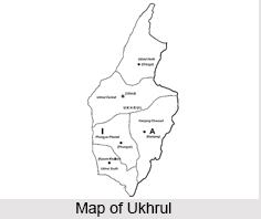
Geography of Ukhrul
The town of Ukhrul is located in the northern part of the state of Manipur. It stands at an elevation of 5,453 ft above sea level and is known to experience a warm and temperate climate. The average temperature in the region is 15.5 degree Celsius with an average precipitation of 1616 mm.
Economy of Ukhrul
The main economic activity of the Tangkhul who live in Ukhrul is agriculture. The lack of electricity, along with the availability of transport and communication infrastructures at a bare minimum, the growth of industries here is absent.
Culture of Ukhrul
Surrounded by picturesque mountains and hills, Ukhrul is interspersed by numerous tribal inhabitants, mainly the Tangkhul tribe. The Tangkhuls like the other Naga tribes came to Manipur and the other north eastern states through Myanmar. The history of the Tangkhuls in Ukhrul is unrecorded but by the beginning of the 13th century, the various facets of this tribal group came to light due to the cultural, trade and traditional aspects.
The cultural activities of the Tangkhuls are centred on the propitiation of their deity known as "Kameo". The tribe also have their traditional folk dance known as "pheichak", which is a representation of the daily lives of the people through the form of dance. The Tangkhuls of Ukhrul have their own traditional costumes, music and dance.
Other than the ethnic tribes and their vibrant culture that adds to the rich tradition of the area and state, Ukhrul is also famous for the Shirui lilies, which endemic to the state. These lilies grow in abundance at a height of 8,500 ft in the Shirui Hills.
Visiting Information on Ukhrul
The nearest railway station is at Dimapur at a distance of almost 284 km from the town of Ukhrul and the Imphal Airport is the closest at a distance of 88 km from Ukhrul.


