 History of Hazaribagh district in Jharkand is quite ennobled and enriched. Keeping track with the findings of historical annals it is said that the illustrious journey of its historical achievement began at early times. In the beginning, the Hazaribagh district was encircled with dense tropical forests. These areas are not easily accessible. It became the ideal hideouts for all the non-Aryan tribes like Munda Tribe, Santhal Tribe, Oraon Tribe, Kharia Tribe, Gond Tribe, Kol Tribe, Kanwar Tribe, Savar Tribe and many other aboriginals who have settled here at different times and thus refused to succumb themselves to the Aryans who were growing strong day by day.
This area has established link with Mahabharata. During that time, famous Magadha ruler namely King Jarasandha had reigned over this region. In the later period, defeated Jarasandha had faced defeat in the hands of Mahapadmanand Ugrasen and took hold of this area.
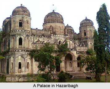
History of Hazaribagh is glorified due to its inclination to religion and spiritualism. In fact a single expedition of this area enables any one to come across various locales of religious, archeological and also historical importance. Experts said that eminent personalities from far off places pay visit to these locales. Hazaribagh is the place where Parasnath, the 23rd Tirthankara expired.
The entire territory of Chota Nagpur Plateau region is known as Jharkhand. The state covered with dense forest territory. This was presumably beyond the pale of district Hindu influence in ancient India. Though out the Turko-Afghan period (up to 1526 AD), the area remained virtually free from extrogenous forces. It was only with the accession of one of the greatest Mughal Emperors in India, Akbar to the throne of Delhi in 1556, that Muslim influence pierced Jharkhand, then known to the Mughals as Kokrah. In 1585, Akbar sent a force under the command of Shahbaj Khan to reduce the Raja of Chotanagpur to the position of a tributary. After the death of Akbar in 1605, the area presumably regained its independence. This necessitated an expedition in 1616 by Ibrahim Khan Fateh Jang, the Governor of Bihar and brother of Queen Noor Jehan. Ibrahim Khan defeated and captured Durjan Sal, the 46th Raja of Chotanagpur. He was imprisoned for 12 years but was later released and reinstated on the throne after he had shown his ability in distinguishing a real diamond from a fake one.
In 1632 Chotanagpur was given as Jagir to the Governor at Patna for an annual payment of Rs. 136000. This was raised to Rs. 161000 in 1636 A.D. During the reign of Muhammad Shah (1719-1748), Sarballand Khan, the Governor of then Bihar, marched against the Raja of Chotanagpur and obtained his submission. Another expedition was led by Fakhruddoula, the Governor of Bihar in 1731.
He came to terms with the Raja of Chotanagpur. In 1735 Alivardi Khan had some difficulty in enforcing the payment of the annual tribute of Rs. 12000 from the Raja of Ramgarh, as agreed to by the latter according to the terms settled with Fakhruddoula. This situation continued until the occupation of the country by the British East India Company. During the Muslim period, the main estates in the district were Ramgarh, Kunda, Chai and Kharagdiha. Subsequent to the Kol Tribal uprising in 1831 which, however, did not seriously affect Hazaribagha, the administrative structure of the territory was changed. The Paraganas Ramgarh, Kharagdiha, Kendi and Kunda became parts of the South-West Frontier Agency and were formed into a division named Hazaribagh as the administrative headquarters.
In 1854 the designation of South-West Frontier Agency was changed to Chota Nagpur and it began to be administered as a Non-regulation province under the Lieutenant Governor of the then Bihar. In 1855-56 there was the great uprising of the Santhals against the British Empire in India but was brutally suppressed.
After the 1991 Population Census, Hazaribagh has been divided into three separate districts viz. Hazaribagh, Chatra and Koderma. The two sub-divisions namely Chatra District and Koderma District were upgraded to the status of independent districts.


