Introduction
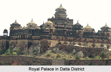 Datia is the District headquarters of the Datia District. The town Datia is situated in the Datia District, which is 69 Kilometers from
 History of Datia District
Datia district is is an ancient district mentioned in Indian Epic, Mahabharata as Daityavakra. Datia District had formerly been a state in the Bundelkhand region. The Rajputs of the Bundela clan ruled Datia District. They are descended from a younger son of a former Raja of Orchha. The state was administered as part of the Bundelkhand agency of Central India. It lay in the extreme north-west of Bundelkhand, near Gwalior, and was surrounded on all sides by other princely states of Central India, except on the east where it bordered upon the United Provinces.
After the independence of India in 1947, the Maharaja of Datia ascended unto the dominion of India. It later merged with the Union of India. Datia, together with the rest of the Bundelkhand agency, became part of the new state of Vindhya Pradesh in 1950. In 1956, Vindhya Pradesh state was merged with certain other areas to form the state of Madhya Pradesh within the Union of India.
After the independence of India in 1947, the Maharaja of Datia ascended unto the dominion of India. It later merged with the Union of India. Datia, together with the rest of the Bundelkhand agency, became part of the new state of Vindhya Pradesh in 1950. In 1956, Vindhya Pradesh state was merged with certain other areas to form the state of Madhya Pradesh within the Union of India.
Princely State of Datia
The Princely State of Datia was an erstwhile state that was located in the Bundelkhand region, established in 1626. It is currently situated in the state of Madhya Pradesh, India. The Rajputs of the Bundela dynasty were the ruling family, who descended from one of the sons of a former raja of Orchha. Datia state was administered as a division of the Bundelkhand Agency of Central India. The territory was situated in the extreme north west of Bundelkhand near Gwalior. It was bordered on all sides by other Indian princely states of Central India and was bounded by the United Provinces in the east. The princely state of Datia was ranked second highest amongst all the Bundela states after Orchha. The state was given a 17 gun salute and the ruler or Maharaja of the state held the hereditary title of Second of the Princes of Bundelkhand.
The princely state covered a total area of 2130 square miles and the total population of the territory was 53,759 in the year 1901. During the period 1896- 1897 and again in 1899- 1900, the princely state of Datia was severely affected by famine. After India gained independence from the rule of the British Empire in India in the year 1947, the Maharaja of Datia acceded the princely state to the Union of India, and was later merged with the Dominion of India. Datia state, along with the other regions in the Bundelkhand agency, was included as a part of the newly formed Vindhya Pradesh state in the year 1950.
Later in 1956, Vindhya Pradesh state was merged with certain other territories in order to form the modern state of Madhya Pradesh, within the Union of India.
Rulers of Princely State of Datia
The chronology of the rulers of the princely state of Datia is mentioned below-
* Rao Ramchandra Singh, who ruled from 1706 to the year 1733
* Rao Indrajit Singh, who succeeded the previous ruler in 1733
* Rao Raja Parichhat, who ascended the royal throne in 1802 to the year 1839
* Raja Bijai Singh, who reined from 1839 to 1857
* Raja Bhavani Singh, who ruled from 1857 to 1865
* Maharaja Bhavani Singh, who ascended the royal throne in 1865 and ruled until 1907
* Maharaja Govind Singh, who succeeded the preceding ruler in 1907 and reigned until 1947
The princely state covered a total area of 2130 square miles and the total population of the territory was 53,759 in the year 1901. During the period 1896- 1897 and again in 1899- 1900, the princely state of Datia was severely affected by famine. After India gained independence from the rule of the British Empire in India in the year 1947, the Maharaja of Datia acceded the princely state to the Union of India, and was later merged with the Dominion of India. Datia state, along with the other regions in the Bundelkhand agency, was included as a part of the newly formed Vindhya Pradesh state in the year 1950.
Later in 1956, Vindhya Pradesh state was merged with certain other territories in order to form the modern state of Madhya Pradesh, within the Union of India.
Rulers of Princely State of Datia
The chronology of the rulers of the princely state of Datia is mentioned below-
* Rao Ramchandra Singh, who ruled from 1706 to the year 1733
* Rao Indrajit Singh, who succeeded the previous ruler in 1733
* Rao Raja Parichhat, who ascended the royal throne in 1802 to the year 1839
* Raja Bijai Singh, who reined from 1839 to 1857
* Raja Bhavani Singh, who ruled from 1857 to 1865
* Maharaja Bhavani Singh, who ascended the royal throne in 1865 and ruled until 1907
* Maharaja Govind Singh, who succeeded the preceding ruler in 1907 and reigned until 1947
Geography of Datia District
The district of Datia has an area of 2,038 square kilometers. Each town of the Datia District is the headquarters of its tehsil. Datia is bounded by the Madhya Pradesh districts of Bhind to the north, Gwalior to the west, and Shivpuri to the south, and by Jhansi District of Uttar Pradesh state to the east. The district is part of Gwalior Division.
Demography of Datia District
In 2011, the census data of India reveals that Datia had population of 786,375. Out of which male and female were 419,432 and 366,943 respectively. The density of Datia district for 2011 is 292 people per square. Kilometers.
The average literacy rate of Datia in 2011 was 73.50 percent. The total literate in Datia District were 497,883 of which male and female were 307,131 and 190,752 respectively.
The average literacy rate of Datia in 2011 was 73.50 percent. The total literate in Datia District were 497,883 of which male and female were 307,131 and 190,752 respectively.
Temples in Datia
 Datia has an illustrious lineage of famous temples. `Peethambara Peeth` and Hanuman Giri are some such temples having a footfall of more that thousands every month. `Puraan Mahal` or `Datia Mahal` is another perfect example of soulful architecture. The Mahal is visible from the railway line passing from Gwalior to Jhansi, built to welcome Prince Jehangir after his coronation as the emperor, but he never arrived, fearing he would have to reward the Datia King with exemplary gifts due his significant role in helping Jehangir achieve the Mughal throne.
Pitambara Peeth: Built somewhere in the 1920s, Pitambara Peeth rebounds in mythological stories.
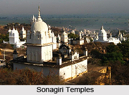
Sonagiri Temples: Sonagiri Temples attract devotees due to its breathtaking architectural magnificience.
Unao-Balaji Sun Temple: Unao-Balaji Sun Temple has an enormous footfall of pilgrims daily.
Datia Palace
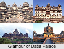 Datia Palace which is also known as Bir Singh Palace is a palace of highest architectural designs and engineering which is the royal abode of founder of the Datia State in Bundelkhand.
Location of Datia Palace : Datia Palace is situated nearly 75 km from Gwalior State in Madhya Pradesh. The princely State of Datia was an erstwhile state that was located in the Bundelkhand region, established in 1626. The Rajputs of the Bundela dynasty were the ruling family, who descended from one of the sons of a former raja of Orchha. Datia state was administered as a division of the Bundelkhand Agency of Central India. The territory was situated in the extreme north west of Bundelkhand near Gwalior.
Architecture of Datia Palace : Datia Palace is built up of seven floors. However neither member from the royal family did ever lived here. The founder of the Datia State in Bundelkhand, Maharaj Birsingh Deo build many such fifty two monuments all around Gwalior. It represents Mughal architecture along with Rajput architecture. It is the biggest and most famous of all the 52 palaces build by Raja Birsingh Deo and it can be seen easily from a long distance. The palace mainly has four quadrangular parts with a "Mandap" or the main centre on the central point of the Palace. It is totally made using stones and neither wood nor iron is used in this whole palace.
Cost of Making Datia Palace : Datia Palace was made by spending 35 lakh rupees and it took nine years to build it. It is situated on an isolated rock on the western side of the Princely State of Datia.
Domes in Datia Palace : The eastern part of Datia Palace is most beautiful and the domes contain beautiful pictorial drawings and windows are beautifully carved out of stones. The central domes and the other two tombs form an incredible view. The central dome has Lord Ganesha `s Temple inside and there is Lord Durga"s temple on both the entrances of the palace. On the first part of the main entrance there is a temple of the main house deity of Bundels and one the second part there`s a Dargah.
Threats of Datia Palace : Datia Palace was partially destroyed by a 1985 cyclone. The Cyclone destroyed some parts of the palace but still Datia Palace is one of the most beautiful places to visit for those who are really interested in Mughal Architecture and Rajputana architecture and their beauty.
Tourist Attraction Sites in Datia District
The "Purana Mahal" or "Datia Mahal"is one of the most important tourist attraction sites. It was built to welcome one of the greatest Mughal Emperors of India, King Jahangir after his coronation but the Emperor never came in this District. The town Datia is a market centre for food grains and cotton products. In Datia District, the handloom weaving is an important industry. It is famous for the seven-storied palace built by Raja Beer Singh Deo in 1614.
It is also the pilgrimage spot for devotees; Datia has the Sidhapeeth of Shri Peetambhara Devi, Buglamukhi Devi Temple and Gopeshwar temple. About 15 Kilometers from Datia is the Sonagiri. In that place, there are a huge number of temples called Sona giri temples.It is a scared Jain hill. Datia is 34 kilometers from Jhansi, Uttar Pradesh and 52 Km from the priencely state of Orchha. Vankhandeshwar temple is an ancient temple in Datia district built during the time of Mahabharata. The temple of Lord Shiva is situated at this place. Pitambra Peeth is about 1 kilometers from Datia Bus Station and 3 Kilometers from Datia Railway Station
The nearest airport to reach the Datia District is at Gwalior. Datia railway station is on the Delhi-Chennai main line. The Peetambra peeth is a famous shaktipitha located at the entrance of Datia in Madhya Pradesh. This pilgrimage spot features Buglamukhi Devi Temple and Dhumavati Mai Temple established by Shri Golokwasi Swamiji Maharaj.
It is also the pilgrimage spot for devotees; Datia has the Sidhapeeth of Shri Peetambhara Devi, Buglamukhi Devi Temple and Gopeshwar temple. About 15 Kilometers from Datia is the Sonagiri. In that place, there are a huge number of temples called Sona giri temples.It is a scared Jain hill. Datia is 34 kilometers from Jhansi, Uttar Pradesh and 52 Km from the priencely state of Orchha. Vankhandeshwar temple is an ancient temple in Datia district built during the time of Mahabharata. The temple of Lord Shiva is situated at this place. Pitambra Peeth is about 1 kilometers from Datia Bus Station and 3 Kilometers from Datia Railway Station
The nearest airport to reach the Datia District is at Gwalior. Datia railway station is on the Delhi-Chennai main line. The Peetambra peeth is a famous shaktipitha located at the entrance of Datia in Madhya Pradesh. This pilgrimage spot features Buglamukhi Devi Temple and Dhumavati Mai Temple established by Shri Golokwasi Swamiji Maharaj.