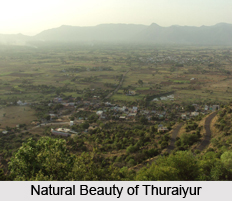
Latehar is a town which is also headquarters of Latehar district of Jharkhand, India. It is located 105 km north-west of the state capital, Ranchi. Latehar is famous for its rich natural beauty, forest, forest products and mineral deposits. It got elevated from sub divisional status to a district on 4th April 2001 by the Jharkhand Government.
History of Latehar
The history of the area is vast and complex. Earlier in 2001 Latehar was part of Palamu. The district of Palamu was constituted in 1928 where its headquarters was Daltonganj and was named after Colonel Dalton, the commissioner of Chotanagpur during the British rule.
This district together with the earlier composite district of Palamau is inhibited by tribes like the Chero, Oraon, and Kharwa. The Chero reigned over the Palamu for more than 200 years. One of the most significant rulers among them was Raja Medini Rai. He stretched his reign over South Gaya (now in Bihar) and parts of Hazaribagh and Sarguja (now in Chattisgarh State). One of the Palamu forts was built by him that was later developed by his son Pratap Rai. He rebuilt his father`s fortress, which is still in existence in Betla which is now part of Latehar District.
Palamu including the present Latehar district itself was a hub for `anti-British` revolt during 1857 movement in Chotanagpur plateau. Brothers Nilambar and Pitambar-the popular tribal patriot and freedom fighters, the chief of Bhogta clan of Kharwar were holding ancestral jagirs. Taking advantage of the movements against British rule, they declared themselves to be independent and were joined by Chero Jagirdars. They jointly attacked on British supporters. However Nilambar and Pitambar were captured and trailed. The August disturbances in 1942 had their echoes in Palamu as well. Railway lines were dismantled, telegraph lines were cut and a large number of people were arrested.
Geography of Latehar
Latehar is located on the north-west corner of Jharkhand in the Palamau Commissionary. It is surrounded by Ranchi, Lohardaga District, Gumla District, Palamau District and Chatra District. Latehar is located at 23.75degreeN 84.50degreeE. It has an average elevation of 327 m. The climate of this district is on the whole dry and bracing. The average annual rainfall for the district as a whole is 1,335 mms. The capital of the district Latehar is also named Latehar which is 105km North West of the state capital Ranchi. The district is rich in various mineral deposits. There is abundance of deposit of Coal, Bauxite, Laterite, Dolomite, and Graphite, Granite, Quartz, Fireclay, Felspar etc.
Economy of Latehar
The economy of Latehar is dependent on agriculture, mines and minerals, forest, trade and commerce and animal husbandry. Thus the economy of Latehar is agro-based.
A large number of people are engaged in the cultivation of paddy, maize, cereals, wheat, oil seeds etc. Kharif and Rabbi are the main agricultural seasons. Latehar is a drought prone district hence the success of agriculture in this district is entirely dependent on rainfall. Subsistence farming is still practiced here.
Animal husbandry is one of the prime livelihoods of the people of Latehar. Cow, goats, piggery and poultry are the common livelihoods.
Flora in Latehar
Latehar covers a total of 2010.2245 sq. km of forest area. The vast majority of the forests lie on the hills of Chandwa, Balumath land Latehar Ranges. The tribal economy revolves around using forest products, by products and minor products. Kendu leave is one of the prime forest produces in the tribal area. Bamboo is another important forest product. It provides raw materials for tribes for bamboo based handicrafts including baskets, mats and bamboo crafts. Another popular forest produce is Mahua flower and seed. They use it for liquor making. Latehar also has huge sal forest resources. The leaves of the sal tree are used for leaf plate making. The seeds of the sal tree have commercial value as non-edible oil.
In the months of March to April tamarind is available in huge quantity in forest villages. This gives additional income to many tribal families. Latehar has huge potentials for lac cultivation. Latehar is also rich in herbal resources. The tribal communities use these herbs for curing many ailments. Ashwagandha is also found in the state, which is used in increasing the physical strength, hemoglobin and increasing the red blood cell. Other herbs like Moosh, Shatawar, Kalmedh, Ghritakumari are found here. Lacquer which is also available here is used in making many products such as Indian bangles, ornaments and polishing various items.


