 Osmanabad district is the southernmost district in the Aurangabad Division of Maharashtra state. It lies between the north latitudes of 17 degrees 35 minutes and 18 degrees 40 minutes. A greater portion of the district lies on the triangular Balaghat plateau generally over 610 metres above sea level, sloping towards the south and east, forming the water divide between the Godavari and Bhima valleys. The northern bounding scarp of the Balaghat plateau running generally eastwards across the middle of the Bhir district enters Osmanabad district near Degaon. The southern bounding scarp of this plateau backed by a chain of hills enters the district just west of Malewadi and Pakhrud villages and runs in a general south-easterly direction though in some sections it has locally easterly and southerly trends. Due to the powerful headward erosion of streams draining down, these scarps themselves have been retreating as also the water divide between these and the plateau drainage, with the result that some of the greater heights are found often away from the steep faces.
The northernmost divide in the district is that between the Manar River and the Godavari River, just south of the district boundary. This is a low divide ranging from about 550 metres above sea level in the west to about 500 metres in the east. The next divide is on the Balaghat plateau just behind northern scarp. It enters the district near Langarwadi and south-eastwards passing through Udgir. Two significant heights on this are Janwal and Wadwal both about 733 metres. The main divide between the Manjra and the Bhima river drainage systems, enters the district just north of Malewadi with a height of about 760 metres. The highest point in the district, a little over 792 meters, is situated on this divide, just north-west of Kanheri about 6 kilometres south-west of Wasi. Some of the significant heights in this are Dharur, 714 metres and Deobet, 668 metres. The active head ward erosion of the Bori river into the plateau has resulted in a valley floor about 30 metres below the plateau level leaving the remnant of the plateau edge on its west as a prominent ridge running parallel to its course with a summit level of 610 metres south-eastwards as far as Naldurg.
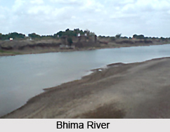
Except the southern and western parts of the district, which are drained by the tributaries of the Bhima system, the rest of the district is drained by the Manjra and its tributaries belonging to the Godavari drainage system. The Manjra itself along with its tributaries, the Terna River, the Tawarja river and the Gharni river, drains the Balaghat Plateau portion, while its three other tributaries, the Manar, the Tiru and the Lendi river drain the area to the north of the plateau. The climate of this district is on the whole dry except during the monsoon season. The year may be divided into four seasons. The cold season from December to about the middle of February, followed by the summer season lasting up to the end of May, the south-west monsoon season from June to September and the post-monsoon or retreating monsoon season in October and November. December is generally the coldest month with the mean daily maximum temperature is at about 29.5 degree Celsius and the mean daily minimum at about 15 degree Celsius. May is generally the hottest month with the mean daily maximum temperature at about 40 degree Celsius, and the mean daily minimum at about 25 degree Celsius. The heat during summer is intense and, the maximum temperature sometimes goes up to about 45 degree Celsius.


