 Geography of Karimganj District comprises varied ecological features like agricultural plains, shallow wetlands, hilly terrains and forests as well as several rivers and their tributaries. Karimganj District is situated in the southern tip of Assam. This district along with two other neighbouring districts of the state Cachar District and Hailakandi District constitutes the Barak Valley zone in the southern region of Assam. Karimganj District covers a total area of around 1809 sq kilometres. A huge portion of the total geographical area of this district is covered by forests. Karimganj district is actually shut in between two hill ranges, whereas there is a third hill that runs through the southern division of the district.
Geography of Karimganj District includes the Chhatachura range that starts from the south-east border forming the whole length of border with Hailakandi district. The summit of the range is called the Chhatachura peak and its height is around 2087 feet above the sea-level. The hills gradually decline in height and in the middle section, which is known as Sarashpur, is near about 1000 feet above the sea-level near the Barak river. At the lowest level the average height is about 500 feet. The Chhatachura range is about 50 miles from north to south and at some parts, 13 miles in breadth. Further, the Adamail or Patharia range marks the western border of the geography of Karimganj district that is forming the international border with Bangladesh. Running from the south to the north, its length is near about 28 miles and breadth about 7 to 8 miles. The highest point of the range is about 800 feet above the sea-level.
The third hilly range crossing through Karimganj district is the Duhalia range, also known as the Pratapgarh range. It runs through the mid-south of the district demarcating the Longai Valley and the Chargola valley. Besides these main ranges, the plains constituting the geography of Karimganj District are also dotted with hillocks and forests. The north and north-eastern portion of the district are mainly plains whereas the southern and south-western regions are principally covered with forests.
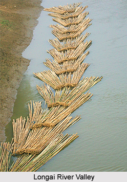
Kushiara, Longai and Shingla are the main rivers flowing through this district of Assam. Barak Rivers enters the district through its north-eastern corner near Badarpurghat and after passing through a length of around seven miles it is divided into two branches - namely, the Kushiara and the Surma. The Kushiara River flows westwards forming the northern boundary of Karimganj District. Karimganj town is situated on the bank of this river. Longai River originates in the Jampui Hills of Tripura. Singla River originates from Mizoram. The Kushiara and the Longai are perennial rivers, whereas the others dry up during the cold weather season.
Thus, it can be said that the geography of Karimganj District is mostly spread over vast ecological landscapes with small hillocks scattered everywhere.
Geography of Karimganj District
Geography of Karimganj District comprises plain lands, forests, hilly territories and a number of rivers. The geographical features of Karimganj District specify that the location of this district is strategic and advantageous.


