Introduction
Bhilwara District is located in the state of Rajasthan. It is an industrial town which is famous country-wide for the textiles industry. Well connected by road and rail, the district is situated at a distance of 260 Kms away from Jaipur. It is not exactly clear as to how the district acquired its name. It is widely held that the district was mostly inhabited by Bhils in the old days, and this is how the name Bhilwara came about. Though primarily an agricultural economy, the district has managed to make a name for itself in the industrial map of the state.

Location of Bhilwara District
Bhilwara district is situated between 25 degrees 0 minutes to 27 degrees 50 minutes North Latitude and 74 degrees 3 minutes to 75 degrees 25 minutes East longitude. It is bounded in the north by Ajmer District, in the north-west, west and south west by Udaipur and Rajasamand district and in the south and south-east by Chittorgarh district. In the east and north east it is surrounded by Tonk and Bundi district. The district is situated 100 metres above sea level. The total length of the district from west to east is 144 km. while the breadth from North to south is 104 km approximately. The district is 260 kilometres away from Jaipur.

History of Bhilwara District
It is traditionally believed that the district of Bhilwara acquired its name because it was mostly inhabited by Bhils in the old days. These Bhils were eventually driven away towards the hilly tracts and interior places of less importance by the ancestors of the peasant settlers. Ironically enough, now very few Bhils live in this area. Another version recounts that the present Bhilwara city had a mint where coins known as `bhiladi` were minted and from this denomination was derived the name of the district. Over the years it has emerged as the textile city of Rajasthan. Nowadays, Bhilwara is better known as the textile city of the country.
Geography of Bhilwara District
Bhilwara district lies between 25 degrees to 27 degrees 50 minutes North Latitude and 74 degrees 03 minutes to 75 degrees 25 minutes East longitude. It is 100 meters above the sea level and situated about 260 km. away from Jaipur. The northern border of the district touches Ajmer district , the north-west border touches district Rajsamand, south and south-east borders touch Chittorgarh district and the east and north eastern borders touch Tonk and Bundi district.

The climate of the district of Bhilwara is characterised by a hot, dry summer and bracing cold winter. The cold season is from December to February and is followed by hot summers from March to the last week of June. The south-west monsoon season which follows, lasts till about mid September. The period from mid September to about the end of November constitutes the post monsoon season. Among the rivers flowing in the district, Banas is the main seasonal river. Its tributaries are the Bedach, Kothari and Khari. Other rivers are Mansi, Menali, Chandrabhaga and Nagri.
The Banas River rises in the Aravalli mountain ranges in the north, in the Udaipur district. It enters Bhilwara near village Doodiya, tehsil Bhilwara. It approaches the hills of Mandalgarh and is joined by the Berach River on the right bank and Kothari on the left at Nandrai in Kotri tehsil. It then flows towards the north and then north-east direction along the western side of the Jahazpur tehsil and enters Tonk district. Banas is not a perennial river. In summer it usually contains only pools of water. The chief feeders of the river are Mansi, Khari and Menali.
The Berach River rises in the hills to the North of Udaipur and enters the district near the village Barundani and joins the river Banas near Bigod at Triveni Sangam in Mandalgarh tehsil. It passes through a little portion of Bhilwara district. The Kothari River rises from the Aravalli hills near Devgarh in the Rajsamand district. It flows in tehsil Raipur, Mandal, Bhilwara and Kotri and ultimately joins the river Banas at Nandrai in Kotri tehsil. The Khari originates in the Rajsamand district and runs from the south to the north-east in the western half of the district and then runs parallel to the district boundaries in the north. After leaving the district in the north it finally merges with the Banas. It is joined by the Mansi River in the tehsil Shahpura.

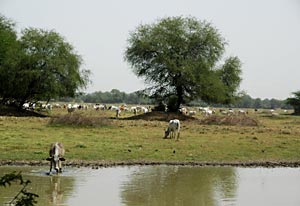
Bhilwara is often called the `Zoo of Minerals` due to the abundance of minerals found here. The main categories of minerals found in Bhilwara are mica, soapstone, copper, feldspar and quartz, white clay, garnet, asbestos, glass sand and sand stone. Bhilwara district is greatly dependant on agriculture. Maize, wheat, barley, til, urad, moong, jeera, gram, groundnut, rai, mustard and cotton are major crops of Bhilwara District. Kharif sowing is done at the beginning of the monsoon which normally reaches Bhilwara in the last week of June. Kharif crops constitute the bulk of the food production in the district as the agricultural activities are mostly dependent on the monsoons. Kharif crops include urad, maize, moong, groundnut etc. Rabi crops are usually sown in November.
Administration in Bhilwara District
Administration of Bhilwara district is carried out by the District Collector. He is the head of the general administration of the district. In the task of administration, the district collector is assisted by three Additional Collectors. The Additional Collector of the city is responsible for law and order in Bhilwara city. The Additional Collector of Administration is responsible for routine and institutional administration. The Chief Executive Officer (CEO of the Zilla Parishad) is responsible for developmental administration.
Following the formation of the state of Rajasthan, a uniform pattern was evolved for the administration of the entire state of Rajasthan. It was divided into a total of six divisions.
Bhilwara was placed in Udaipur range after the formation of state, but now it is in Ajmer range. The entire police of the district is divided in to five police circles viz., Bhilwara, Shahpura, Gangapur, Gulabpura and Mandalgarh. These are placed under the control of D.S.P`s. The Circles are again sub-divided into 27 police stations which in their turn are subdivided into 40 police chowkies. Besides, Reserve Police Line and the City and Traffic control police are stationed at district headquarters.
In keeping with the principles of decentralisation, the district of Zila Parishad is divided into eleven Panchayat Samitis, visibly Suwana, Mandal, Kotri, Mandalgarhs, Sahada, Hurda, Asind, Banera, Raipur, Shahpura and Jahajpur. These Panchayat Samities are further sub-divided in to Gram Panchayats. The Political head of Zila Parishad is called Zila Pramukh and Administrative head of the institution is called Chief Executive Officer. Panchayat Samities follow the same pattern. The political representative is called Pradhan and administrative head is the Block Development Officer.
The structure of local self-government at the urban level is made with two institutes, the Urban Improvement Trust and Nagar Parishad. Both political representatives and civil servants are there in these institutions. Beside these, all the sub divisions are managed by Nagar Palikas.
Economy in Bhilwara District
Economy of Bhilwara district is mainly dependant on agriculture. Agriculture is the main occupation of a majority of the population of Bhilwara district. Of the total work force in the district, more than 80 percent of the workers are engaged in agricultural activities. The major crops grown here are maize, wheat, barley, til, urad, moong, jeera, gram, groundnut, rai, mustard and cotton. Kharif sowing is done Kharif sowing is done at the beginning of the monsoon which normally reaches Bhilwara in the last week of June. Kharif crops constitute bulk of the food production in the district as agricultural activities are mostly dependent on monsoons. Kharif crops include urad, maize, moong, groundnut etc. Rabi crops are usually sown in November.

Bhilwara district has made an important place for itself in the industrial map of the state. During the last decade the district has developed into a leading place in the textile industry the in the country. The major agro-based industries here are oil mills, flour mills, ice candy manufacturing units, dal mills and units producing biscuits, confectionary items, Khandsari, masala and cattle feed. Cotton based industries also feature in a big way in the economy of Bhilwara district. Cotton is grown in Asind and Hurda Panchayat Samities of Bhilwara. A number of cotton Ginning and Pressing units are established there. Where wood-based industries are concerned, Bhilwara district is backward from the point of view of forests. The mere wood produced locally is used for making bullock carts, ploughs, wooden windows, doors. Furniture is made from Teak and Sunmica wood imported from outside the district.
The district has a number of units manufacturing agricultural tools and instruments, thresher, spades axes repair shops, welding, motor winding, pump repairing auto mobile workshop etc. Cotton textile industries include cotton spinning, cotton ginning, cotton mercerizing, doubling yarn, cotton dying, handloom and power loom fabrics and cotton tape producing units. Other major industries are wool based industries, synthetic fabric unit, paper based industries that produce paper bags, envelopes and cardboard boxes, exercise books, paper cones and paper printing, electrical machinery and instruments, leather and leather based industry, rubber and plastic unit and more. There are deposits of soap stone, mica, china clay, garnets, marble etc. Based on them a number of units have come up for manufacturing insulation bricks, mica grinding, marble cutting and polishing, china clay, washing powder etc. There are also units for manufacturing cement jali, tanki, pipes and P.C.C. poles.
Education in Bhilwara District
Education in Bhilwara district has a well-developed structure. The Department of Education of the Government of Rajasthan is responsible for Primary, Secondary and Higher Secondary Education. To achieve the goal of literacy in Rajasthan, the government has a very strong network of schools. The schools are divided in three categories to provide education at various stages. The division is as follows: 1.Primary Education 2.Secondary Education 3.Higher Secondary Education. In order to make education accessible to the masses, the government has further given recognition to various private institutes that provide education to the children. Besides this, the Government is also running Rajiv Gandhi Pathashala (School) Scheme to provide primary education to the rural children.

A number of schemes are being carried out to improve the status of education in the district: Shiksha Aapke Dwar (Education at your door) District Primary Education Program (DPEP) Ghummakad Vidyalaya Shiksha Mitra Yojna. To impart higher College education, there are six colleges in the district and one Engineering college: Manikya Lal Verma Textile College, Bhilwara Manikya Lal Verma Government College, Bhilwara Seth Muralidhar Maansinghka Government Girls College, Bhilwara. Beside this there are colleges at Shahpura, gangapur, Gulabpura and Mandalgarh. Besides, there are school run By CBSE. They are: Central School, Bhilwara Central School, Hurda Navodaya Vidhyalaya and Hurda.
Tourism in Bhilwara District
Tourism in Bhilwara district comprises visiting a number of beautiful places of religious and historical worth located here. Ancient temples and old historical sites figure prominently among the various places of tourist interest located in the district. Listed below are the various tourist attractions in Bhilwara district.

Bijoliyan is situated in the south east of Bhilwara. It is close to the borders of the Bundi district. The ancient name of Bijoliya was `Vindhyavali`. It is walled with two gates, North and South, and picturesquely situated on a plateau called the Uparmal. Objects of historical interest here include three Saivite temples, probably of the tenth century; a reservoir called the Mandakini Baori with steps; five Jain temples dedicated to Parashvanatha. The remains of a palace and two rock inscriptions deserve mention. The Jain temples, situated about 1.5 Km. of the south east were built by Mahajan Lala in the time of the Chauhan Raja Someshwar of Ajmer in 1170 AD. One of them is considered sacred, containing a complete small model of a temple inside. The rock inscriptions are both dated 1170 AD.

Shahpura, the capital of the erstwhile state of Shahpura, is the town that houses the headuarters of the sub division, tehsil and panchayat samiti of the same name. It is about 58 Kms. from district headquarters. The rulers of the erstwhile chiefship of Shahpura belonged to the Sisodia Clan of Rajputs. Shahpura is a place of pilgrimage for the followers of the `Ram Snehis` Sect .Founded by the Hindus in 1804, they have a shrine in the town as `Ram Dwara` .The chief priest of Ram Dwara is the head of the sect. Pilgrims from all over the world visit the shrine throughout the year. Ram Snehi is an Internation Hindu sect. An annual fair, which is called `Phool Dol Ka Mela` is held here on Phalgun Shukla `15(March-April) for five days. About one lac people attend the fair. It is also famous for Phad painitings.
Mandalgarh is situated at a distance of 54 Kms from towards the south east of Bhilwara. It has a sub division, tehsil and panchayat of the same name. The place is of great historical importance because it was the scene of many a fierce battle during the mediaeval times, according to Muslim historians. The place was taken twice by Mahmud Khilji of Malwa in the middle of the fifteenth century, and subsequently appears to have belonged alternately to the Ranas of Mewar and the Mughal Emperors. In or about 1650 A.D.

Shah Jahan granted it as a Jagir to Raja Roop Singh of Kishangarh, who partially built a palace here, but Rana Raj Singh retook it in 1660.A.D. Rana Amar Singh recovered the palace in 1706 AD from the Chief of Pisangan, Jhujar Singh. It has since remained in the uninterrupted possession of his successors. Lying to the north-west is a fort, about half a mile in length, with a low rampart wall and bastions encircling the crest of the hill on which it stands. The fort is said to have been constructed by a chief of the Balnote Clan of Rajputs (a branch of Solankis). There is an old temple by the name of Jaleswar. The fort also houses a temple dedicated to Lord Shiva.
Asind is a tehsil and Panchayat Samiti. The town is known for the temples situated on the left bank of the Khari River, built by Sawai Bhoj. During the princely rule, it was an estate comprising seventy two villages, held by one of the first class nobles of the Mewar state, who had the title of Rawat. Gangapur, headquarters of the Sahara tehsil, is a town situated at a distance of about 46 Kms in the south-west of the district headquarters. It was part of the erstwhile princely state of Gwalior (now in Madhya Pradesh.) prior to independence. It is now municipal town. The Ganga Bai Chhatri is located here. Pur is situated at about 10 Kms from Bhilwara city. It is famous for the Udan Chhatri, Adhar Shila and Patola Mahadev. The Bhilwara Municpal Corporation is developing a tourist place at Gata Rani Mandir. The Badnore fort is situated 70 Kms from Bhilwara on the Bhilwara-Asind road. It is a beautifully constructed ancient forth which is well worth a visit when on a visit to the district.