 Jhalu is a small town and a nagar panchayat situated in Bijnor District of the northern state of India, Uttar Pradesh. Bijnor, the district headquarters is located in the east at a distance of 13 km from Jhalu. The important towns in the neighbourhood are Haldaur and Nehtaur
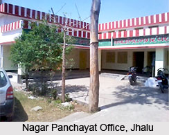
Location of Jhalu
Geographically, the town is located at a distance of 29.35 degree North latitude and 78.25 degree East longitude at an altitude of 225 metres (738 feet) above mean sea level. Jhalu is located 23.1 km away from the nearest railway station Chandpur Railway Station. It is located 55.3 km away from the nearest Airport - Muzaffarnagar.
Demographics of Jhalu
According to India census 2001, the town had a population of 18,701. The population of men was 52% and women 48%. In Jhalu, 19% of the population was under 6 years of age. On the basis of the report of same year, Jhalu had an average literacy rate of 46%, lower than the national average of 59.5%. The male literacy was 53%, and female literacy was 38%.
Attractions of Jhalu
Sena Ka Dawar and Vidur Kuti are exciting excursion sites. To the north of Jhalu there is Nagina a town, which is famous for its exquisite ebony carvings.
This article is a stub. You can enrich by adding more information to it. Send your Write Up to content@indianetzone.com


