


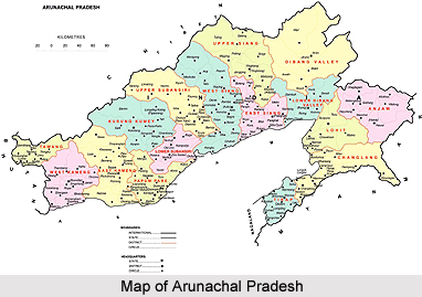
 Geography of Arunachal Pradesh states that the state is divided into six natural regions. The Western parts of Kameng District, Tirap District, the upper, middle and the lower belts and concentrated pockets of the Arunachal Pradesh foothills are the six regions that form the topography of Arunachal Pradesh. Geography of Arunachal Pradesh states that the state is divided into six natural regions. The Western parts of Kameng District, Tirap District, the upper, middle and the lower belts and concentrated pockets of the Arunachal Pradesh foothills are the six regions that form the topography of Arunachal Pradesh.
The state of Arunachal Pradesh is the largest state in the northeast. The state stretches from the snow-capped eastern Himalayas to the plains of the Brahmaputra River valley. Arunachal Pradesh is surrounded by Bhutan, China and Burma. Assam lies to its south. Kangto and Nyegi Kangsang, and the Gori Chen Peak are some of the highest peaks in this part of the Himalayas. Arunachal Pradesh is situated between 26 degree and 28 minutes and 29 degree and 30' North latitudes and 97 degree and 30 minutes and 97 degree and 30 minutes East Longitudes. It is situated in the Eastern Himalayan province. The entire territory is an intricate hill system with varying elevations, traversed throughout by a number of rivers and rivulets. The diversity in the topography and climatic conditions has favoured the growth of luxuriant forests, which are home to myriad plant, and animal forms. The richness of the flora and fauna that occur in these forests presents a panorama of biological diversity with over 5000 plants, about 85 terrestrial mammals, over 500 birds and a large number of butterflies, insects and reptiles. This state is at the junction of the Palaearctic, Indo-Chinese, and Indo-Malayan bio-geographic regions. The vegetation of Arunachal Pradesh falls under four broad climatic categories. This is further classified into five broad forest types. These are tropical forests, sub tropical forests, pine forests, temperate forests and alpine forests. There are bamboos and forests of other grasses too. The major rivers that flow through the state are Kameng River, Subansiri River, Siang River, Lohit River and Tirap River. The rivers have created broad valleys in these areas. The Brahmaputra River enters Arunachal Pradesh from Tibet and flows into Assam from where it goes down to Bangladesh before falling into the Bay of Bengal. The capital of the state is Itanagar, which is situated in the foothills of the Himalaya Mountain. The climate varies with elevation. Areas with very high elevation enjoy an alpine or Tundra climate. Areas near to the Middle Himalayas experience a temperate climate. Areas at the sub-Himalayan and sea-level elevation experience a humid sub-tropical climate, with very hot summers and mild winters. The state receives very heavy rainfall. Due to the heavy rains, the forests are luxuriant in growth and the rain also accounts for the large number of rivers and lakes in the region. The rainy seasons are from May to September. |
| |||


Geography of Arunachal Pradesh
| Geography of Arunachal Pradesh reveals that it is a hilly tract nestled in the foot of Himalayas. |
| ||||||||||||||||||||||||||||

