 Nabarangpur District is located in the south west district of Odisha, is situated in the midst of nature. Nabarangpur District has a unique culture and history. The people living here are also quite interesting. Home to more than ten tribes, and with more than half the population being tribal, Nabarangpur district has a vibrant life style.
Nabarangpur District
Nabarangpur District in Odisha is situated among lush green forests in the South-West of Orissa. The unique history and culture of this picturesque district is quite fascinating.
Introduction
Nabarangpur District is located in the south west district of Odisha, is situated in the midst of nature. Nabarangpur District has a unique culture and history. The people living here are also quite interesting. Home to more than ten tribes, and with more than half the population being tribal, Nabarangpur district has a vibrant life style.Location of Nabarangpur District
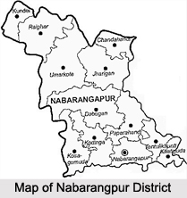
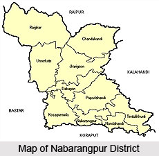
Nabarangpur district is located in the district of Odisha. The district headquarters is in the city of Nabarangpur. Situated in the south west corners of Odisha, Nabarangpur district`s boundary stretches in the north to Kalahandi district, west to Jagdalpur district, east to Kalahandi and Rayagada district and south to Koraput District. The Indravati River forms the border between Nabarangpur and Koraput districts. It lies at 19.14` latitude and 82.32` longitude at an average elevation of 1,876 feet (572 m).
History of Nabarangpur district
 History of Nabarangpur district, until recently called as Nowrangpur, was a part of erstwhile Koraput District ruled by the Solar Dynasty of Jeypore in the past. It was a grant received from the Maharaja of Jeypore in the year 1820 AD. The language, style of living, heritage, geographical location, flora and fauna and even climate of Nabarangpur is not dissimilar from the rest of the component of Koraput district. Its boundary stretches in the north to Kalahandi district west to Jagadalpur district in Chhatishgarh, east to Kalahandi and Rayagada and south to Koraput district with the river Indravati separating the two districts. Nabarangpur is located on the 2000 ft Plateau (about 2000 ft above mean sea level) like that of the historically, famous Jeypore town in the Koraput district.
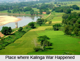
The history of Nabarangpur district in Orissa, which was in the past a part of Koraput, have experienced the rule of several dynasties. The Atavika people were native of Koraput, and valiantly fought the Kalinga war in the 3rd century BC. Kalinga regained her former glory during Mahamegha Bahan dynasty in the first century BC. The third king of this dynasty Kharabela made the Kalinga Empire and the Atavika land very strong. The successive dynasties - the Satavahans (2nd century AD), the Ikshvakus (3rd century AD), the Nalas (3rd and 4th century AD) ruled the Nabarangpur district. The Kesaribeda excavations bear testimony to the rule of King Bhabadatta Verman and King Arathapati. The inscriptions of Podagarh refer to King Skanda Verman .The Nala King are traced to the kings who ruled from Gwalior in Madhya Pradesh. Their rapid growth landed them in Bastar in the Koraput region. Around 10th century AD one of the Nala kings Bhimsen, was ruling over a region now located to the Koraput and Ganjam District.
The erstwhile Koraput was a small principality of Tri Kalinga under the Ganga era during the 5 the century AD. The patches of Odra, Kalinga and Kosala were brought under the power of Ganga kings. This dynasty became well-known during the 11th century AD with the rise of Somanakshi. Their suzerainty extended from the modern Sambalpur, Sonepur to Bastar - Koraput regions and they enjoyed their being in command till the beginning of 14th century AD. The next dynasty belonged to the Famous Sailavansis, who ruled over Vindhya during the 14th century AD. The last king of Sailavansa, Pratap Ganga Raju, was succeeded by Vinayak Dev of Surya Vansa which lasted till the eon of the British Empire. During the anglo- French conflict, Vikram Dev I was successful in driving out the French from Malkangiri area and the Marathas from the Umerkote belt. King Vikram Dev I (1758 -1781 AD) was succeeded by Ramachandra Dev-II (1781 -1825) while his other two sons Jagannath and Narasingh Dev were placed in charge of Nabarangpur and Gudari regions. Jagannath Dev`s son Arjun Dev and Narasingha Dev`s son Chaitanya Dev were issueless. Hence, Nabarangpur and Gudari were remerged to Jeypore kingdom.
During the 20th century Ramachandra Dev-IV (1920-31) was an honourable lieutenant in World War-I. He was issueless and was succeeded by Vikram Dev IV, the son of Krishna Chandra Dev. During this period the Boundary Commission headed by Sir O`Donnel was delegated with the task of writing the different Oriya speaking tracts. The Commission went round Jeypore, Paralakhumendi, Ganjam, and Visakhapatnam agency before finalising. The state of Orissa was formed on 1st April 1936 with Koraput as one of the six districts. In the year1951 Vikram Dev IV died and the Estate abolition Act was passed the year after. The Estate of Jeypore was taken over by Government of Orissa. And on 2nd October 1992, the district of Nabarangpur was inaugurated.
Geography of Nabarangpur District
 Nabarangpur district experiences the first arrival of monsoon where as the rest of the state take about ten days more for the same ecstasy. While the rest of Odisha gets rain due to monsoon from the Bay of Bengal, the whole of Nabarangpur derives it straight from the Arabian Sea through the Southwest direction. Nabarangpur enjoys adequate rainfall and there is hardly any dry spell, acute shortage of food, or drought.
Culture of Nabarangpur District
When it comes to the culture, Nabarangpur district of Orissa has a lot to offer. With three dominant religions, the culture of this district is diversified. Hindu, Muslim and Christianity are the major religion practiced here. The main festivals are Ratha Yatra, Maha Shiva Ratri, Dussehra, Holi, Muhharam and Christmas. Town dwellers and the hill tribes all come together to celebrate the festivals.
Holi, the festival of spring is a three day long celebration. While the first two days are spent on ceremonies, the third is mostly for the young people that rejoice in sprinkling coloured liquid or smearing coloured power on one another. All difference of birth, caste, sex or even community melts away. Rath Yatra is a much bigger festival. The presiding deity Lord Jagannath along with his elder brother and younger sister move away from the temple on a nine-day resort. Devotees drag them along a main route on a wooden chariot. The Bahuda Jatra or the return car festival marks the end of the annual carnival. Dussehra is again a ten-day long Hindu festival, a time honoured ritual in which Goddess Durga, epitome of power and energy, motherhood of the whole universe, is worshipped with due fervour and solemnity. Deities from various areas, towns and villages, are symbolically brought through bedecked large bamboo poles to the accompaniment of beating drums and sounds of other musical instruments. On the day of Vijaya Dasami, special elaborate offerings are made to the Deity which includes the age-old practice of animal sacrifice of appeasing the Goddess, the destroyer of demonical forces. People are always in their colourful best costume and celebrate the majestic occasion.
Shivaratri is also celebrated with much splendour in Nabarangpur. Mahadev- the God of gods is the central figure of worship for saving the whole of creation by drinking the deadly venom spit out by the legendary serpent Vasuki. Papadahandi temple of this district is a pilgrim centre to celebrate such occasion. Festivals of other communities too evoke reverence. The Muharram of the Muslims is a day of prayer and remembrance. Huge processions are taken round the township and mass prayers are held at Mosques. Inter community greetings are exchanged in a spirit of brotherhood. The Christmas Day marks the beginning of a long festival running up to the New Year`s Day. Christians of all hues celebrate at home, churches and open fields. Members of other communities also rejoice in it to mark communal harmony.
People of Nabarangpur District
 People of Nabarangpur district constitute of several tribes, such as Paraja, Kondhas, Gadava, Bhumias and Dombs. There are also nomadic and aboriginal inhabitants dwelling in this district of Orissa. Encounter with the civilised population in the township has changed the lifestyle of the people to some extent but tribes like Paraja, Kondhas and Gadava still prefer to live in the primitive life style. They mostly depend on cultivation and forest products.
Majority of the population speak a distorted form of Oriya, which is difficult for the chaste Oriya speaking people to understand. They are an admixture of several words and phrases from aboriginal parlance. Boarder areas have a heavy dosage of Chattishgarhi language in the west and of Kalahandi dialect in the north. Three main religions dominate the district of Nabarangpur, which are Hindus, Christians and Muslims. The tribal worship the Hindu gods. The Mohammedans, though small in population are supposed to be the descendents of soldiers from Golkonda who invaded Jeypore. Some had settled down, married Paraja women and followed the Muslim festivals. The Christians are direct result of the Lutheren Mission Conversion. The American and German missionaries had a field day during the British Raj. They set up schools with boarding houses, dispensaries and built Churches. Protestants Catholic and other denomination of Christian are prevalent here. The Christian hospital of Nabarangpur town has been an attraction for patients from far-flung areas.
Bhumias and Dombs are among the other tribes dwelling in this district. Dombs are scattered throughout the district and enjoy the status next to the Kondhas. They are weavers and drummers by profession and enjoy great authority over others. The Dombs are engaged in cattle trade. The Mirganis are sub caste of Dombs. They earn their livelihood by cultivation and weaving. In the upper rank of the social scale we come across Sankharies, who deal with lac and who make basket, chains and dolls out of it. They are good artists, artisans and traders. Malis originally grow and collect flowers for temple worship. They have now switched over to cultivation of Sugarcane, tobacco etc. on the banks of Indravati river. Sundhis are well-known for distillation and selling of liquor. Tradition holds that they are the descendants of a Brahmin father and royal mother. They are generally affluent and prosperous in status.
Tourism in Nabarangpur District
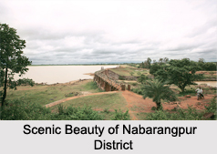
Tourism in Nabarangpur is undoubtedly a fascinating experience. The ancient temples are noteworthy of their mythological importance and architectural splendour. Maa Pendrani temple, Maa Bhandargharani temple and Lord Jagannath temple are much visited places of this district. Pilgrim tourists come here to offer their prayers and get blessings. The temples are also noted for their architectural wonder. The dams of this district serve as great picnic spots for the visitors. The Sahid Minar and the Sahid Smriti Stambha are the two famous historical monuments of Nabarangpur district. The Deer Park here also attracts a large crowd. Watching Nature`s bounties from the watch Tower in this park is a unique experience. Gosein Dorah and Chandan Dhara are the natural waterfalls which are huge crowd pullers. When it comes to tourism, this south western state of Odisha has a lot to offer.
Recently updated articles in States of India

History of Thissur District
Early History of Thissur District explains flourishing of the port cities. Now these port cities are transformed into archaeological sites.

Tippi Orchid Research Centre, Arunachal Pradesh
Tippi Orchid Research Centre in Arunachal Pradesh is renowned for its rich collection of exotic and endangered orchids. Surrounded by lush rainforest...

Tourism in Nashik District
Pilgrimage tourism in Nashik district involves visiting the various places of Hindu and Jain worship located here. Some of the holiest sites for Hind...

Mangadu, Kerala
Mangadu in Kerala’s Kollam district is a significant megalithic site known for its urn burials, cist burials, menhirs, and stone circles. Excavations...

Devaswom
History of Devaswom is not very ancient and can be dated back to late seventeenth century.
Related articles in States of India

East Indian States
East Indian States comprises of Bihar, Jharkhand, West Bengal, Odisha and also the Union Territory of Andaman and Nicobar Islands. It defines the cult...

Purnia District in Bihar
Purnia District is located in Bihar and extends from River Ganga to Nepal. The district has a rich Hindu history and glorious past.

Hooghly district
Hooghly District along the bank of the river Hooghly is one of the principal trading ports of West Bengal.

Geography Of Chittoor District
Geography of Chittoor district is spread along the topography of the land which is divided into two natural divisions; Chittoor has a dry and healthy...

Districts of West Bihar
Districts of West Bihar is comprised of medieval monuments that were built by the different governors of Mughal era.