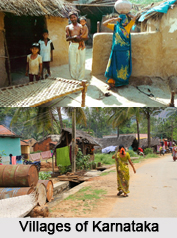
 Boragori is a village of Hooghly District in West Bengal.
Location of Boragori
Boragori is a village under Pandua police station in West Bengal.
Administration of Boragori
Boragori is administered by Berela-Kochmali-Boragori Panchayet.
Population of Boragori
Boragori is the only village in Hooghly District of West Bengal which has 100% Hindu population. This village has one primary school and one health centre.
Geography of Boragori
Boragori is the developed village in West Bengal. Boragori is located in 23.130805North to 88.162985 degree east. It has an average elevation of 20.5 meters. This village surrounded by some villages, Panpara, Gokuldanga to the north, Berela, Abodpara, Moglompur to the south, Kochmali to the east, Debipur and Burdwan District to the west are the connecting villages with Boragori.
Economy of Boragori
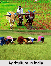
Boragori is covered by pure agricultural lands. In this village there are two Cold Storages, one milk factory, a cotton factory, and many different types of small industries. Kochmali-Boragori Krishi Unnayan Samabay Samity Ltd. is a co-operative bank of this village. This co-operative is dealer of Hindustan Petroleum, IFFCO.
Tourism in Boragiri
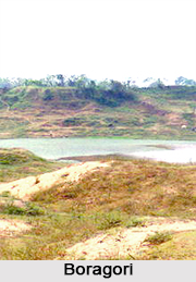
The sand trenches are the main attraction of Boragori. It is a very famous picnic spot. Balir khad or the sand trenches are situated to the south of Grand Trunk Road.
Temple in Boragori
Maa Kali Mata or Maa Manasha Temple is situated in this village. Baba Gopikanta is the main deity of Roy family of this village.
Visiting Information
Boragori can be connected with G.T Road SH 13 (Formerly NH 2B). Boragori is the last village of Hooghly District to the north, border of Burdwan District. Nearest rail station is Debipur. Boinchi and Simlagarh rail station also well connected with Boragori by GT Road.