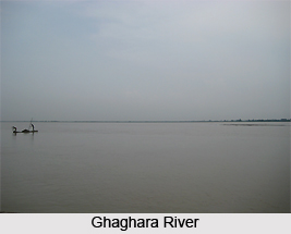
 Geography of Sant Kabir Nagar District, in spite of its apparent uniformity of aspect, is divided into several distinct tracts. These divisions are the low valley of Ghaghara River in the south, extending from that river to its tributary, the Kuwana; the central upland, between the latter and Rapti River; and the low and ill-drained paddy belt between Rapti and others. The district has two main river systems namely, the Ghaghara and Rapti, both of which ultimately form a part of the great Gangetic system. The other streams of the district include Kuwana, its tributaries, Rawai, Manwar and Katnehia. Ami is a tributary of Rapti. Ghaghara forms the southern boundary of the district.
The climate of Sant Kabir Nagar District is more composed than the adjoining districts in the south. The year may be divided into four seasons. The winter season, from mid-November to February, this is followed by the summer season lasting till about the middle of June. The period from mid-June to the end of September constitutes the south-west monsoon season. October to mid-November is the post monsoon or the transition period. The average annual rainfall in the district is 1166 mm. During the winter seasons the mean minimum temperature is about 9 degree Celsius and the mean maximum 23 degree Celsius while during the summer seasons the minimum is about 25 degree Celsius and mean maximum is about 44 degree Celsius. In the post monsoon seasons the relative humidity is high. Winds are in general very light with a slight increase in force during the late summer and monsoon seasons.
Geography of Sant Kabir Nagar District also includes numerous lakes and several of them are of considerable size. They are most commonly formed by the changes in the river channels. The largest and the most celebrated lake in the district is the Bakhira or Badhanchh Tal, also known as the Moti Jhil, which lies on the eastern borders of the district between Bakhira and Mehdawal. The district is underlain by Quaternary alluvium comprising various gravel, Kanker and clay. Substantial deposits of Kanker are available in the tehsil of Harriya only. The Alluvium can be classified into two groups, older alluvium and newer alluvium. Older alluvium is of middle Pleistocene age and generally occupies high ground which is not affected by floods during the rainy season. On the other hand, the newer alluvium covers the lower height and is mainly conferred to the flood plains along the river channels.
In the former days a large part of the district was covered with forest of Sal and other trees, but since then most of it has been cleared and brought under the plough. Though the district is no longer rich in timber, it can still be described as well-wooded.


