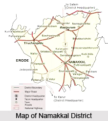
 Geography of Namakkal district is vast and it posses several hilly regions. This district of the Tamil Nadu state is located at seventy seven degree and forty minutes and seventy eight degree and five minutes of the East longitude and eleven degree and twelve degree of the North latitude. The district is situated at an altitude of three hundred meters above the MSL (mean sea level). The district of Namakkal comes under the North-Western Agro-climatic zone (excluding Tiruchengode taluk) of the Tamil Nadu state. It is placed in the dividing portion of two watersheds between the Kaveri River and the Vellar System with the taluks of Attur, Rasipuram and Namakkal on the East and Salem, Omalur and Mettur on the West. The Tiruchengode taluk is placed under Western Agro-climatic zone.
Apart from the two zones, the Kolli hills in Namakkal and few isolated hills and ridges scattered over Namakkal, Rasipuram and Tiruchengode along with the Valleys and rolling topography contributes to the beautiful physiography of the Namakkal district. The Kolli hills comprises of fourteen village panchayats called `Nadu` is having an area of 371.03 square kilometers at an altitude of one thousand and three hundred meters above the mean sea level. The northern regions of the district of Namakkal are mountains and the southern areas are plains. The plain area of this district can be divided into three elevating stages. The lower elevation (which is below one hundred and fifty meters) has Namakkal and Paramathy taluks which are benefited by the Kaveri River. The mid-elevation (which is from one hundred fifty to three hundred meters above the mean sea level) occupies the major area in all taluks. The high elevation area (which is between three hundred to six hundred meters) spreads over mainly in Rasipuram and Namakkal taluks. The major rivers running through the district of Namakkal in Tamil Nadu are Kaveri, Karipottamaru and Thirumanimuthar.
The famous Kaveri River flows along the Western and Southern boundaries of the Namakkal district at an elevation of one hundred and fifty meters. This river benefits most of the cultivated lands in Mohanur and Paramathy block. The tributaries of the Kaveri River are Tirumanimuthar and Sarabanga. The average annual rainfall received by the district of Namakkal in the Tamil Nadu state is seven hundred and seventy six millimetre. About eighty percent of the total rainfall is received during the south-west monsoon and the north-east monsoon.


