 Geography of East Singhbhum District comprises temperate climate. During the summer season the maximum is near about 40 degree Celsius to 45 degree Celsius and in winter season the minimum temperature remains around 8 degree Celsius. The region receives heavy rainfall in between July to September. The average rainfall received by the district is 1200 mm to 1400 mm.
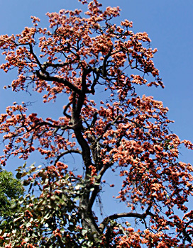
Topography of East Singhbhum District basically includes deciduous forests in which Sal, Gamhar, Mahua, Palash, Bamboo, Shrubs and grass are found. These forests are found scattered throughout the district but the bulk lies in south-western parts where it runs unbroken in long stretches covering a number of steep rocky hills and intervening valleys. This type of topography becomes a determining factor in the distribution, nature and type of vegetation which varies from a dry thorny type on very dry, exposed, badly eroded rocky hills to semi-evergreen type in sheltered damp valleys. But apart from these two extreme types, the ruling vegetation is moist tropical deciduous forest which tends to become dry deciduous on ridges.
Further, the northern and western faces of the hills are covered over with almost pure stands of Sal and other vegetation species. In such areas, combretum decandrum, Acacia species, bamboo, neem tree, holarrhena, Flacourtia, woodfordia, Phoenix acaulis and Lygodium species and Lantana camara, croton sparsiflours, cassia species and hyptis suaveolens are mainly found. In the Dhalbhum area the forests are mainly on the open ridges and in the undulating valleys and belong mainly to the reserved and protected types. The forests are very dense and contain tall trees both evergreen and deciduous standing close together and bearing lots of orchids and other epiphytes. Some of the hill tops barren due to exploitation for minerals. Geography of East Singhbhum District includes some interesting plants like the Gymnosperm and Gnetum scandens. These are mainly found in valleys.
East Singhbhum District is abundant in minerals. Iron Ore, Copper, Gold and Uranium are the main minerals found in the region.


