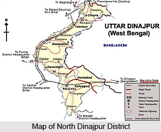
 North Dinajpur District lies in the state of West Bengal. It came into existence on 1st April 1992, after after the bifurcation of erstwhile West Dinajpur District. The District lies between latitude 25 degrees 11minutes north to 26 degrees 49 minutes North and longitude 87 degrees 49 minutes east to 90 degrees 00 minutes east. It occupies a total area of 3142 Sq. Kms and is enclosed by Bangladesh on the East, Bihar on the West, Darjeeling and Jalpaiguri District on the North and Malda District on the South. North Dinajpur is well connected with the rest of the State through National Highways, State Highways and Railways. NH-31 and NH-34 passes through the heart of the district. The regional topography is generally flat with a gentle southerly slope.
North Dinajpur district has been blessed with a very fertile soil. The district forms a part of the basin lying between Rajmahal hills on the East. The older alluvium is estimated to be Pleistocene age. The soil is very rich in nature due to the alluvial deposition which helps to grow Paddy, Jute and Mesta, sugarcane etc. Raiganj on the bank of the River Kulik is the District Headquarter where Raiganj Wildlife Sanctuary, the second largest bird sanctuary in Asia situated.
The district has good annual rainfall of about 160 cm. The rivers are either rain fed or are perennial with their source being the snowmelt of the Himalayas. The main rivers in the district are the Mahananda River, Kulik, Dauk, Nagar, Sudhani and a number of other streams. This river network provides sufficient surface water all over the district. Underground water supply and management is satisfactory in this region through Tube Wells, Deep Tube wells and other pump sets.
The North Dinajpur district is primarily agricultural in nature. Here, due to its diverse and surplus production of various crops like tea, jute, potato, ginger, spices and pineapple etc. the district has a strong base for agro-based and horticulture- based industry. Due to the suitability of climate and the fertility of soil, the district of North Dinajpur produces a number of fruits. Among the major fruits grown here are mango, jackfruit, litchi, sapota, guava, citrus fruits, banana, papaya, pineapple, cashew nut and coconut.
Since the district is mainly agriculture-based, high yield seed, agriculture accessories etc are distributed among the farmers at subsidy rate through various schemes. Also, training is imparted on developed and scientific ways of cultivation through display centres and training centres. Farmers have much been benefited by these schemes. Where industries are concerned, the district of North Dinajpur has as many as 9 large and medium scale industries and about 1261 registered small scale units.


