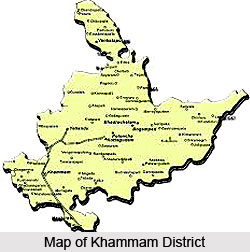
 Geography of Khammam district in Telangana is determined by its location and consequent agricultural inclinations. The district is located between 16-45 and 18-35 North Latitude and 79 degree and 47 minutes and 80 degree and 47 minutes East Latitude. It is bounded by the Krishna district on the North, East Godavari district and West Godavari district on the East, the Nalgonda District and Warangal district on the West and by the Krishna district on the South. The total area covered by the Khammam district is around 16,029 Sq. Kms.
Khammam District is one of the leading districts of the state of Telangana in total forest coverage. Out of a total geographical area of 16029 Sq. Km. In the district, an area of 7488.82 Sq Km is under forest cover spreading over 5 territorial and one wild life divisions. The Godavari River passes through the eastern part of the district and harbours one of the richest bio-diversity in the state. Other tributaries of the river Godavari like Taliperu, Kinnersani River and Sabari River also help in bringing prosperity to the area. Commonly seen species are Teak, Nallamaddi, Bijasal, Jitregi (rose wood), hard vickia, Binta, Bamboo and many other trees.
Khammam District is endowed with rich mineral resources of both the major and minor minerals. Among the various minerals found here, the most important ones are coal, dolomite, garnet, corrundum, barytes and iron ore.
There are a wide variety of crops grown in the Khammam district. Among the various crops grown, the climate is most favourable for Maize, Pulses, Cotton and Chillies. Other crops grown here include rice, jowar, bajra, red gram, green gram, black gram, horse gram, Bengal gram, cowpea, groundnut, sesamum, castor, sunflower, chillies, sugarcane and tobacco.
The livestock production is an integral part of farming system. Dairy, Poultry, Sheep, Goat rearing and Piggeries are providing gainful employment to small and marginal farmers, agricultural labourers, unemployed rural youth and self help group members, protein rich milk, meat and eggs produced from livestock, supplements the diet of rural people. Sericulture is an important agro-based labour intensive and rural industry with adequate scope to contribute to increase the rural economy with high potentiality for work like leaf picking, cultural operation, and application of manure fertilizers and feeling the silkworm and harvesting of cocoon in the sericulture activity, and fetching an income of Rs.15, 000/- to 20,000/- in an extent of one acre in year.
Khammam District is endowed with Agro climatic and Soil conditions in which a wide range of Horticulture crops like Mango, Banana, Cashew, Coconut, Oil palm, Cocoa, Pepper Areca nut etc., can be grown. Production of various kinds of fruits, vegetables, flowers, establishing orchards and plantations production and distribution of fruit plants and vegetable seeds are the major activities supported by the Horticulture Department. The District has 84,583.00 Hectare of land under Horticulture crops with a total production of 4, 24,506.000 Metric tonnes of Horticulture produce.
Khammam district is a accumulation of mosaic cultures representing the Hindus, Muslims and Christians. There are a sizeable number of scheduled tribes, who constitute an integral part of the Hindu community. Among tribes, koyas and lambadas constitute a sizeable part of the population. The tribal people are still following their own traditions and customs in their social life.


