Akola, a district in Maharashtra is an important historical, cultural, political, agricultural and industrial city. The city is renowned for its cotton production and is the largest cotton-producing district in India. The place is developing into a great market center.
The main language spoken by the people of Akola is Marathi. Some communities also speak Urdu and Hindi.
History of Akola
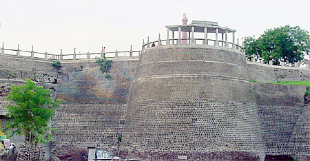 The historical reference of Akola is found in the 17th century. It was the time when Aurangzeb ascended the throne of Delhi. Akola at that time was known as Akola Balapur. Akola in olden days was part of Berar. The city was then under Nizam of Hyderabad`s dominion. In 1853, Nizam surrendered Berar to the British East India Company. In 1857, part of the city was restored to Nizam. In 1903 Nizam leased Berar to the British Government and as a result was transferred to the Central Provinces. In 1956 with the reorganization of states, Akola was transferred from Madhya Pradesh to the Bombay Province. In 1960, with the formation of Maharashtra, Akola became one of the districts of Maharashtra.
Geography of Akola
Akola is a district in Maharashtra. The ditrict is bounded on the north and east by Amravati District, which is the administrative headquarters of the district. To the south, the district is bounded by Washim District and to the West by Buldhana District.
The Purna River forms the northern boundary and the Vaan river forms the north western boundary of Akola. The tributaries of the rivers in Akola are, Uma River, Katepurna River, Shahanur River, Morna River, Mann river, Mas River, Gandhari River, Utawali River, Viushwamitri River, Nirguna River, Aas River and Vaan River.
Demography of Akola
As per the 2001 census, the population of the district is 1,629,305. Out of which men amounts to 840,883 and women to 788,422. The density of population (persons/sq km) is 300. The sex ratio accounts to 938 females for 1000 males. The rural population of the state accounts to 1,002,302 and urban population of the state accounts to 627,003. The percentage of scheduled castes is 11.95% and the percentage of scheduled tribes accounts to about 7.03%. The literacy rate of the state is 81.77%. About 39% of the people are below poverty line.
Festivals of Akola
The major festival celebrated by the people of Akola is the Lona Fair. The annual Urs is also held at the Aga Miya dargah and the Zulpikaralli dargah. Apart from these around 237 minor fairs are held in the district.
Economy of Akola
At Akola there are many industrial centers. The industrial centers are located at Akot, Akola, Telhara, Murtijapur, Paras, Patur. There are industries for ginning and pressing, handloom industries, textile and weaving industries, thermal power stations etc. There are oil and dhal mills at Akola. The predominant crops grown in the area are cotton and jowar.
Akola - Maharashtra
Akola, a district in Maharashtra is an important historical, cultural, political, agricultural and industrial city.


