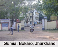
 Gumia is located in the Bokaro district of Jharkhand. The district headquarters is in the town of Bokaro, which is in the east at a distance of 15 km. from Gumia. Ranchi, the state capital is located in the southwest at a distance of 72 km. from Gumia. The closest airport is at Ranchi and the Gumia Railway Station on the Barwadih -Gomoh line is the nearest railway station. The nearby towns surrounding Gumia are Rahawan, Narkandi, Banaso, Aiyer, Sarubera and Tenughat. Geographically, the town is located between 23.78° North latitude and 85.82° East longitude at an average elevation of 238 metres (780 feet) above mean sea level.
As far as the demography of the place is concerned it is revealed in the 2001 India census report, Gumia had a population of 45,532. Out of it, 53% of the population consists of males and 47% of the population consists of females. In Gumia, 14% of the population is less than six years of age. The town has an average literacy rate of 64% which is higher than the nationwide average literacy rate of 59.5%. The male literacy rate is 74% and the female literacy rate is 52%.
The tribal communities mainly the Santhal, Oraon, Munba and Kharia dominate Gumia. The Tenughat Bird Sanctuary at a distance of 15 km from Gumia, is a major attraction in the neighbourhood.


